
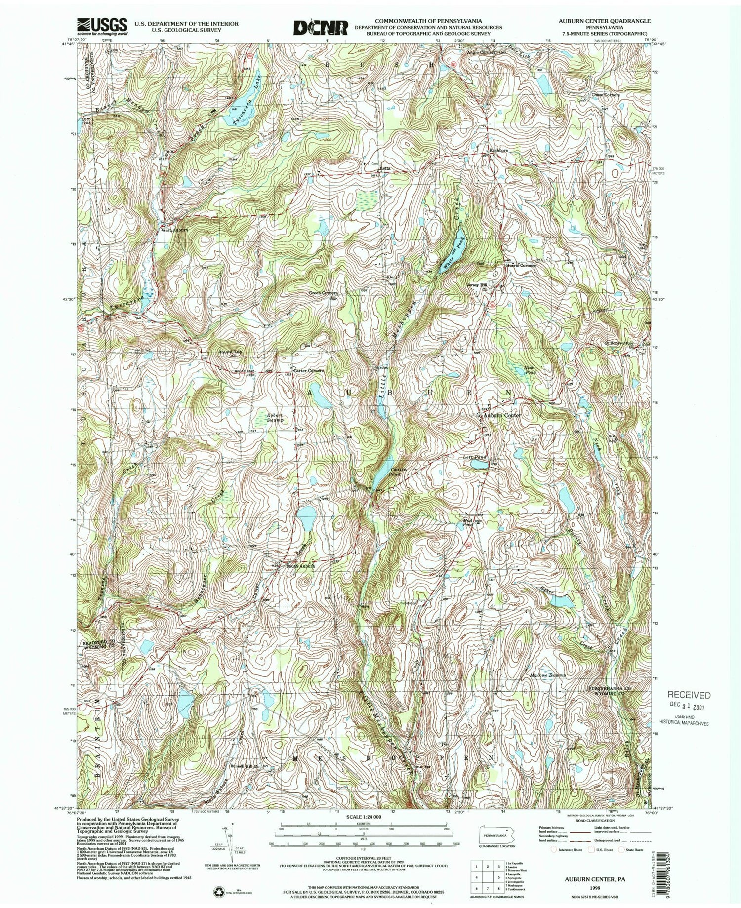
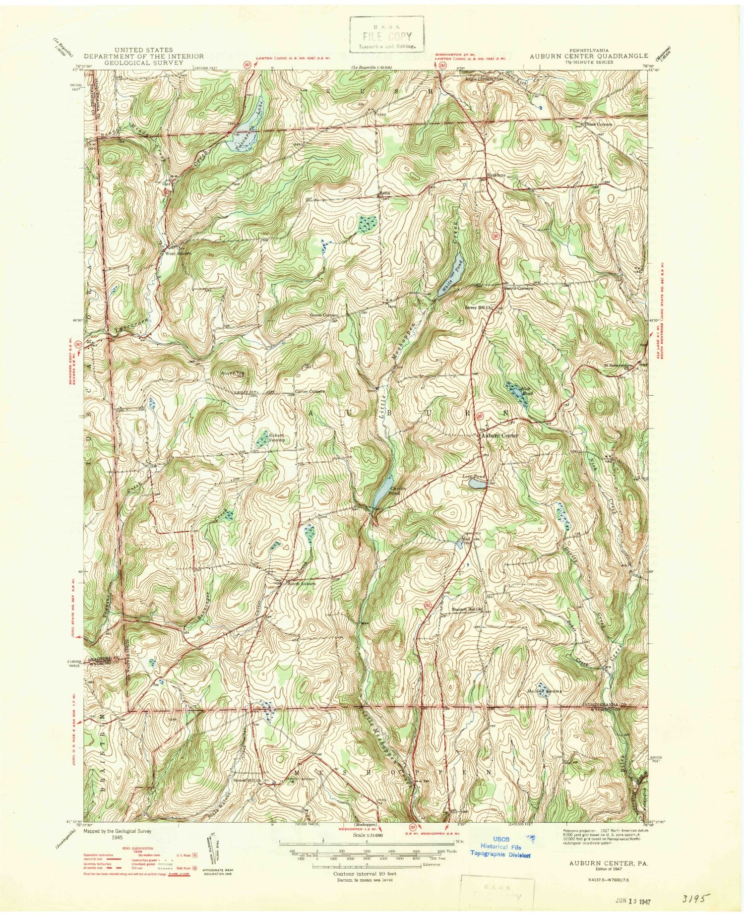

MyTopo
Classic USGS Auburn Center Pennsylvania 7.5'x7.5' Topo Map
Couldn't load pickup availability
Historical USGS topographic quad map of Auburn Center in the state of Pennsylvania. Map scale may vary for some years, but is generally around 1:24,000. Print size is approximately 24" x 27"
This quadrangle is in the following counties: Bradford, Susquehanna, Wyoming.
The map contains contour lines, roads, rivers, towns, and lakes. Printed on high-quality waterproof paper with UV fade-resistant inks, and shipped rolled.
Contains the following named places: Angle Corners, Auburn Center, Baker Creek, Beaver Meadow Creek, Benninger Creek, Bolles Cemetery, Bunnell Hill Church, Carlin Pond, Carter Corners, Carter Creek, Chase Corners, Crescent Lake Dam, Dority Creek, Green Corners, Harris Corners, Jersey Hill Church, Lott Pond, Malone Swamp, Mud Pond, Nick Creek, Nick Pond, Retta, Riley Creek, Robert Swamp, Round Top, Rushboro, Saint Bonaventure Church, Scranton Corners, Shannon Hill, South Auburn, Township of Auburn, Transue, Tuscarora Lake, Tuscarora Lake Dam, West Auburn, White Pond, ZIP Code: 18630


