
MyTopo
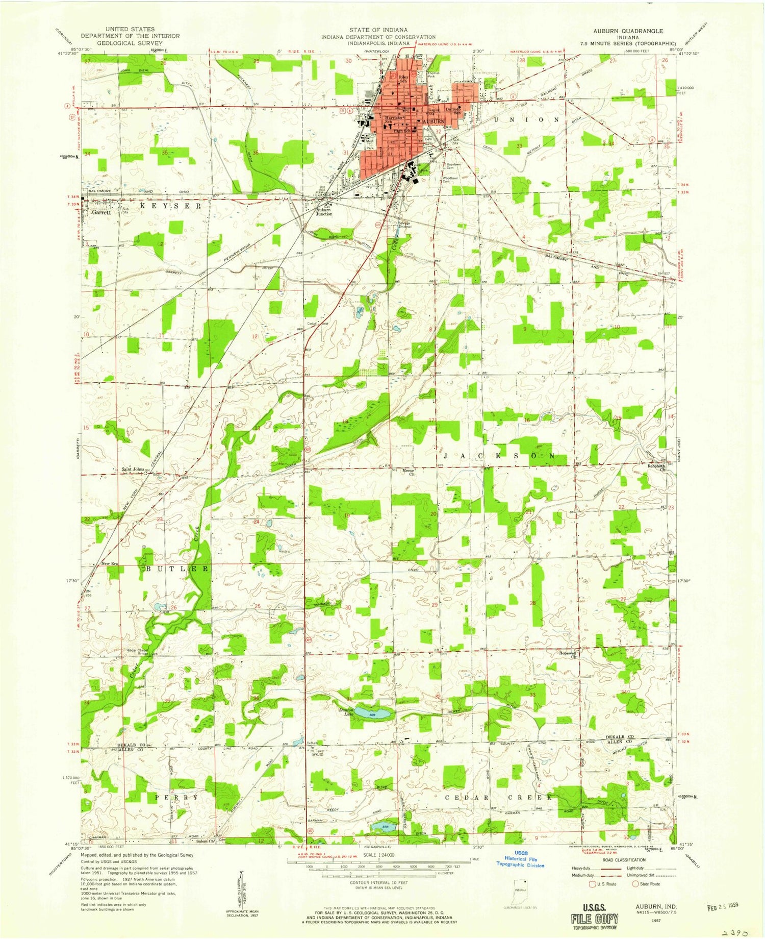
Classic USGS Auburn Indiana 7.5'x7.5' Topo Map
Couldn't load pickup availability
Historical USGS topographic quad map of Auburn in the state of Indiana. Map scale may vary for some years, but is generally around 1:24,000. Print size is approximately 24" x 27"
This quadrangle is in the following counties: Allen, DeKalb.
The map contains contour lines, roads, rivers, towns, and lakes. Printed on high-quality waterproof paper with UV fade-resistant inks, and shipped rolled.
Contains the following named places: Auburn, Auburn Fire Department, Auburn Fire Department Station 1, Auburn Fire Department Station 2, Auburn Junction, Auburn Police Department, Auburn Post Office, Beedy Ditch, Beedy Lake, Beedy Lake Dam, Carr Field, Cecil Metcalf Ditch, City of Auburn, City of Garrett, County Line Church, De Kalb County Airport, De Kalb County Sheriff, Dekalb Health Hospital, Desoto Park, Dosch Ditch, Dunton Lake, East Auburn Elementary School, Garrett Ditch, Halkey Ditch, Hopewell, Jackson Township Fire Department, John Diehl Ditch, McKenney Harrison Elementary School, Meese Church, Memorial Park, Mooney Field, New Era, Northeastern Center, Riley Park, Roselawn Cemetery, Saint Anthonys Center Lake, Saint Anthonys Center Lake Dam, Saint Johns, Salem Church, Schmadel Ditch, Swartz-Carnahan Ditch, Thomas Park, Township of Jackson, WIFF-AM (Auburn), WIFF-FM (Auburn), Woodlawn Cemetery, ZIP Code: 46706


