
MyTopo
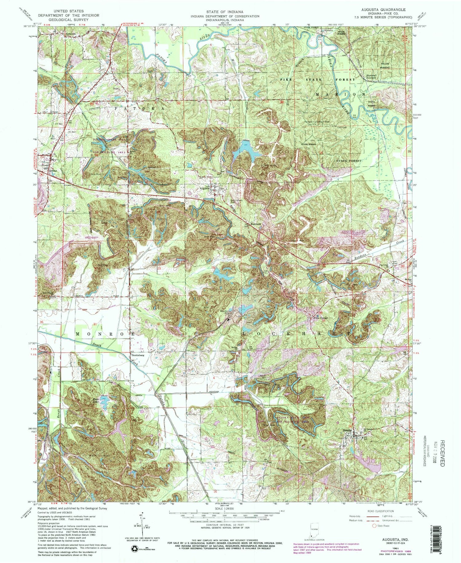
Classic USGS Augusta Indiana 7.5'x7.5' Topo Map
Couldn't load pickup availability
Historical USGS topographic quad map of Augusta in the state of Indiana. Map scale may vary for some years, but is generally around 1:24,000. Print size is approximately 24" x 27"
This quadrangle is in the following counties: Pike.
The map contains contour lines, roads, rivers, towns, and lakes. Printed on high-quality waterproof paper with UV fade-resistant inks, and shipped rolled.
Contains the following named places: Arthur, Ashby Church, Augusta, Augusta Cemetery, Augusta Lake, Augusta Lake Dam, Ayrshire, Barret Cemetery, Bethel Church, Blackfoot Landfill, Blackfoot Mine, Clifford Creek, Corn Cemetery, Cup Creek Church, Enos Lake Dam, Eros Lake, Fritz Corner, Grey Lake, Grey Lake Dam, Hartwell, Hartwell Junction, Hartwell Lookout Tower, Hog Branch, Hoskins Pits, Houchin Ditch, Lockhart Township Fire Department, Mill Creek, Mount Zion Church, New Liberty Church, Oxley Lake, Oxley Lake Dam, Patoka Township Volunteer Fire Department, Pike State Forest, Rough Creek, Saint Peters Cemetery, Saint Peters Church, Scottsburg, South Patoka River, Stendal, Stendal Post Office, Survant, Township of Lockhart, ZIP Code: 47585


