MyTopo
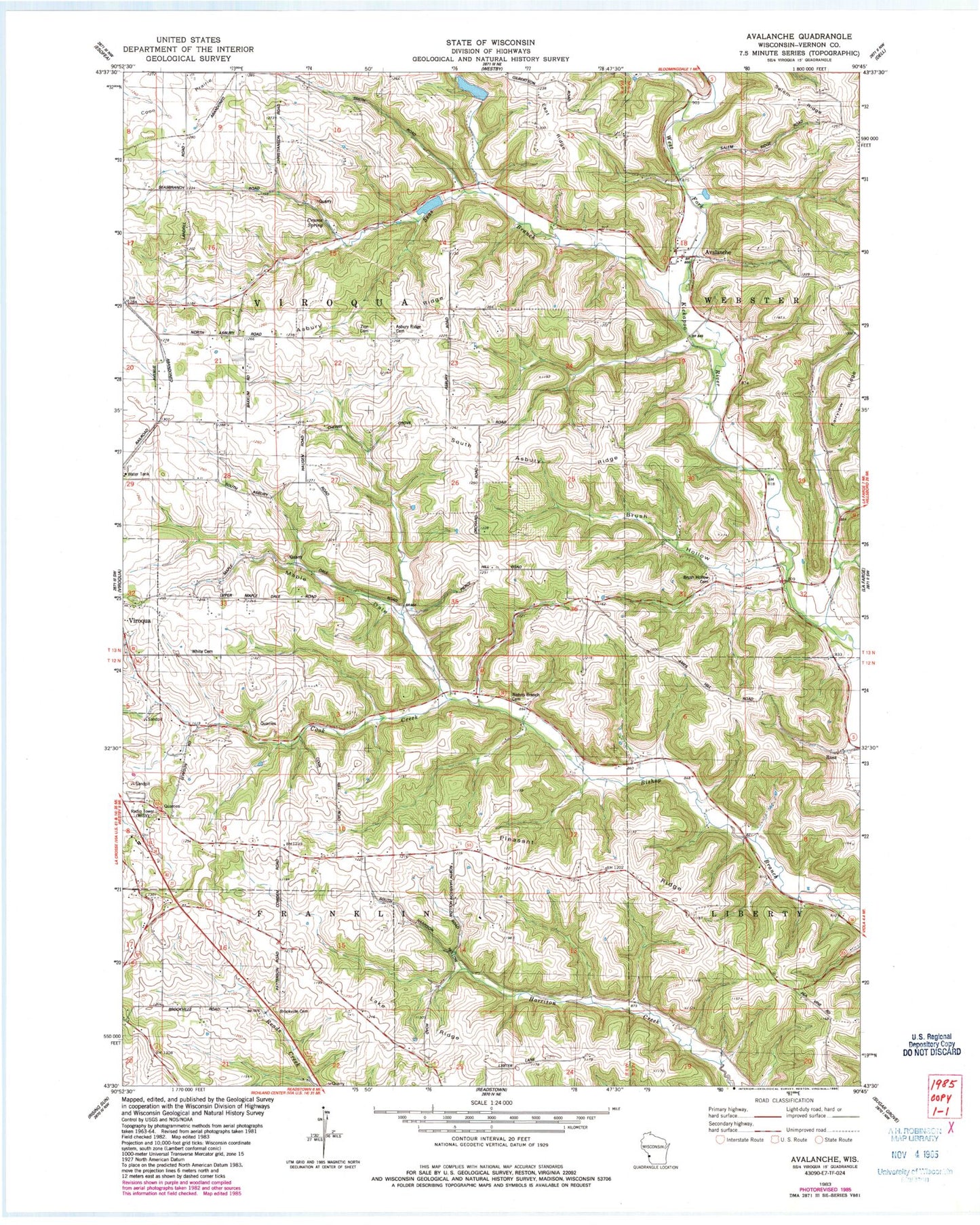
Classic USGS Avalanche Wisconsin 7.5'x7.5' Topo Map
Couldn't load pickup availability
Historical USGS topographic quad map of Avalanche in the state of Wisconsin. Map scale may vary for some years, but is generally around 1:24,000. Print size is approximately 24" x 27"
This quadrangle is in the following counties: Vernon.
The map contains contour lines, roads, rivers, towns, and lakes. Printed on high-quality waterproof paper with UV fade-resistant inks, and shipped rolled.
Contains the following named places: 5 Reservoir, 7 Reservoir, Asbury Ridge, Asbury School, Asbury Union Methodist Cemetery, Avalanche, Bishop Branch Cemetery, Bishop Branch School, Brookville, Brookville Cemetery, Brookville School, Brush Hollow, Brush Hollow Cemetery, Brush Hollow School, Cherry Grove School, Cook Creek, Cook Quarry, Cook School, Cooks School, Crume Spring, East Ridge, Foraker School, Lake Ridge, Maple Dale, Pleasant Ridge, Pleasant Ridge School, Rocky Run, Ross, Seas Branch, Seas Branch School, South Asbury Ridge, Town of Viroqua, Vernon County, West Fork Kickapoo 17 D 2592.2 Dam, West Fork Kickapoo 4 D 2592.2 Dam, West Fork Kickapoo 5 D 2592.2 Dam, White Cemetery, WVRQ-AM (Viroqua), WVRQ-FM (Viroqua), Zion Cemetery