MyTopo
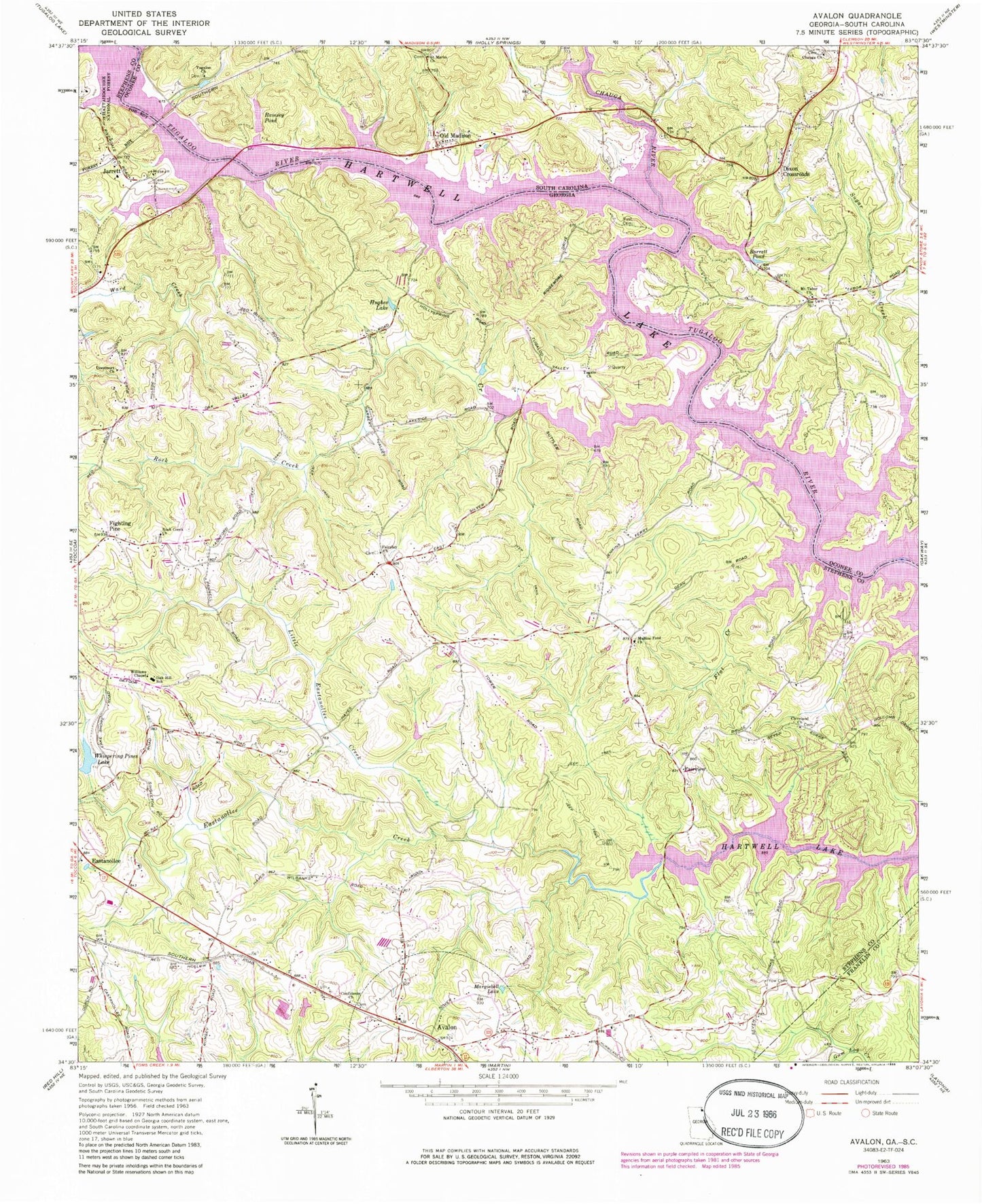
Classic USGS Avalon Georgia 7.5'x7.5' Topo Map
Couldn't load pickup availability
Historical USGS topographic quad map of Avalon in the states of Georgia, South Carolina. Map scale may vary for some years, but is generally around 1:24,000. Print size is approximately 24" x 27"
This quadrangle is in the following counties: Franklin, Oconee, Stephens.
The map contains contour lines, roads, rivers, towns, and lakes. Printed on high-quality waterproof paper with UV fade-resistant inks, and shipped rolled.
Contains the following named places: Avalon, Avalon School, Bakers Mill, Barrett Pond, Chauga Baptist Church, Chauga Baptist Church Graveyard, Chauga River, Cleveland Cemetery, Cleveland Church, Cleveland Shoal, Colonel Cleveland Monument, Confidence Cemetery, Confidence Church, Deercourt Church, Dixon Crossroads, Eastanollee Baptist Church, Eastanollee Cemetery, Eastanollee Creek, Eastanollee Elementary School, Fair Play Cemetery, Fairplay Church, Fairview, Fighting Pine, Flat Creek, Hartwell Lake, Hughes Lake, Hurricane Church, Jarrett, Jarrett Bridge, Jenkins Ferry, Little Eastanollee Creek, Margiebell Lake, Mount Tabor Baptist Church, Mount Tabor Baptist Church Graveyard, Mullens Ford, Mullins Ford Cemetery, Mullins Ford Church, Oak Hill School, Old Madison, Old Madison Church, Providence Cemetery, Providence Methodist Church, Ramsey Ferry, Ramsey Pond, Ramsey-Jarrett Bridge, Rock Creek, Rock Creek Cemetery, Rock Creek Church, Rock Creek Division, Rust Cemetery, Saint Marks Church, Stephens County Fire Department Station 4, Sugar Creek, Tabor, Town of Avalon, Travelers Rest, Tugalo Cemetery, Tugalo Church, Tugaloo Church, Walton Cemetery, Walton Creek, Waltons Ford, Wards Creek, Whispering Pines Lake, Williams Chapel, Yow Cemetery