
MyTopo
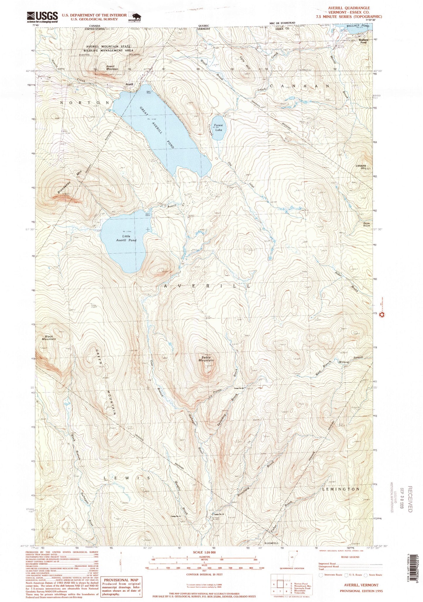
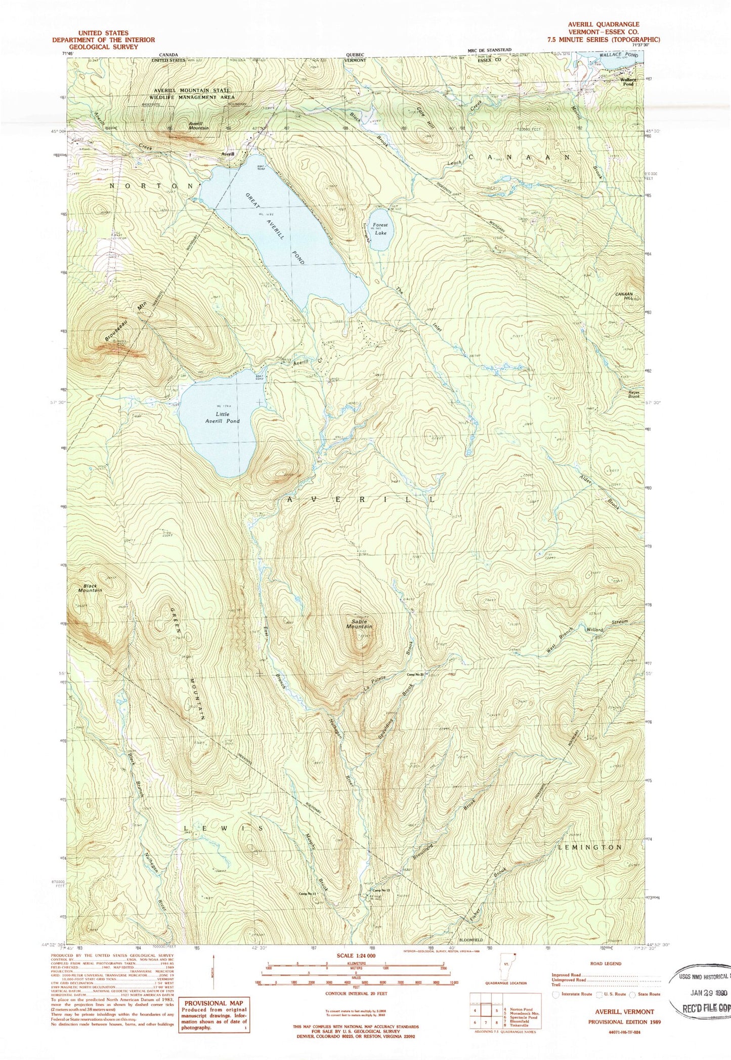
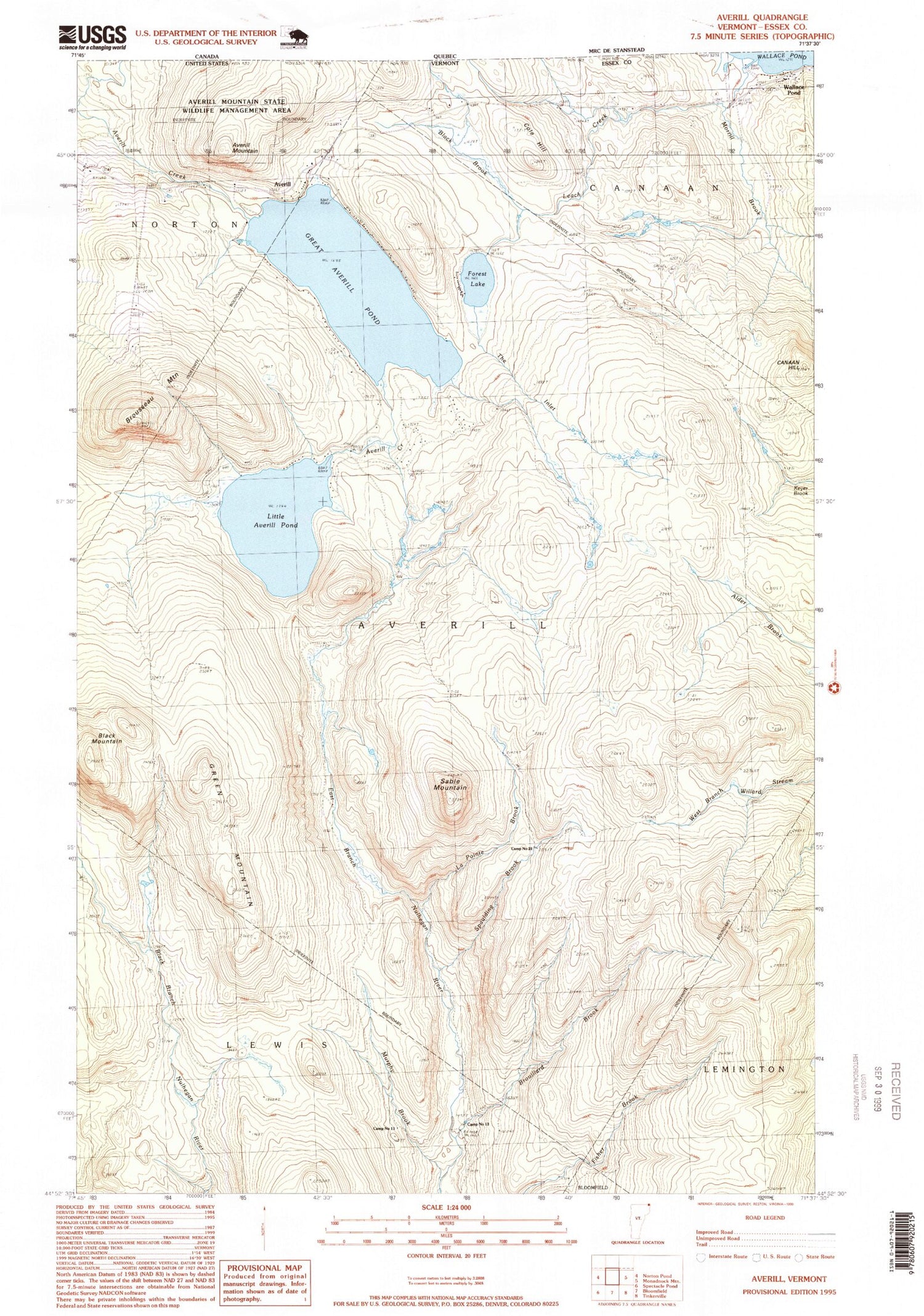
Classic USGS Averill Vermont 7.5'x7.5' Topo Map
Couldn't load pickup availability
Historical USGS topographic quad map of Averill in the state of Vermont. Typical map scale is 1:24,000, but may vary for certain years, if available. Print size: 24" x 27"
This quadrangle is in the following counties: Essex.
The map contains contour lines, roads, rivers, towns, and lakes. Printed on high-quality waterproof paper with UV fade-resistant inks, and shipped rolled.
Contains the following named places: Averill, Black Brook, Black Mountain, Brouillard Brook, Brousseau Mountain, Camp Number Eleven, Camp Number Twelve, Camp Number Thirteen, Camp Number Fourteen, Camp Number Sixteen, Camp Number Eighteen, Camp Number Nineteen, Camp Number Twenty, Camp Number Twentyone, Canaan Hill, Cole Hill, Conway Dam, Dam Number Four, Dam Number Five, Dam Number Six, Forest Lake, Green Mountain, La Pointe Brook, Murphy Brook, Sable Mountain, Spaulding Brook, The Inlet, Great Averill Pond, WKNW-FM (Canaan), Town of Averill, Little Averill Pond, Great Averill Pond Dam, Little Averill Dam, Little Averill Lake, Cold Spring Camp (historical)