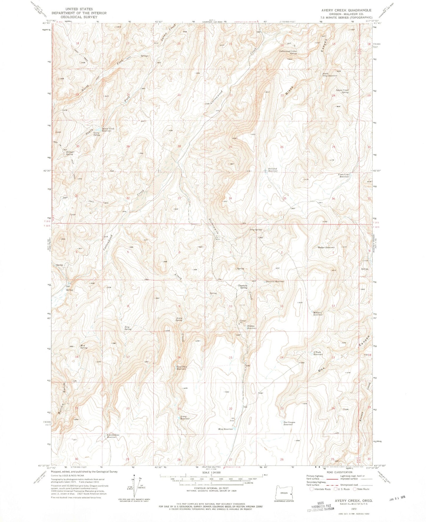
MyTopo
Classic USGS Avery Creek Oregon 7.5'x7.5' Topo Map
Couldn't load pickup availability
Historical USGS topographic quad map of Avery Creek in the state of Oregon. Map scale may vary for some years, but is generally around 1:24,000. Print size is approximately 24" x 27"
This quadrangle is in the following counties: Malheur.
The map contains contour lines, roads, rivers, towns, and lakes. Printed on high-quality waterproof paper with UV fade-resistant inks, and shipped rolled.
Contains the following named places: Avery Creek, Avery Reservoir, Avery Spring, Badger Reservoir, Box Canyon Reservoir, Chastain Spring, Copeland Trough Spring, Cottonwood Cabin Spring, Division Reservoir, Drip Spring, Fence Line Reservoir, Gacey Spring, Good Place Reservoir, Hidden Reservoir, Hu Tsi Tehaga Creek, Knucklebone Reservoir, Mesa Reservoir, Military Reservoir, Mud Spring, North Drip Reservoir, O'Toole Reservoir, Petrified Reservoir, Riley Place, Sai-be Spring, Sixteenmile Creek, Squaw Creek Dam, Squaw Creek Reservoir, Stringer Spring, Ti-he-cha-paa nena Creek