MyTopo
Classic USGS Avery Iowa 7.5'x7.5' Topo Map
Couldn't load pickup availability
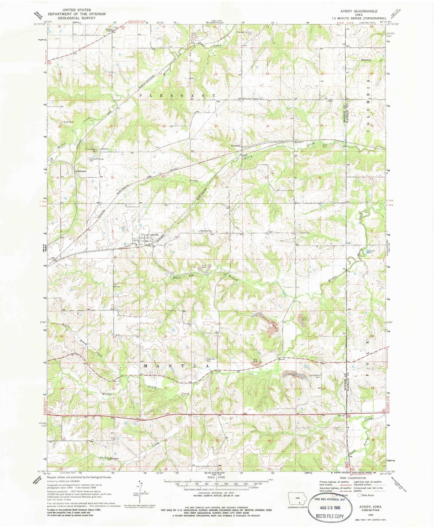
Historical USGS topographic quad map of Avery in the state of Iowa. Map scale may vary for some years, but is generally around 1:24,000. Print size is approximately 24" x 27"
This quadrangle is in the following counties: Monroe, Wapello.
The map contains contour lines, roads, rivers, towns, and lakes. Printed on high-quality waterproof paper with UV fade-resistant inks, and shipped rolled.
Contains the following named places: Anderson Hill Cemetery, Avery, Avery Post Office, Bethel Cemetery, Chedister Cemetery, Chisholm Post Office, Coalfield, Coalfield Post Office, Cuba Cemetery, Cuba Post Office, Daggett Grave, Dave Roberts Farm Cemetery, East Bethel Cemetery, Fall Cemetery, Frederic, Fredric, Fredric Post Office, Halfway Prairie Post Office, Hayden Chapel, Hayden Chapel Cemetery, Hickory Grove Cemetery, Hynes Post Office, Johnston Family Cemetery, KLBA-AM (Albia), Little Avery Creek, Lockman, Lockman Post Office, Old Shahan Cemetery, Packinghouse Creek, Pleasant Corner, Pleasant Corners Cemetery, Pleasant Corners Church, Pleasant Divide Cemetery, Thorpe Cemetery, Township of Mantua, Township of Pleasant, White Ash Branch