MyTopo
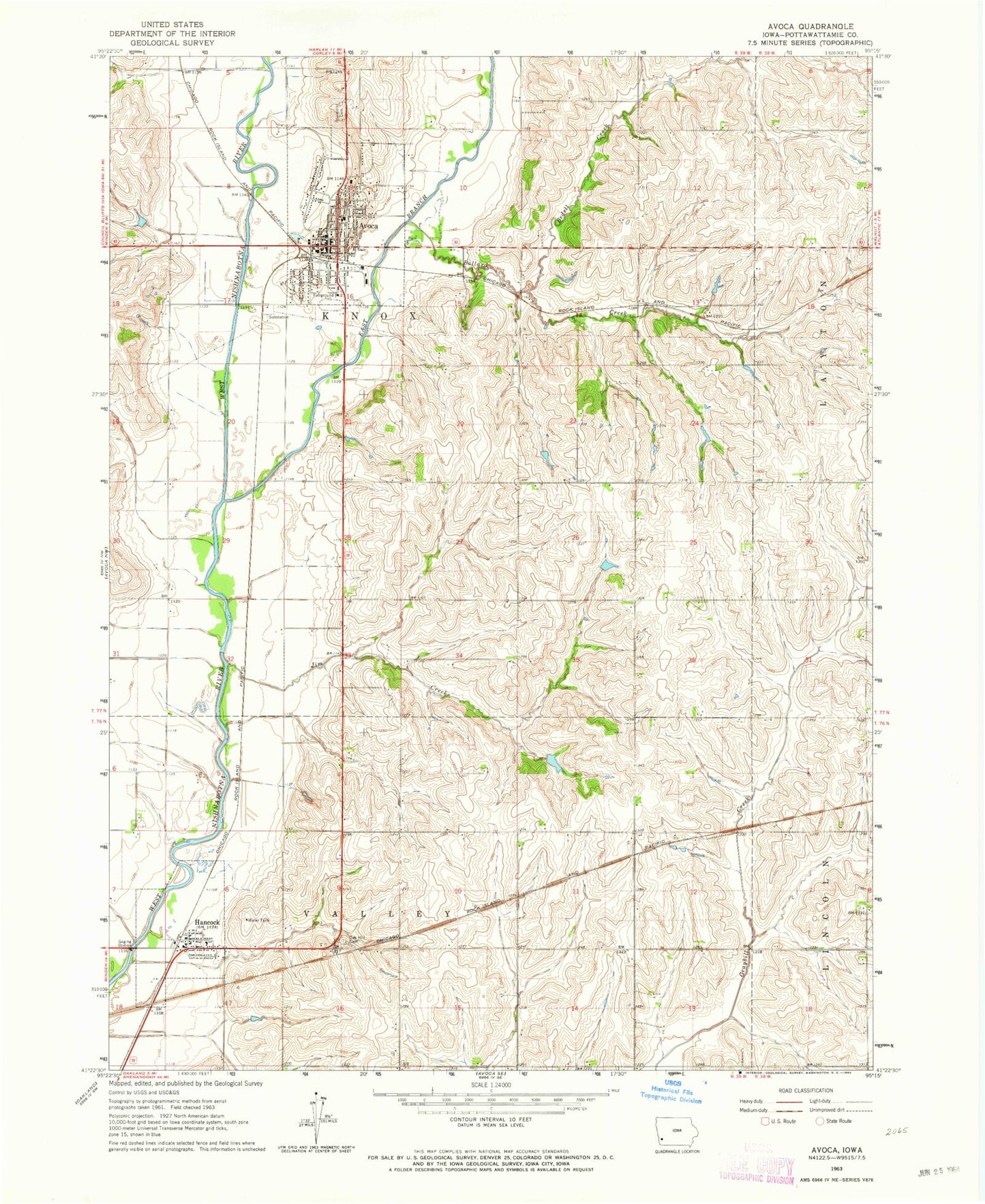
Classic USGS Avoca Iowa 7.5'x7.5' Topo Map
Couldn't load pickup availability
Historical USGS topographic quad map of Avoca in the state of Iowa. Map scale may vary for some years, but is generally around 1:24,000. Print size is approximately 24" x 27"
This quadrangle is in the following counties: Pottawattamie.
The map contains contour lines, roads, rivers, towns, and lakes. Printed on high-quality waterproof paper with UV fade-resistant inks, and shipped rolled.
Contains the following named places: AHSTW Community High School, AHSTW Elementary School, Avoca, Avoca Elevator, Avoca Fairgrounds, Avoca Golf Club, Avoca Nursing and Rehabilitation Center, Avoca Physicians Clinic, Avoca Post Office, Avoca Public Library, Avoca Volunteer Fire Department, Ballard Creek, Bedell Creek, Botna Bend County Park, City of Avoca, City of Hancock, Crossroads Church, East Branch West Nishnabotna River, Eddington Memorial Park, Graceland Cemetery, Hancock, Hancock Elevator, Hancock Post Office, Hancock Town Hall, Hancock Volunteer Fire Department, Harlan Junction, Jim Creek, Memorial Park, New Town Post Office, Newton Cemetery, Newtown, Nishna, Nishna Post Office, Oak Hill Cemetery, Parkway Cafe and Campground, Parkway Campground, Saint Marys Catholic Church, Sweet Vale of Avoca Heritage Museum, Township of Knox, Township of Valley, Trinity Lutheran Church, United Church of Avoca, United Methodist Church, ZIP Codes: 51521, 51536