
MyTopo
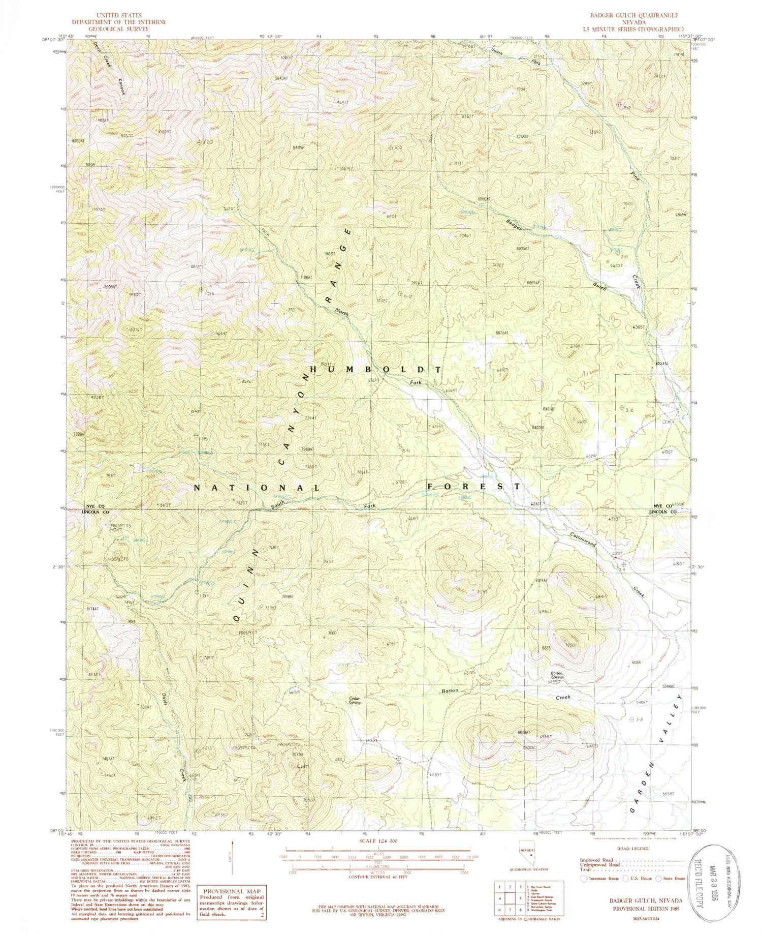
Classic USGS Badger Gulch Nevada 7.5'x7.5' Topo Map
Couldn't load pickup availability
Historical USGS topographic quad map of Badger Gulch in the state of Nevada. Map scale may vary for some years, but is generally around 1:24,000. Print size is approximately 24" x 27"
This quadrangle is in the following counties: Lincoln, Nye.
The map contains contour lines, roads, rivers, towns, and lakes. Printed on high-quality waterproof paper with UV fade-resistant inks, and shipped rolled.
Contains the following named places: Badger Gulch, Barton Spring, Cedar Spring, Davis Mine, Davis Northern Mine, Dresser Mine, El Cortez Mine, Emerald Mine, Higrade Mine, Mustang Spring, North Fork Cottonwood Creek, Pine Creek Ranch, Quinn Canyon Range, Shannon Queen Mine, Skull Mountain, South Fork Cottonwood Creek, South Fork Pine Creek, Stairstep Mountain, Steele Mine, Sunbeam Mine, Toms Mine, Welch Ranch, Willow Creek Mining District, Wingfield Mine


