MyTopo
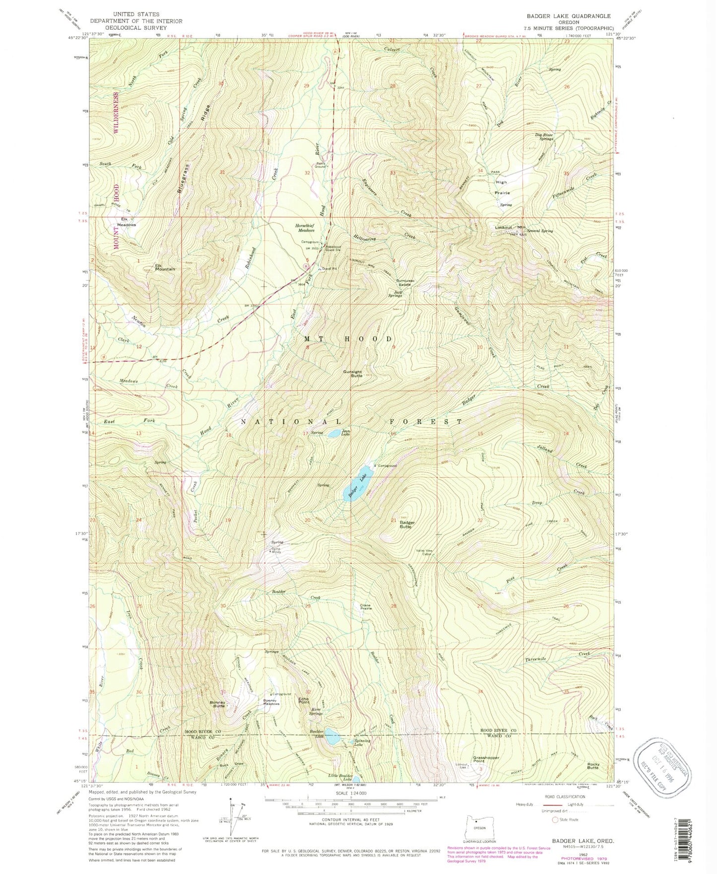
Classic USGS Badger Lake Oregon 7.5'x7.5' Topo Map
Couldn't load pickup availability
Historical USGS topographic quad map of Badger Lake in the state of Oregon. Typical map scale is 1:24,000, but may vary for certain years, if available. Print size: 24" x 27"
This quadrangle is in the following counties: Hood River, Wasco.
The map contains contour lines, roads, rivers, towns, and lakes. Printed on high-quality waterproof paper with UV fade-resistant inks, and shipped rolled.
Contains the following named places: Senecal Spring, Badger Butte, Badger Lake, Bluegrass Ridge, Bonney Butte, Bonney Meadows, Boulder Lake, Boulder Lake Trail, Boulder Lake Way Trail, Buck Draw, Camp Windy Recreation Site, Clark Creek, Crane Prairie, Dog River Springs, Echo Point, Elk Meadows, Elk Meadows Trail, Elk Mountain, Engineers Creek, Flag Point Trail, Grasshopper Point, Gumjuwac Creek, Gumjuwac Saddle, Gunsight Butte, Hellroaring Creek, High Prairie, Horsethief Meadows, Iron Creek, Jack Springs, Jalland Creek, Jean Lake, Kane Springs, Lookout Mountain, Lookout Mountain Trail, Meadows Creek, Newton Creek, Pine Creek Trail, Pocket Creek, Robinhood Creek, Robinhood Guard Station, Rocky Butte, Rocky Butte Way Trail, South Fork Cold Spring Creek, Spinning Lake, Tolo Creek, Valley View Cabin, Robinhood Recreation Site, Nottingham Campground, Mine Creek, Lunch Creek, Badger Lake Dam, Bonney Meadows Recreation Site, Badger Lake Recreation Site, Boulder Lake Recreation Site, Robinhood Quarry, East Fork Hood Wild and Scenic River, Senecal Spring, Badger Butte, Badger Lake, Bluegrass Ridge, Bonney Butte, Bonney Meadows, Boulder Lake, Boulder Lake Trail, Boulder Lake Way Trail, Buck Draw, Camp Windy Recreation Site, Clark Creek, Crane Prairie, Dog River Springs, Echo Point, Elk Meadows, Elk Meadows Trail, Elk Mountain, Engineers Creek, Flag Point Trail, Grasshopper Point, Gumjuwac Creek, Gumjuwac Saddle, Gunsight Butte, Hellroaring Creek, High Prairie, Horsethief Meadows, Iron Creek, Jack Springs, Jalland Creek, Jean Lake, Kane Springs, Lookout Mountain, Lookout Mountain Trail, Meadows Creek, Newton Creek, Pine Creek Trail, Pocket Creek, Robinhood Creek, Robinhood Guard Station, Rocky Butte, Rocky Butte Way Trail, South Fork Cold Spring Creek, Spinning Lake, Tolo Creek, Valley View Cabin, Robinhood Recreation Site, Nottingham Campground, Mine Creek, Lunch Creek, Badger Lake Dam, Bonney Meadows Recreation Site, Badger Lake Recreation Site, Boulder Lake Recreation Site, Robinhood Quarry, East Fork Hood Wild and Scenic River