MyTopo
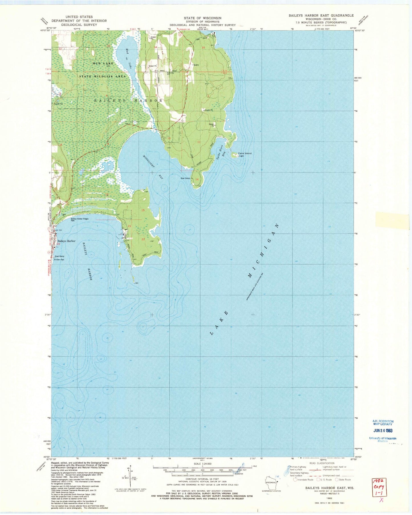
Classic USGS Baileys Harbor East Wisconsin 7.5'x7.5' Topo Map
Couldn't load pickup availability
Historical USGS topographic quad map of Baileys Harbor East in the state of Wisconsin. Map scale may vary for some years, but is generally around 1:24,000. Print size is approximately 24" x 27"
This quadrangle is in the following counties: Door.
The map contains contour lines, roads, rivers, towns, and lakes. Printed on high-quality waterproof paper with UV fade-resistant inks, and shipped rolled.
Contains the following named places: Anclam Park, Baileys Harbor, Bailey's Harbor Boreal Forest And Wetlands State Natural Area, Baileys Harbor Post Office, Baileys Harbor Ridges Park, Baileys Harbor Yacht Club Incorporated, Cana Cove, Cana Island, Cana Island Light, Door County, Door County Library McArdle Branch, Moonlight Bay, Moonlight Bay Bedrock Beach State Natural Area, Mud Lake, Mud Lake State Natural Area, Mud Lake State Wildlife Area, Rieboldt Creek, Spike Horn Bay, The Ridges Sanctuary State Natural Area, Toft Point State Natural Area, Voecks Marsh