MyTopo
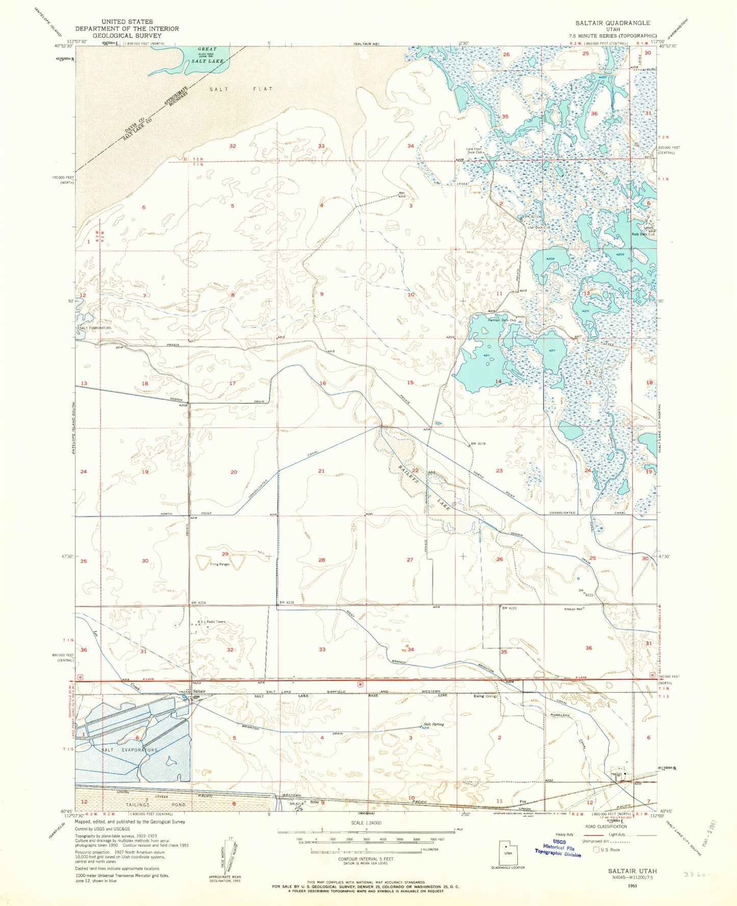
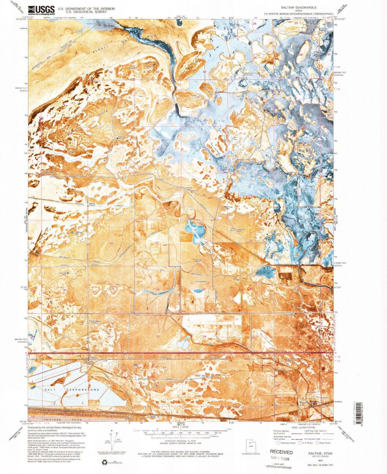
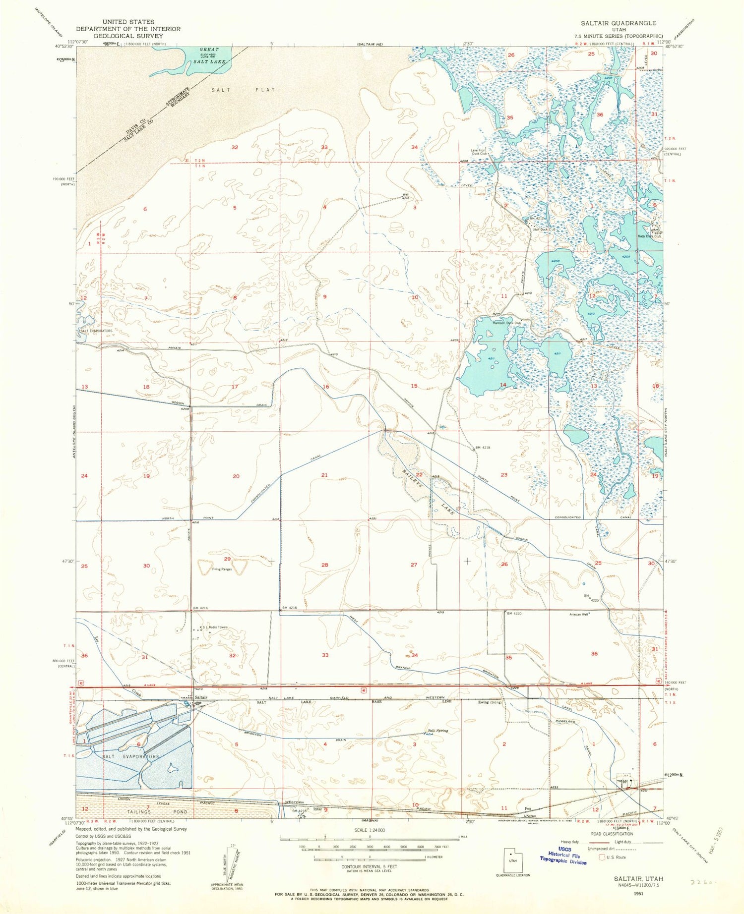
Classic USGS Baileys Lake Utah 7.5'x7.5' Topo Map
Couldn't load pickup availability
Historical USGS topographic quad map of Baileys Lake in the state of Utah. Map scale may vary for some years, but is generally around 1:24,000. Print size is approximately 24" x 27"
This quadrangle is in the following counties: Davis, Salt Lake.
The map contains contour lines, roads, rivers, towns, and lakes. Printed on high-quality waterproof paper with UV fade-resistant inks, and shipped rolled.
Contains the following named places: Baileys Lake, Bonneville Center, Brighton Drain, Browns Island, Cow Bay Knoll, Goggin Drain, Harrison Duck Club, KSL-AM (Salt Lake City), Lake Front Duck Club, Magna Division, Maplewood Addition, North Point Consolidated Canal, Rabbit Knoll, Riter, Riter Drain, Round Knoll, Rudy Duck Club, Salt Lake City Fire Department Fire Station 9, Salt Lake City Fire Station Number 9, Salt Lake International Center, Salt Spring, Saltair, Terminal, Utah Duck Club, West Branch Brighton Canal