MyTopo
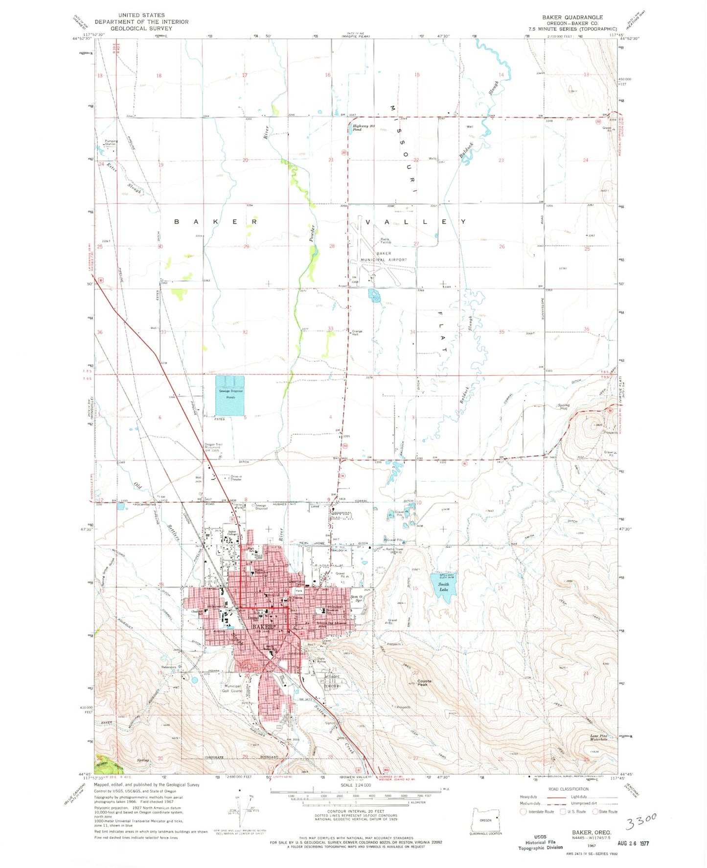
Classic USGS Baker City Oregon 7.5'x7.5' Topo Map
Couldn't load pickup availability
Historical USGS topographic quad map of Baker City in the state of Oregon. Map scale may vary for some years, but is generally around 1:24,000. Print size is approximately 24" x 27"
This quadrangle is in the following counties: Baker.
The map contains contour lines, roads, rivers, towns, and lakes. Printed on high-quality waterproof paper with UV fade-resistant inks, and shipped rolled.
Contains the following named places: Adler House, American Red Cross Northeast Oregon District Baker City Office, Baker City, Baker City Chinese Cemetery, Baker City Fire Department, Baker City Golf Club, Baker City Hall, Baker City Municipal Airport, Baker City Police Department, Baker City Post Office, Baker City Public Works Department Office, Baker City Wastewater Treatment Facility, Baker College, Baker County Courthouse, Baker County Fairgrounds Cockram Arena, Baker County Fairgrounds Office, Baker County Fairgrounds Rodeo Arena, Baker County Library Baker City Main Branch Library, Baker County Public Health Department, Baker County Sheriff's Office, Baker Heritage Museum, Baker High School, Baker Middle School, Baker Ranger Station, Baker Rural Fire Protection District Lindley Road, Baker Valley, Baker Valley Seventh - Day Adventist School, Baldock Ditch, Brooklyn Elementary School, Bureau of Land Management Baker Field Office, Churchill School, City of Baker City, Community Connection of Baker County Transit and Trolley District, Corral Ditch, Correll Ditch, Coyote Peak, Crossroads Carnegie Art Center Theatre, Department of Motor Vehicles Baker City, Estes, Estes Ditch, Estes Slough, Greyhound Station Baker City, Highway 203 Pond, Iron Gate Theatre, KBKR-AM, KBKR-FM, Kolb Reservoir, Lighthouse Christian School, Lone Pine Waterhole, McCord Ditch, Missouri Flat, Mount Hope Cemetery, New Home Ditch, North Baker Elementary School, Oregon State Police Department - Baker City, Oregon Trail Monument, Powder River Correctional Facility, Saint Alphonsus Medical Center - Baker City, Saint Elizabeth Community Hospital Helipad, Saint Elizabeth Hospital Heliport, Saint Francis de Sales Catholic Cemetery, Saint Francis High School, Sam O Spring, Smith Lake, Smith Lake Dam, South Baker Intermediate School, Spring Grove Gulch, Stack Junior High School, Sutton Creek, United States Forest Service Whitman Ranger Station, Wallowa-Whitman National Forest Headquarters, ZIP Code: 97814