MyTopo
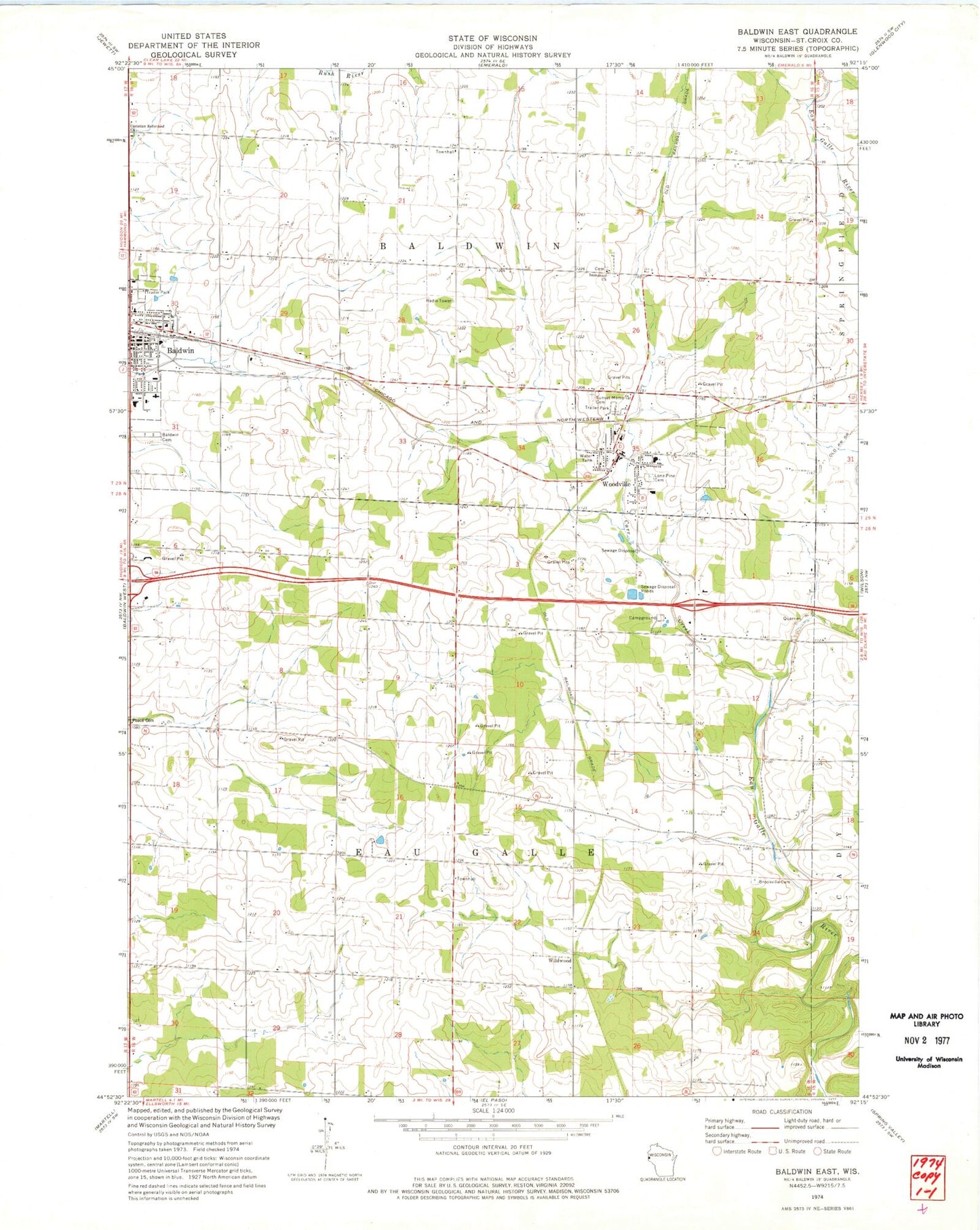
Classic USGS Baldwin East Wisconsin 7.5'x7.5' Topo Map
Couldn't load pickup availability
Historical USGS topographic quad map of Baldwin East in the state of Wisconsin. Map scale may vary for some years, but is generally around 1:24,000. Print size is approximately 24" x 27"
This quadrangle is in the following counties: St. Croix.
The map contains contour lines, roads, rivers, towns, and lakes. Printed on high-quality waterproof paper with UV fade-resistant inks, and shipped rolled.
Contains the following named places: Baldwin, Baldwin Ambulance Service, Baldwin Area Medical Center, Baldwin Cemetery, Baldwin Greenhouse, Baldwin Police Department, Baldwin Post Office, Baldwin Townhall, Birchdale School, Brookville Cemetery, Brookville School, Carr Creek, Christian Reformed Church, Dahl, Deringer Mobile Home Park, East Baldwin School, Eau Galle Townhall, Flyplassen Airport, Hoover School, Immanuel Church, Lone Pine Cemetery, Loyalty School, Pleasant Grove School, Riverside School, Spooner Quarry, Sunnyside School, Sunset Memorial Cemetery, Town of Baldwin, Town of Eau Galle, Tydalen School, United Fire and Rescue District Woodville Station, Viking Middle School, Village of Baldwin, Village of Woodville, Wildwood, Woodville, Woodville Municipal Mobile Home Park, Woodville Police Department, Woodville Post Office, ZIP Codes: 54002, 54028