MyTopo
Classic USGS Baldwin West Wisconsin 7.5'x7.5' Topo Map
Couldn't load pickup availability
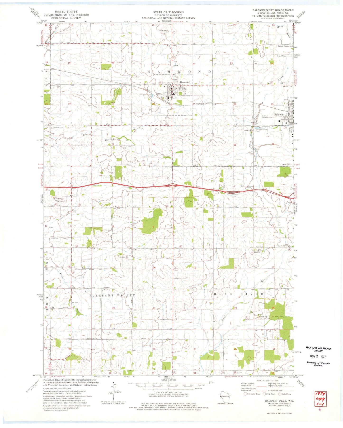
Historical USGS topographic quad map of Baldwin West in the state of Wisconsin. Map scale may vary for some years, but is generally around 1:24,000. Print size is approximately 24" x 27"
This quadrangle is in the following counties: St. Croix.
The map contains contour lines, roads, rivers, towns, and lakes. Printed on high-quality waterproof paper with UV fade-resistant inks, and shipped rolled.
Contains the following named places: Baldwin - Woodville High School, Baldwin Airport, Baldwin Christian School, Elm Grove School, First Reformed Church, Gethsemane Lutheran Church, Golfview Mobile Home Park, Greenfield Elementary School, Hammond, Hammond Central School, Hammond Police Department, Hammond Post Office, Lincoln School, North Centerville School, North Rush River Peace Church, North Valley School, Oak Grove School, Palmer, Peace Cemetery, Peace Lutheran Church, Pleasant Valley Townhall, Rush River Airport, Rush River Townhall, Saint Croix Central High School, Saint Croix Central Middle School, Town of Hammond, Town of Pleasant Valley, Town of Rush River, United Fire and Rescue District Baldwin Station, United Fire and Rescue District Hammond Station, Valley View School, Village of Hammond, Willow Hill School, Woodside School, ZIP Code: 54015