MyTopo
Classic USGS Baldwin Iowa 7.5'x7.5' Topo Map
Couldn't load pickup availability
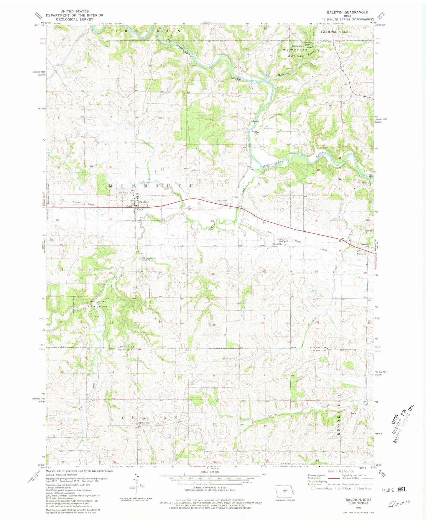
Historical USGS topographic quad map of Baldwin in the state of Iowa. Map scale may vary for some years, but is generally around 1:24,000. Print size is approximately 24" x 27"
This quadrangle is in the following counties: Clinton, Jackson.
The map contains contour lines, roads, rivers, towns, and lakes. Printed on high-quality waterproof paper with UV fade-resistant inks, and shipped rolled.
Contains the following named places: Baldwin, Baldwin Monmouth Methodist Church, Baldwin Post Office, Baldwin Volunteer Fire Department, Bear Creek, Beers Creek, Buckhorn, Buckhorn Waterford Cemetery, Burgess, Burgess Post Office, City of Baldwin, Eden Valley County Refuge, Eden Valley Nature Centure, Foley Farm Cemetery, Hershberger Cemetery, Holy Trinity Catholic Cemetery, Holy Trinity Church, Joinerville County Park, Lost Nation Public Hunting Area, Maquoketa Caves Natural Bridge, Maquoketa Caves State Park, Mill Rock School County Park, Millrock, Nashville, Nashville Post Office, Pence Cemetery, Raccoon Creek, Rat Run, Reel Cemetery, Township of Monmouth, Washington Cemetery, Waterford Post Office, ZIP Code: 52207