MyTopo
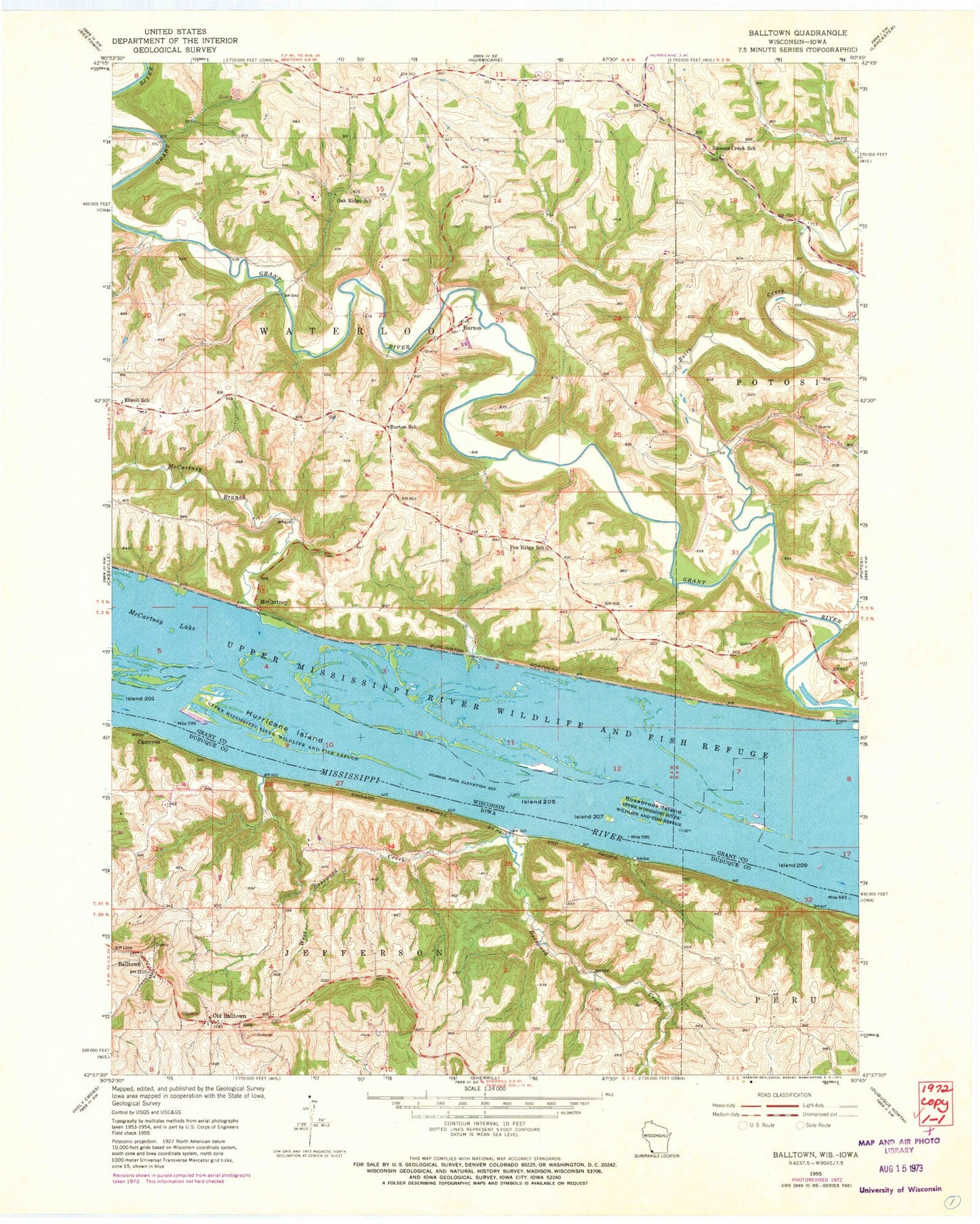
Classic USGS Balltown Iowa 7.5'x7.5' Topo Map
Couldn't load pickup availability
Historical USGS topographic quad map of Balltown in the states of Iowa, Wisconsin. Map scale may vary for some years, but is generally around 1:24,000. Print size is approximately 24" x 27"
This quadrangle is in the following counties: Dubuque, Grant.
The map contains contour lines, roads, rivers, towns, and lakes. Printed on high-quality waterproof paper with UV fade-resistant inks, and shipped rolled.
Contains the following named places: Arrow Branch, Aspinwall Post Office, Balls Island, Balltown, Balltown Methodist Church, Balltown Post Office, Basswood Creek, Bertom Island, Bertom Island Sanctuary, Boice Creek, Burton, Burton Bridge, Burton School, Cameron, Chaffie Hollow Bridge, City of Balltown, Elwell School, Finley Landing Post Light, Finleys Landing Park, Graham Hollow, Hurricane Chute, Hurricane Island, Island Number Two Hundred Five, Island Number Two Hundred Nine, Island Number Two Hundred Seven, Masseyville Bridge, McCartney, McCartney Branch, Mulligan Island, Oak Ridge School, Old Balltown, Pea Ridge School, Rigsby Hollow, Rosebrook Island, Saint Francis of Assisi Cemetery, Sinners Creek School, Snyder Slough, Spring Lake, Town of Waterloo, West Basswood Creek