MyTopo
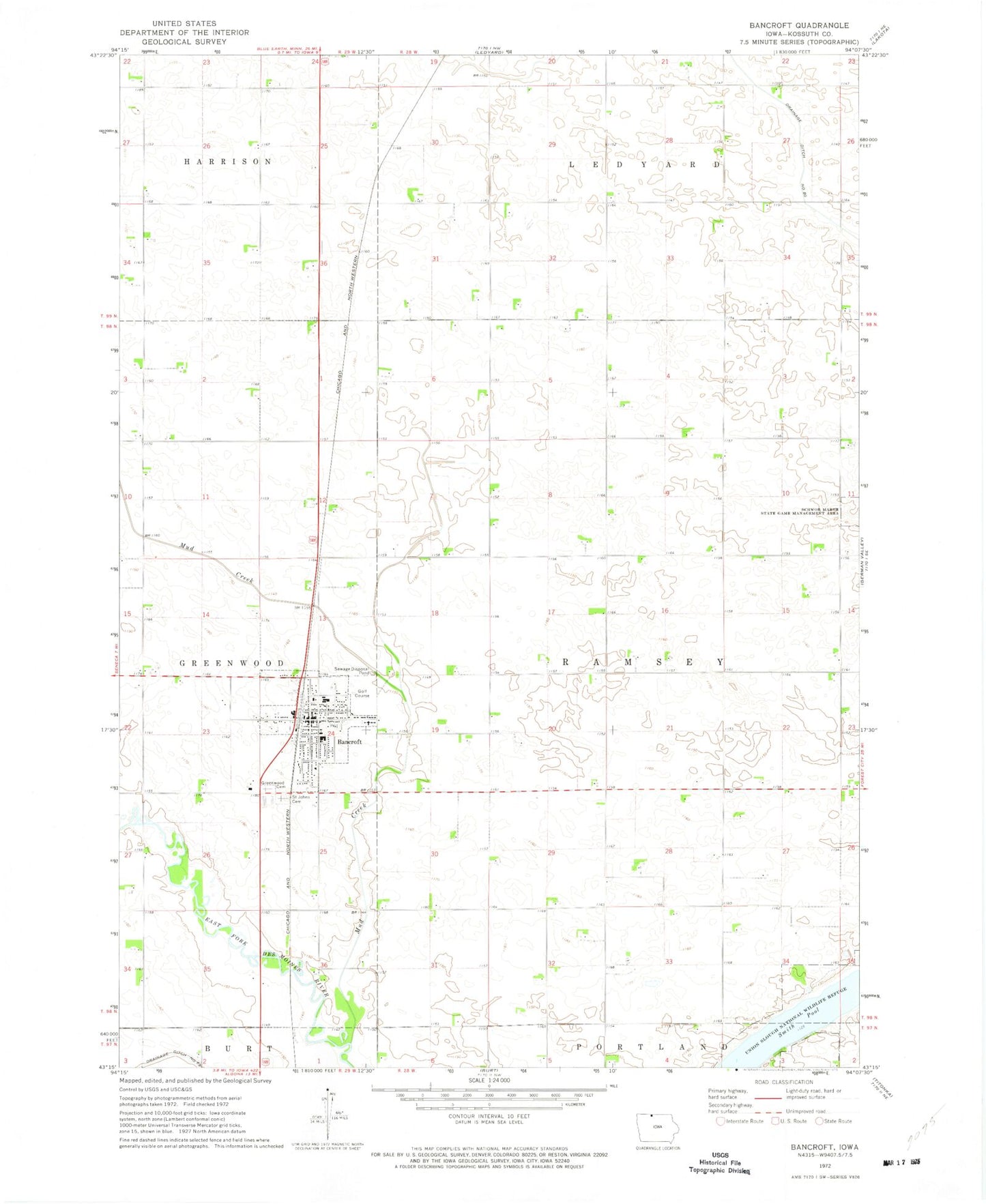
Classic USGS Bancroft Iowa 7.5'x7.5' Topo Map
Couldn't load pickup availability
Historical USGS topographic quad map of Bancroft in the state of Iowa. Map scale may vary for some years, but is generally around 1:24,000. Print size is approximately 24" x 27"
This quadrangle is in the following counties: Kossuth.
The map contains contour lines, roads, rivers, towns, and lakes. Printed on high-quality waterproof paper with UV fade-resistant inks, and shipped rolled.
Contains the following named places: Bancroft, Bancroft Ambulance Service, Bancroft Medical and Dental Clinic, Bancroft Post Office, Bancroft Public Library, Bancroft Volunteer Fire Department, City of Bancroft, Drainage Ditch Number 69, First Baptist Church, Greenwood Cemetery, Heritage Homes, Kossuth County Waterfowl Production Area, Kossuth Regional Health Center, Maynard Reese Area, Mud Creek, North Kossuth Golf Club, North Kossuth Middle School, Saint John Catholic School, Saint Johns Cemetery, Saint John's Church, Smith Pool, Township of Ramsey, Union Slough National Wildlife Refuge, ZIP Code: 50517