MyTopo
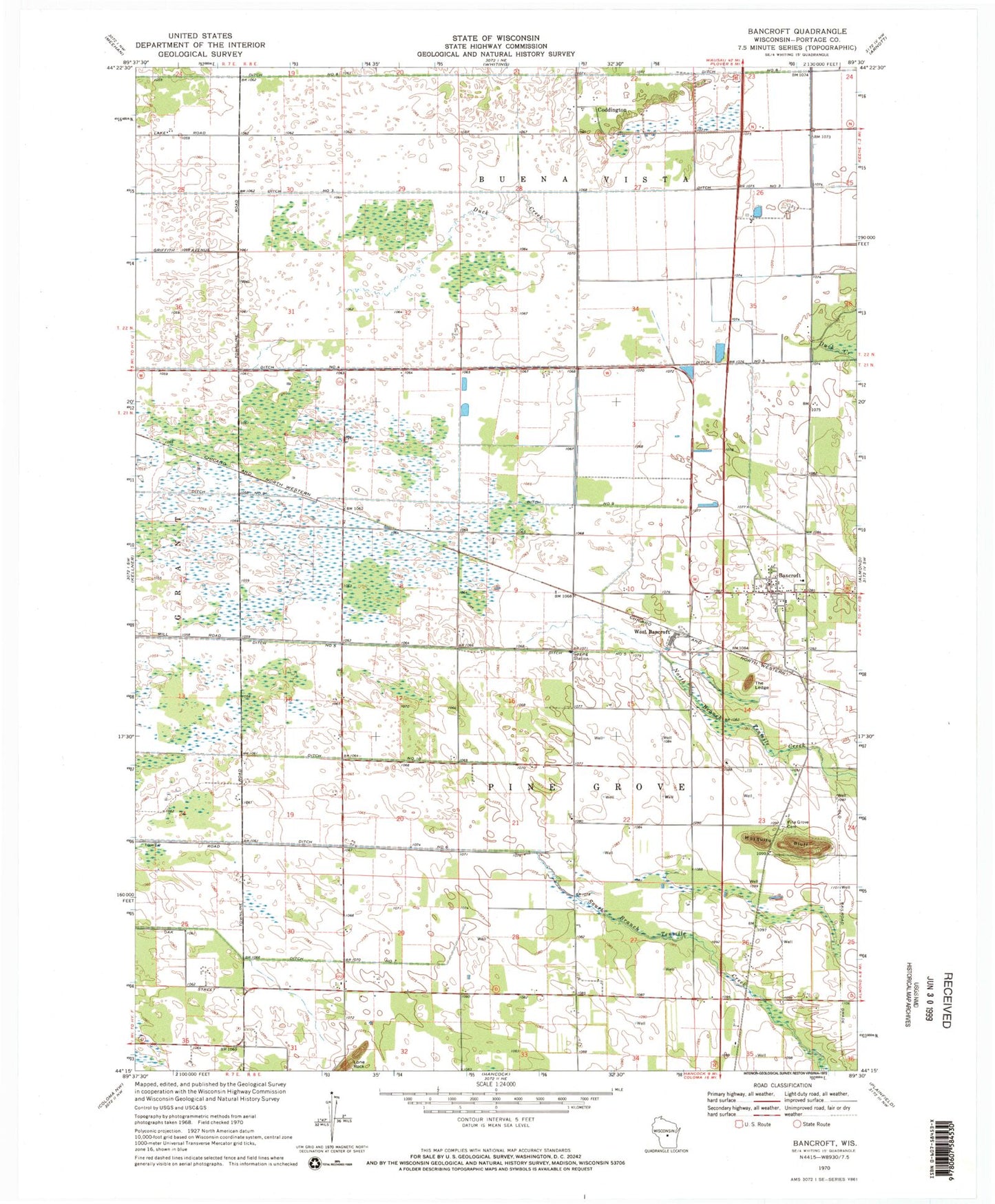
Classic USGS Bancroft Wisconsin 7.5'x7.5' Topo Map
Couldn't load pickup availability
Historical USGS topographic quad map of Bancroft in the state of Wisconsin. Map scale may vary for some years, but is generally around 1:24,000. Print size is approximately 24" x 27"
This quadrangle is in the following counties: Portage.
The map contains contour lines, roads, rivers, towns, and lakes. Printed on high-quality waterproof paper with UV fade-resistant inks, and shipped rolled.
Contains the following named places: Bancroft, Bancroft Census Designated Place, Bancroft Pine Grove Fire Department, Bancroft Post Office, Bluff School, Coddington, Ditch Number Eight, Ditch Number Five, Ditch Number Four, Ditch Number Nine, Ditch Number Seven, Ditch Number Six, Ditch Number Ten, Ditch Number Three, Duck Creek, Lone Rock, Mosquito Bluff, Pine Grove Cemetery, The Ledge, Town of Pine Grove, West Bancroft, ZIP Code: 54921