MyTopo
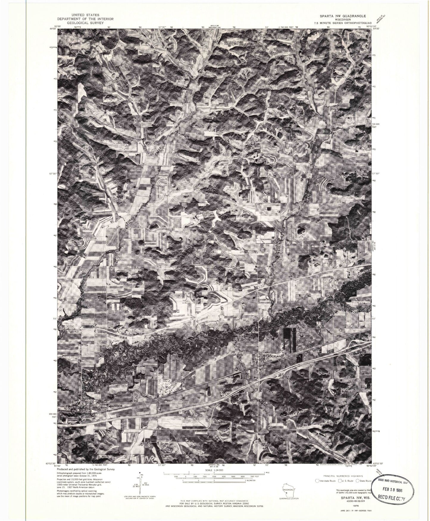
Classic USGS Bangor Wisconsin 7.5'x7.5' Topo Map
Couldn't load pickup availability
Historical USGS topographic quad map of Bangor in the state of Wisconsin. Map scale may vary for some years, but is generally around 1:24,000. Print size is approximately 24" x 27"
This quadrangle is in the following counties: La Crosse, Monroe.
The map contains contour lines, roads, rivers, towns, and lakes. Printed on high-quality waterproof paper with UV fade-resistant inks, and shipped rolled.
Contains the following named places: 17 Reservoir, 54614, Anderson Coulee, Bangor, Bangor - Burns Fire Department Rockland Station, Bangor - Burns Volunteer Fire Department, Bangor Elementary School, Bangor Middle School, Bangor Police Department, Bangor Post Office, Big Creek, Big Creek Church, Burns, Burns Dam, Burns Valley Church, Culpitt Coulee, Dutch Creek, East Upper Big Creek, Elm Grove School, Fairview Cemetery, Fish Creek, Fish Creek School, Heller Hill, Hill Grove School, Jenkins Valley, La Crosse River Trail Prairies State Natural Area, Little LaCrosse River, Lower Big Creek School, Moss Hill, Norwegian Coulee, Olson Coulee, Pettinger Hill, Prairie School, Progressive School, Quall Coulee, Raffelson Coulee, Rockland, Rockland Post Office, Saint Marys Cemetery, Saint Paul's Evangelical Lutheran School, Striped School, Tamarack Coulee, The Notch, Town of Burns, Upper Big Creek, Upper Burns Valley, Village of Bangor, Village of Rockland, Waldness Hill, Webster Field, Welsh Calvanistic Cemetery, Welsh Congregational Cemetery, White School