MyTopo
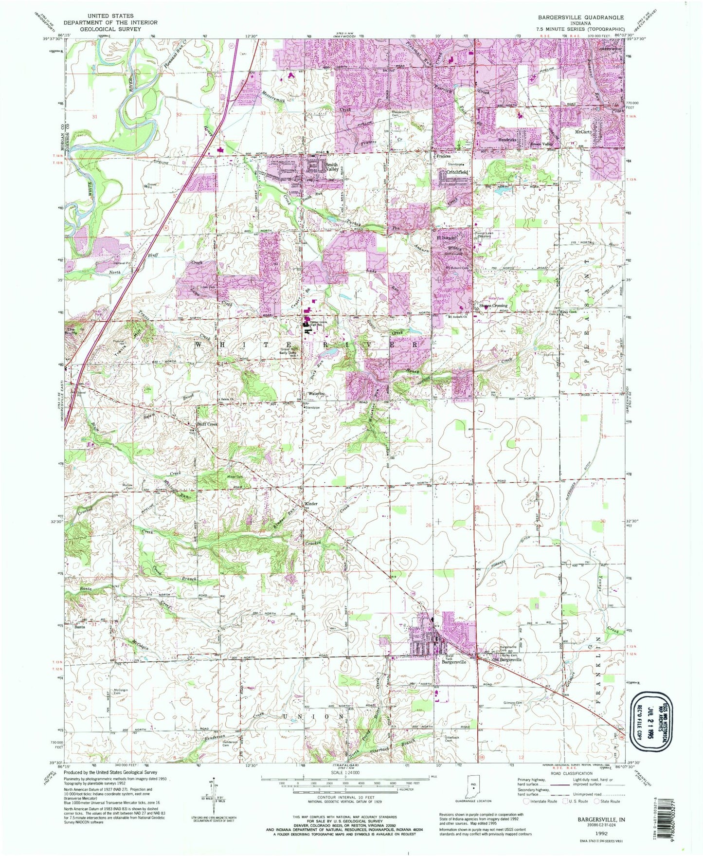
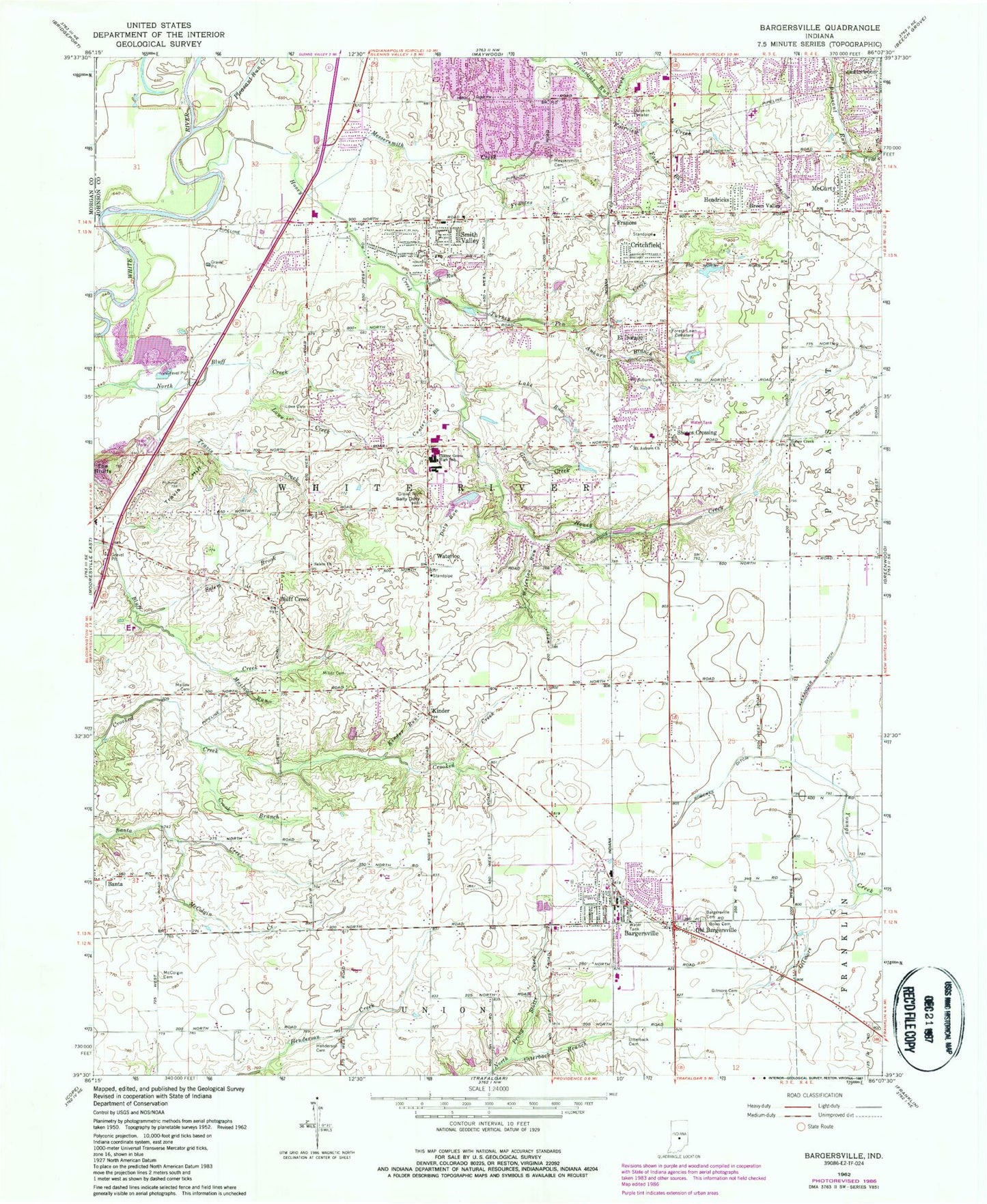
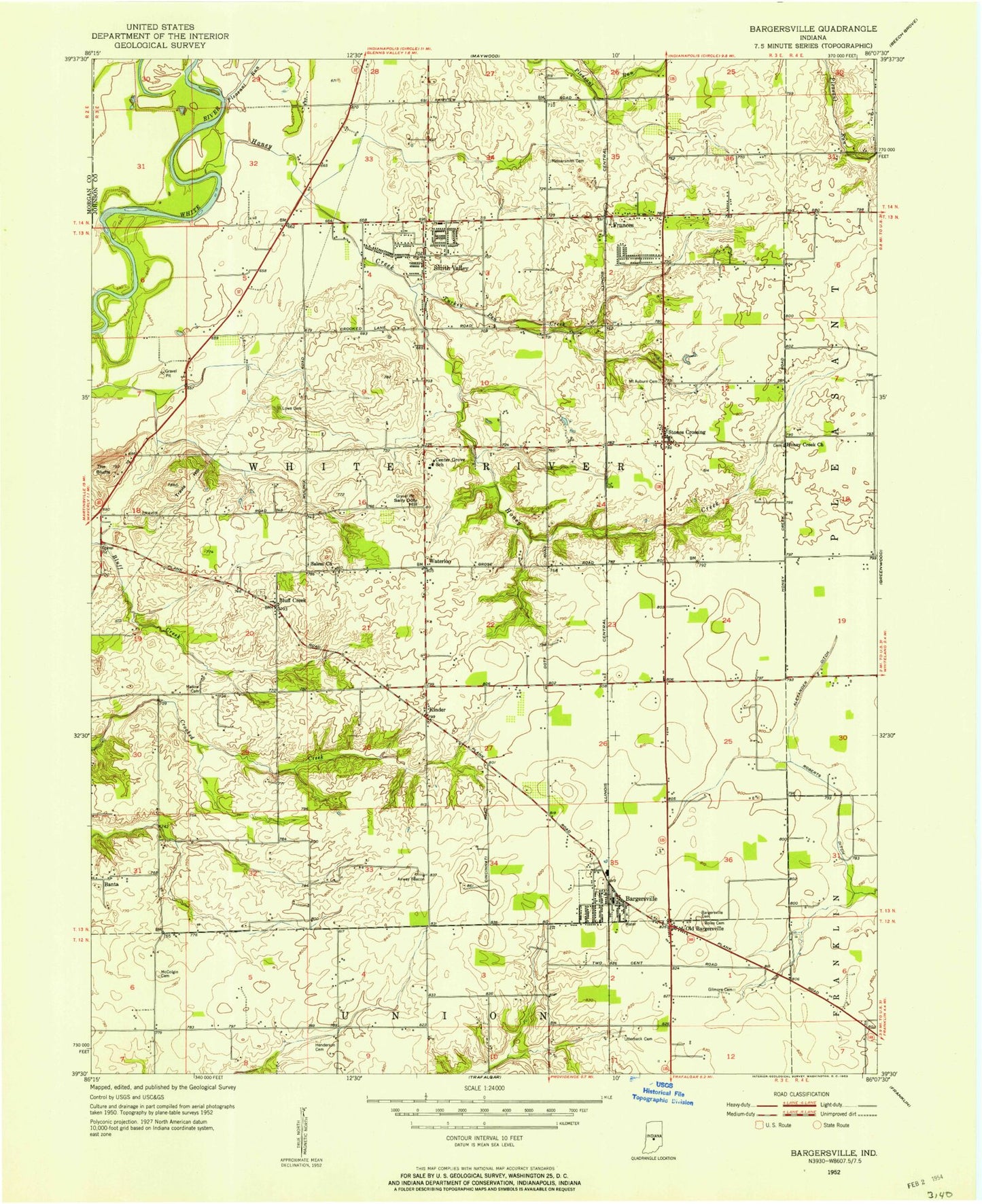
Classic USGS Bargersville Indiana 7.5'x7.5' Topo Map
Couldn't load pickup availability
Historical USGS topographic quad map of Bargersville in the state of Indiana. Map scale may vary for some years, but is generally around 1:24,000. Print size is approximately 24" x 27"
This quadrangle is in the following counties: Johnson, Morgan.
The map contains contour lines, roads, rivers, towns, and lakes. Printed on high-quality waterproof paper with UV fade-resistant inks, and shipped rolled.
Contains the following named places: Alexander Ditch, Al-Mar, Auburn Branch, Auburn Trace, Bargersvill Police Department, Bargersville, Bargersville Cemetery, Bargersville Christian Church, Bargersville Community Fire Department Station 1, Bargersville Community Fire Department Station 2, Bargersville Community Fire Station 1, Bargersville Community Fire Station 2, Bargersville Post Office, Beck Airport, Bluff Acres, Bluff Creek, Bluff Creek Christian Church, Boles Cemetery, Brentridge, Brentwood, Brockton Manor, Cedar Hills, Center Creek, Center Grove High School, Clearview, Critchfield, Crook Branch, Deerwood, Doty Run, Doty Run Lake Dam, Eagle Trace, El Dorado, Elmer C Summit Lake Dam, Fair Brook, Fairview Creek, Forest Lawn Memory Gardens, Foxberry Trace, Frances, Frances Creek, Gilmore Cemetery, Gilmore Creek, Golden Grove, Green Valley, Greenwood Fire Department Station 93, Greenwood Nursing Home, Henderson Cemetery, Hendricks, Hickory Stick Golf Club, Honey Creek, Honey Creek Church, Horizon Estates, Hunters Pointe, Kinder, Kinder Run, Lake Run, Lowe Cemetery, Lowe Creek, Mallow Cemetery, Mallow Run, McCarty, McColgin Cemetery, McColgin Creek, Meridian Place Shopping Center, Messersmith Cemetery, Messersmith Creek, Miles Field Airport, Miller Cemetery, Mount Auburn Cemetery, Mount Auburn United Methodist Church, Mount Pleasant Christian Church, Old Bargersville, Pebble Hills, Pebble Run, Pennington Estates, Pleasant Run Creek, Roberts Ditch, Royal Oak Country Club, Salem Brook, Salem Cemetery, Salem Church, Sally Doty Hill, Scott Ditch, Smith Run, Smith Valley, Smith Valley Baptist Church, Stones Crossing, The Centre At Smith Valley Shopping Center, Thorn Field, Town of Bargersville, Township of White River, Travis Creek, Travis Hill, Tremont, Turkey Pen Creek, Utterback Branch, Utterback Cemetery, Walnut Ridge Golf Course, Waterloo, Waterloo Run, Waters Edge, White River Township Fire Department Station 51, White River Township Fire Department Station 52, White River Township Fire Department Station 53, Willow Lakes, Woodland Stream, ZIP Codes: 46106, 46142