MyTopo
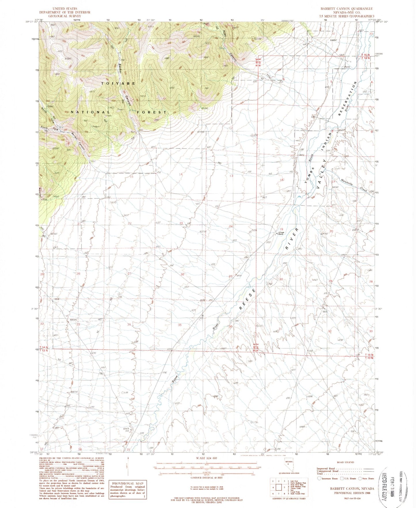
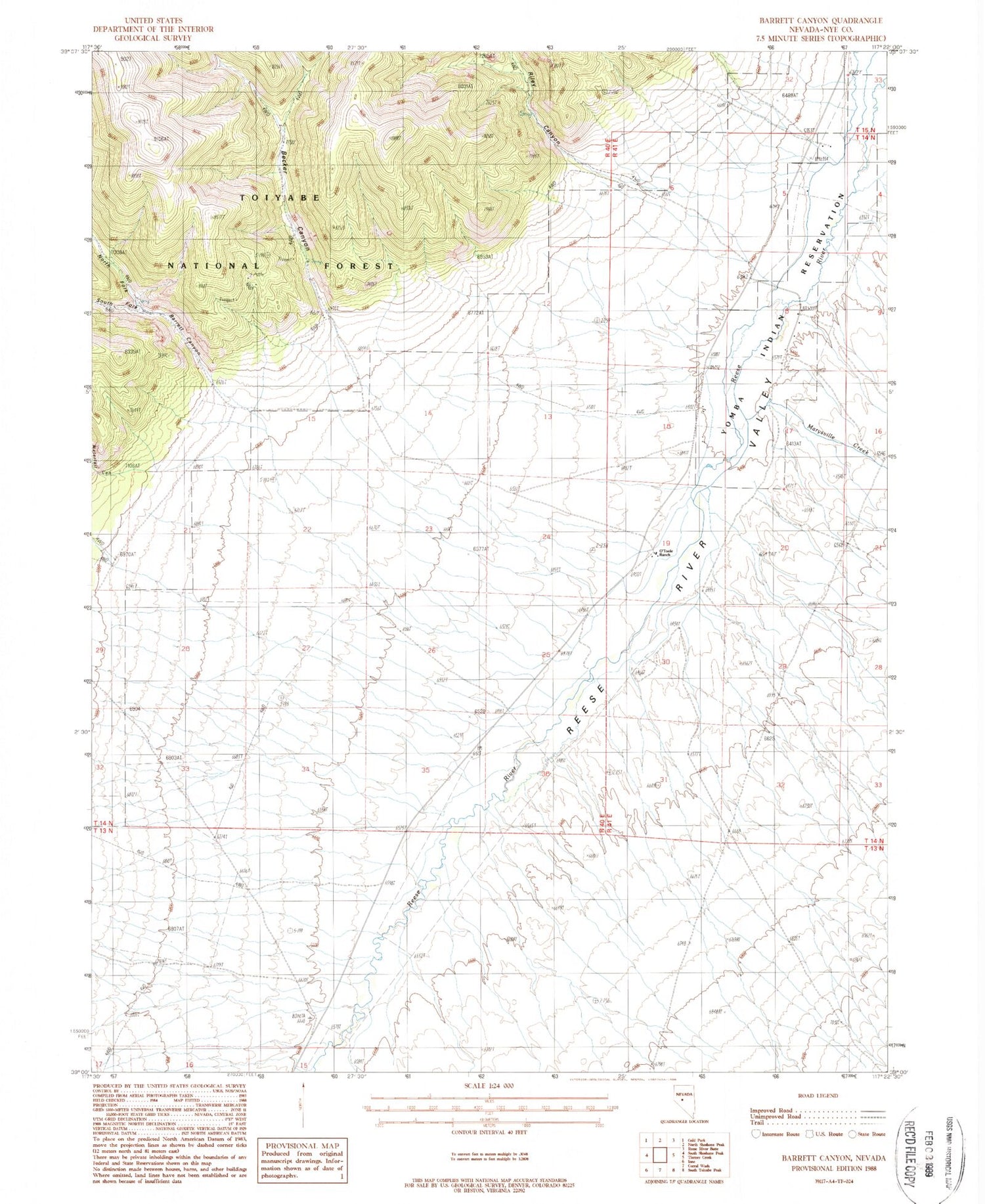
Classic USGS Barrett Canyon Nevada 7.5'x7.5' Topo Map
Couldn't load pickup availability
Historical USGS topographic quad map of Barrett Canyon in the state of Nevada. Map scale may vary for some years, but is generally around 1:24,000. Print size is approximately 24" x 27"
This quadrangle is in the following counties: Nye.
The map contains contour lines, roads, rivers, towns, and lakes. Printed on high-quality waterproof paper with UV fade-resistant inks, and shipped rolled.
Contains the following named places: Barrett, Barrett Canyon, Barrett Post Office, Becker Canyon, Becker Creek, J F Bowler Ranch, Marysville, Marysville Creek, Meadow Creek, North Fork Barrett Canyon, O'Toole Ranch, O'Toole Ranch Airport, Reese River Post Office, Riley Canyon, Riley Creek, South Fork Barrett Canyon, Ward Mine, Waterfall Canyon