
MyTopo
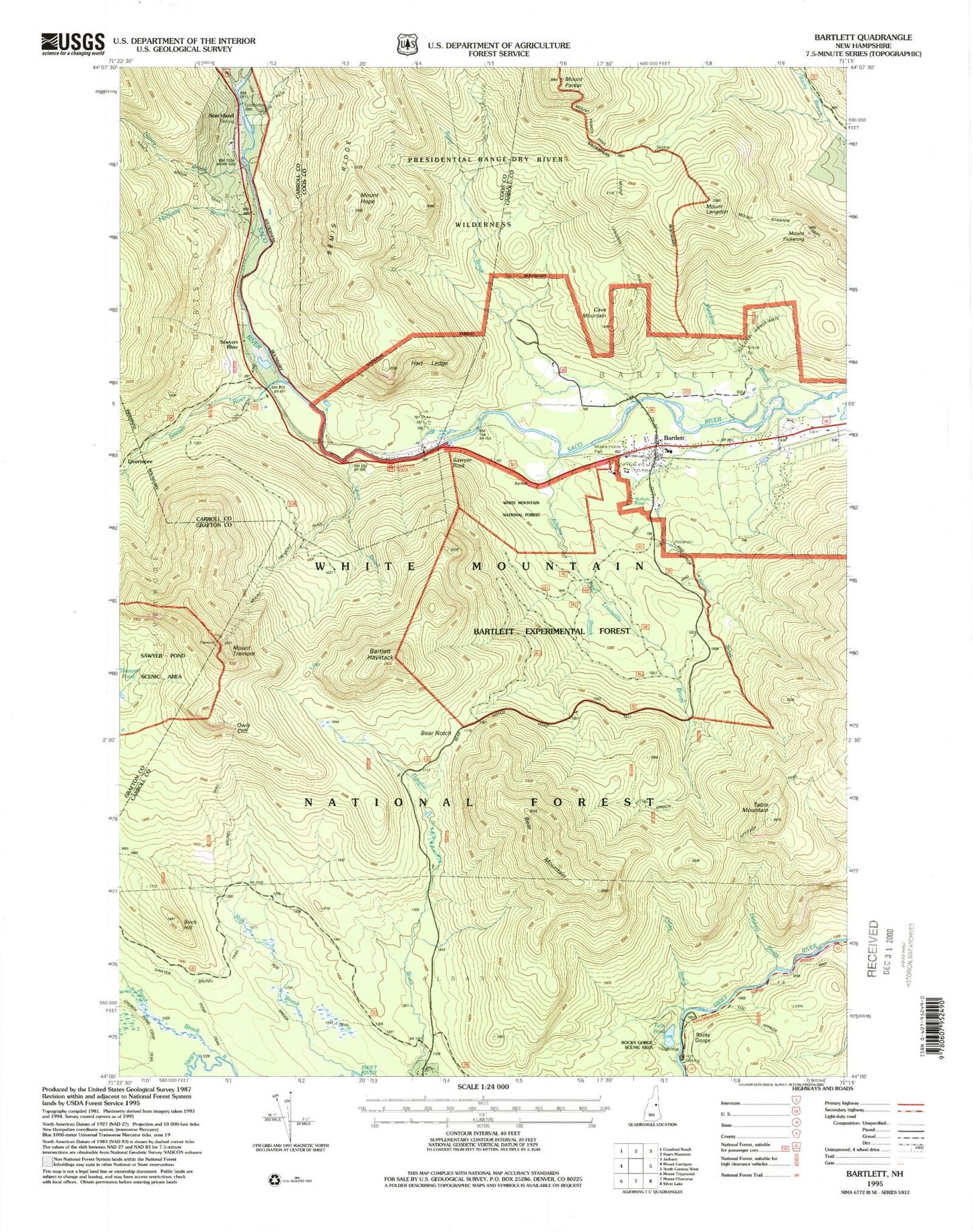
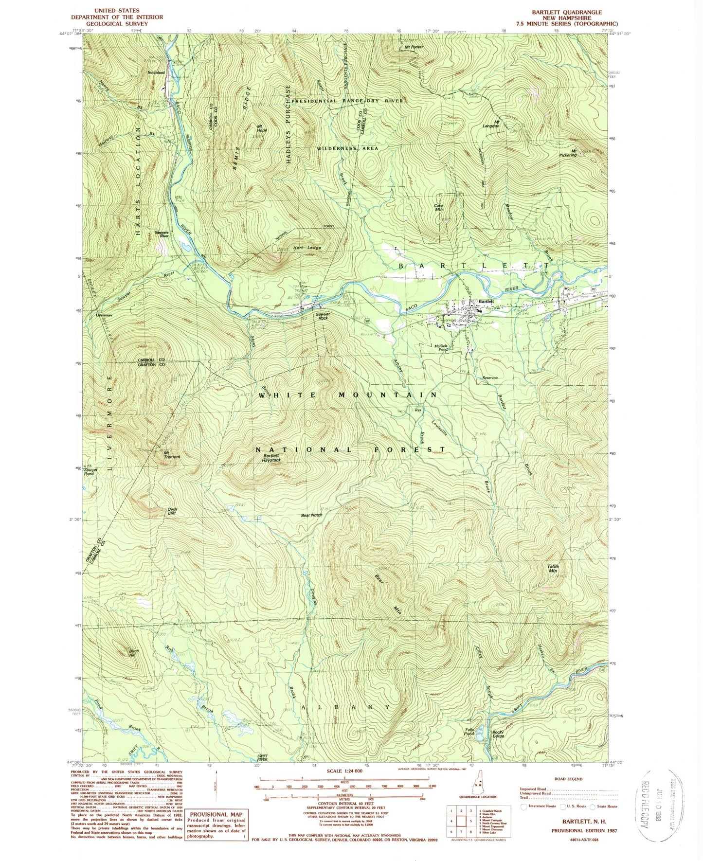
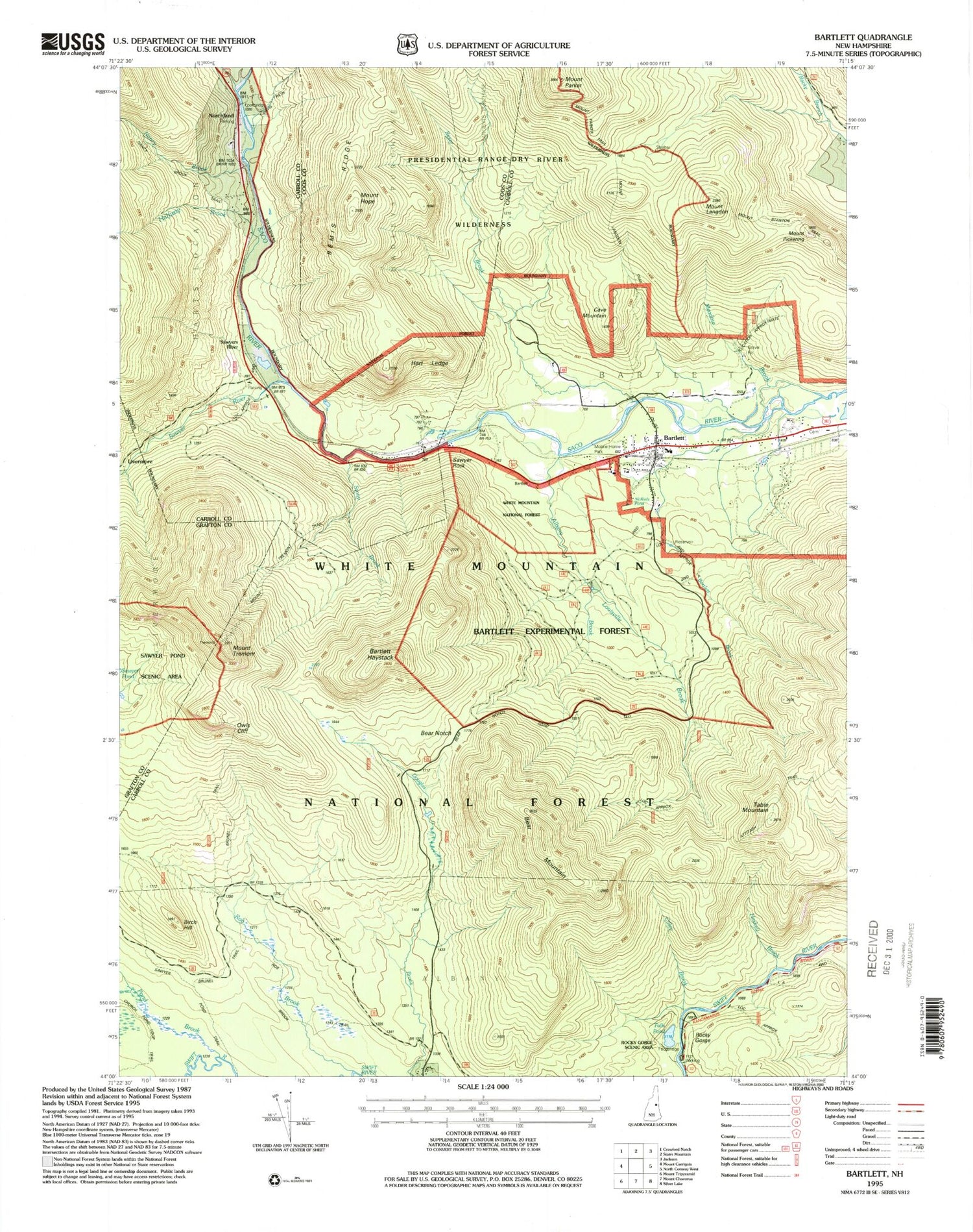
Classic USGS Bartlett New Hampshire 7.5'x7.5' Topo Map
Couldn't load pickup availability
Historical USGS topographic quad map of Bartlett in the state of New Hampshire. Typical map scale is 1:24,000, but may vary for certain years, if available. Print size: 24" x 27"
This quadrangle is in the following counties: Carroll, Coos, Grafton.
The map contains contour lines, roads, rivers, towns, and lakes. Printed on high-quality waterproof paper with UV fade-resistant inks, and shipped rolled.
Contains the following named places: Sawyer Rock, Albany Brook, Albany Intervale, Bartlett Haystack, Bartlett, Bartlett Brook, Bear Brook Trail, Bear Mountain, Bear Mountain Ski Trail, Bear Mountain Trail, Bear Notch, Birch Hill, Brunel Trail, Cave Mountain, Cilley Brook, Deer Brook Trail, Falls Pond, Halfway Brook, Hart Ledge, Haskell Brook, Mount Hope, Mount Langdon, Louisville Brook, McKiels Pond, Meadow Brook, Mount Langdon Shelter, Mount Stanton Trail, Mount Tremont Trail, Nancy Brook, Notchland, Owls Cliff, Mount Parker, Passaconaway Trail, Pond Brook, Razor Brook, Razor Brook Trail, Reservoir Trail, Rob Brook, Rob Brook Trail, Sawyer Pond Trail, Sawyers River, Sawyer River, Stony Brook, Table Mountain, Mount Tremont, Church Pond Loop Trail, Rocky Gorge Scenic Area, Bartlett Experimental Forest, Sawyer Rock Picnic Area, Nancy Brook Trail, Mount Pickering, Bartlett First Assembly of God, Bartlett Post Office, Josiah Bartlett Elementary School, Sawyer Rock Picnic Area, Bartlett Fire Department Station 1, Bartlett Census Designated Place, Rocky Gorge