MyTopo
Classic USGS Bass Lake Indiana 7.5'x7.5' Topo Map
Couldn't load pickup availability
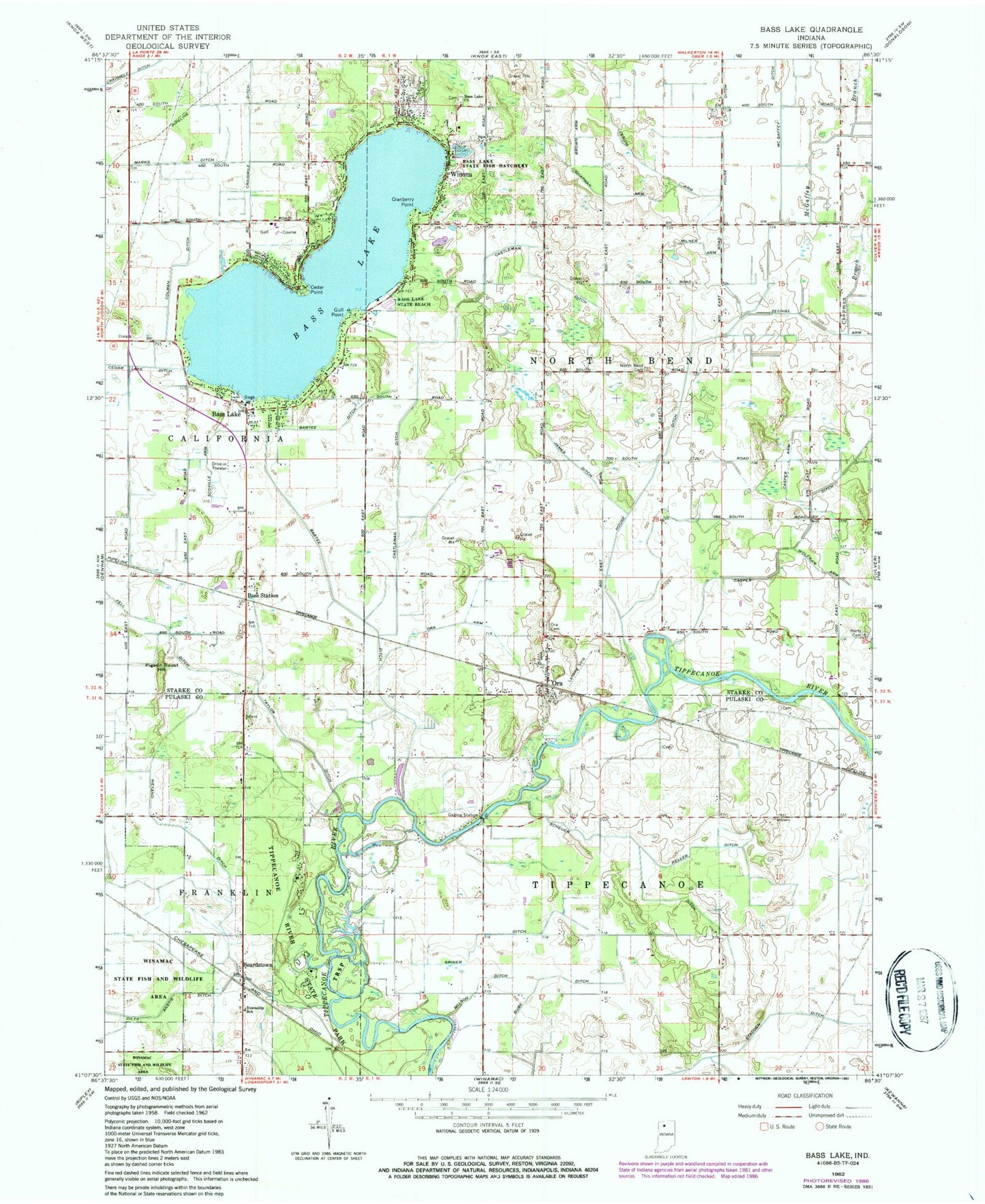
Historical USGS topographic quad map of Bass Lake in the state of Indiana. Typical map scale is 1:24,000, but may vary for certain years, if available. Print size: 24" x 27"
This quadrangle is in the following counties: Pulaski, Starke.
The map contains contour lines, roads, rivers, towns, and lakes. Printed on high-quality waterproof paper with UV fade-resistant inks, and shipped rolled.
Contains the following named places: Bartee Ditch, Bass Lake, Bass Lake, Bass Lake Church, Bass Lake State Beach, Bass Station, Beardstown, Brown Arm, Bube Ditch, Casper Arm, Casper Ditch, Castleman Ditch, Cedar Point, Chapman Arm, Chapman Branch, Colman Ditch, Cranberry Point, Fell Ditch, Griner Ditch, Gull Point, House Ditch, James Ditch, Keller Ditch, Marks Ditch, McGaffey Ditch, Milner Arm, North Bend Cemetery, Ora, Ora Arm, Alexander Heinemann Memorial Cemetery, Pigeon Roost Hill, Scheuer Ditch, Scoville Arm, Stadden Ditch, Taylor Ditch, Vergin Arm, Weyand Ditch, Winona, Wolfram Arm, Wheeler Airport, Blackmon Field, Bass Lake State Fish Hatchery, Township of North Bend, Township of Tippecanoe, Bass Lake Census Designated Place, Bass Lake - California Township Fire Department Station 1, Melody Drive-In, Van de Mark Airport, Bass Lake - California Township Fire Station