MyTopo
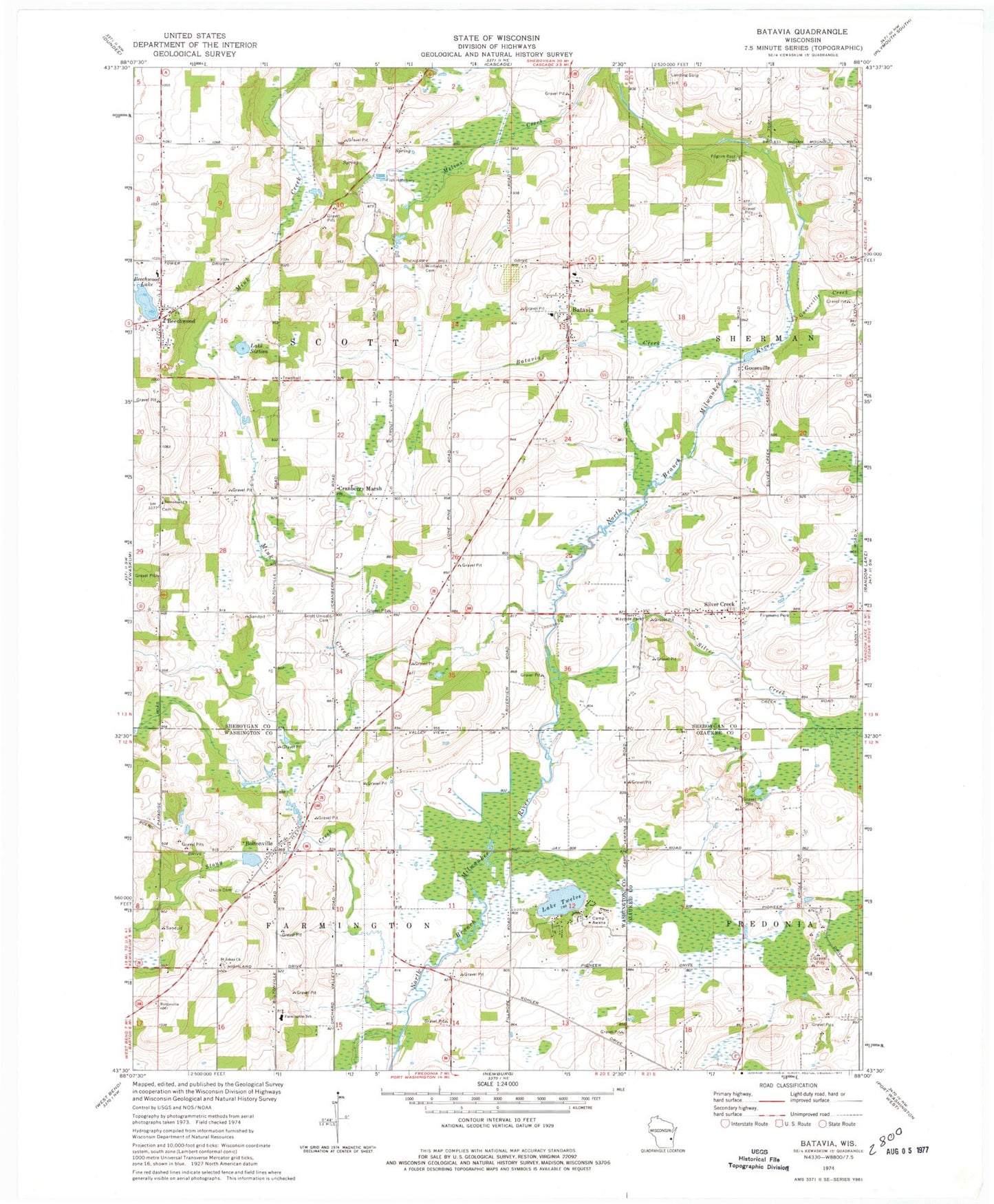
Classic USGS Batavia Wisconsin 7.5'x7.5' Topo Map
Couldn't load pickup availability
Historical USGS topographic quad map of Batavia in the state of Wisconsin. Map scale may vary for some years, but is generally around 1:24,000. Print size is approximately 24" x 27"
This quadrangle is in the following counties: Ozaukee, Sheboygan, Washington.
The map contains contour lines, roads, rivers, towns, and lakes. Printed on high-quality waterproof paper with UV fade-resistant inks, and shipped rolled.
Contains the following named places: 13 Reservoir, 53001, Batavia, Batavia Census Designated Place, Batavia Creek, Batavia Elementary School, Batavia Volunteer Fire Department, Batavis Pond, Beechwood, Beechwood Cemetery, Beechwood Lake, Beechwood Volunteer Fire Department, Boltonville, Boltonville 2WP1738 Dam, Boltonville Union Cemetery, Boltonville Volunteer Fire Department, Camp Awana, Cranberry Marsh, Farmington Elementary School, Firemans Park, Gooseville, Gooseville 3WR 1559 Dam, Gooseville Creek, Gooseville Millpond 40, Hartmann Pit, Hillside School, Immanuel Church, Immanuel Lutheran Cemetery, Lafollette School, Lake Sixteen, Lake Twelve, Longfellow School, Mink Creek, Pilgrims Rest Cemetery, Riverside Strip, Saint John of God Roman Catholic Church, Saint Stephens Lutheran Cemetery, Scott Center School, Scott Union Cemetery, Silver Creek, Silver Creek Volunteer Fire Department, Stony Creek, Town of Scott, Winfield Cemetery, Zion United Methodist Cemetery