MyTopo
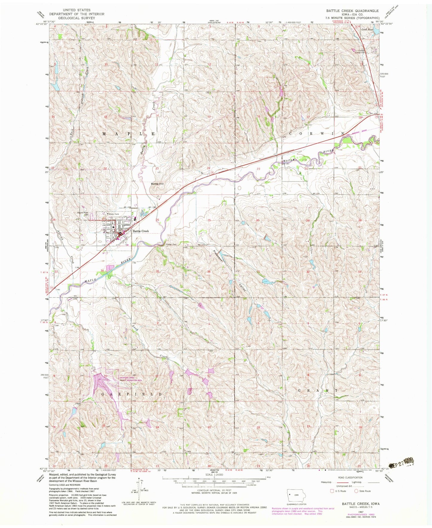
Classic USGS Battle Creek Iowa 7.5'x7.5' Topo Map
Couldn't load pickup availability
Historical USGS topographic quad map of Battle Creek in the state of Iowa. Map scale may vary for some years, but is generally around 1:24,000. Print size is approximately 24" x 27"
This quadrangle is in the following counties: Ida.
The map contains contour lines, roads, rivers, towns, and lakes. Printed on high-quality waterproof paper with UV fade-resistant inks, and shipped rolled.
Contains the following named places: Aldrich Creek, Battle Creek, Battle Creek - Ida Grove Intermediate School, Battle Creek City Fire Department, Battle Creek City Hall, Battle Creek City Police, Battle Creek Community Ambulance Service, Battle Creek Elementary School, Battle Creek Post Office, Battle Creek Public Library, Battle Hill, Battle Hill Museum of Natural History, City of Battle Creek, Crawford Creek, Crawford Creek County Recreation Area, Evergreen Lawn Farm, Final Four Farm, Grell Pond, Grell Pond Dam, Hieber Park, Hofmann Farms, Ida County Fairgrounds, J and K Farms, J B W Farms, Lund Creek, Maple Number Five School, Moorehead School, Mount Hope Cemetery, Pale Willow Care Center, Pleasant Valley, Presbyterian Church, Rabe Farms, Saint Johns Lutheran Church, Schoen Farms, Township of Garfield, Township of Maple, Uhl Farms, Van Houten Farms, ZIP Code: 51006