MyTopo
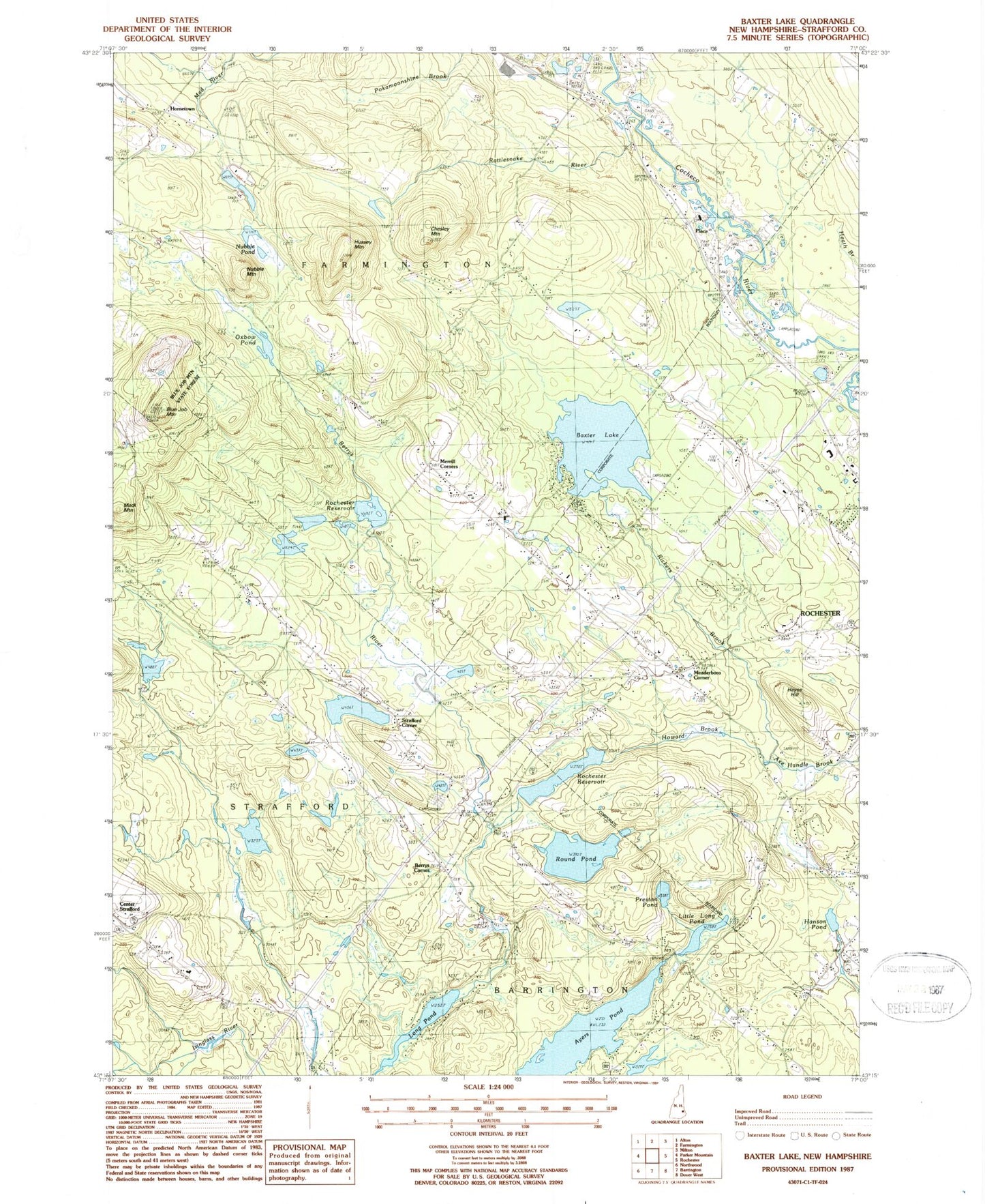
Classic USGS Baxter Lake New Hampshire 7.5'x7.5' Topo Map
Couldn't load pickup availability
Historical USGS topographic quad map of Baxter Lake in the state of New Hampshire. Typical map scale is 1:24,000, but may vary for certain years, if available. Print size: 24" x 27"
This quadrangle is in the following counties: Strafford.
The map contains contour lines, roads, rivers, towns, and lakes. Printed on high-quality waterproof paper with UV fade-resistant inks, and shipped rolled.
Contains the following named places: Ayers Pond, Baxter Lake, Berrys Corner, Berrys River, Blue Job Mountain, Chesley Mountain, Crown Point School, Gerrish Chapel, Hanson Pond, Hayes Hill, Hornetown, Howard Brook, Hussey Mountain, Kimball Cemetery, Little Long Pond, Long Pond, Mack Mountain, Meaderboro Corner, Merrill Corners, Nubble Mountain, Nubble Pond, Oxbow Pond, Place, Preston Pond, Rickers Brook, Rochester Reservoir, Round Pond, Squamanagonic Camp, Strafford Corner, Whitehouse Mountain, Strafford County, Town of Farmington, Berrys River Dam, Berrys River Reservoir, Round Pond Dam, Rochester Reservoir Dam, Kenneth Hill Dam, Kenneth Hill Pond, Berry Brook Dam, Berrys River Reservoir, Baxter Lake Easterly Dike, Baxter Lake Center Dike, Baxter Lake Main Dam, Preston Pond Dam, Nubble Pond Brook Dam, Blue Job Mountain State Forest, Brock Cemetery, Foss Cemetery, Gray Cemetery, Ham Cemetery, Hersey Haven, Johnson Cemetery, Meaderboro Community Church, Montgomery Cemetery, Rattlesnake Pond, Stanton Cemetery, Ten Rod Marsh, Academy for Equine Sciences Charter School, Strafford Fire and Rescue Crown Point Station, Strafford Fire and Rescue Center Station, Butternut Farm, Crown Point Cemetery