MyTopo
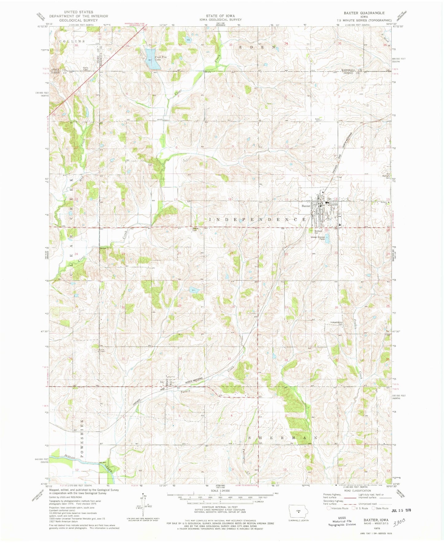
Classic USGS Baxter Iowa 7.5'x7.5' Topo Map
Couldn't load pickup availability
Historical USGS topographic quad map of Baxter in the state of Iowa. Map scale may vary for some years, but is generally around 1:24,000. Print size is approximately 24" x 27"
This quadrangle is in the following counties: Jasper, Marshall, Story.
The map contains contour lines, roads, rivers, towns, and lakes. Printed on high-quality waterproof paper with UV fade-resistant inks, and shipped rolled.
Contains the following named places: Barbee Cemetery, Baxter, Baxter City Hall, Baxter Elementary School, Baxter Fire Department, Baxter High School, Baxter Medical Clinic, Baxter Police Department, Baxter Post Office, Baxter Public Library, Baxter Rescue Unit, Bethany Cemetery, Bethany Church, Bethel Cemetery, City of Baxter, Clear Creek Wildlife Area, Congregational United Church, Crab Tree Lake, Dawson, Dawson Post Office, Evangelical Free Church, Flock Cemetery, Independence Cemetery, Ira, Ira Post Office, Mud Creek, Restland Cemetery, Township of Independence, Turkey Creek, Union Chapel, Union Chapel Cemetery, ZIP Codes: 50028, 50127