MyTopo
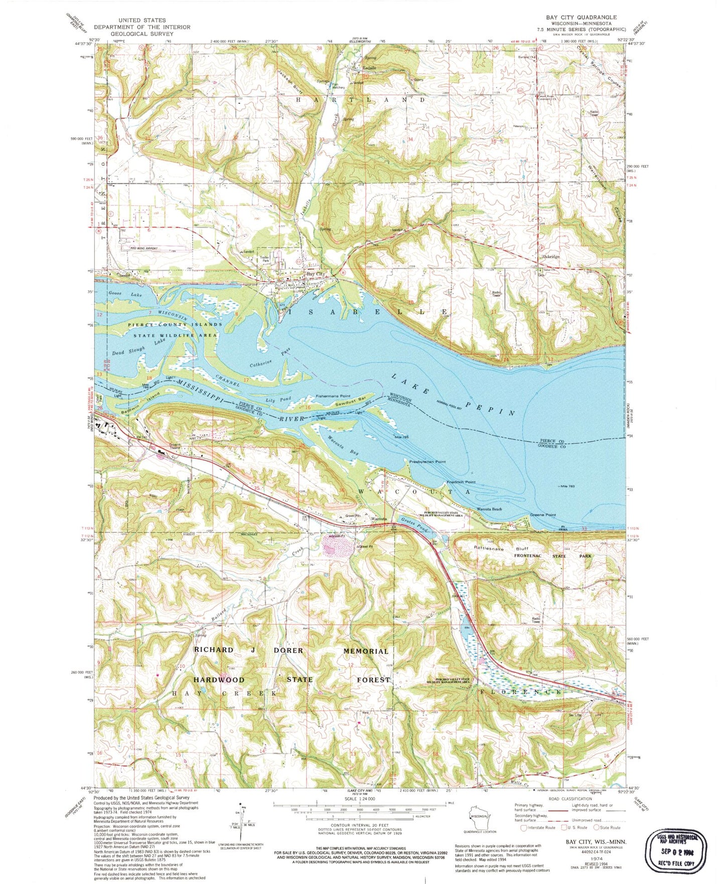
Classic USGS Bay City Wisconsin 7.5'x7.5' Topo Map
Couldn't load pickup availability
Historical USGS topographic quad map of Bay City in the states of Wisconsin, Minnesota. Map scale may vary for some years, but is generally around 1:24,000. Print size is approximately 24" x 27"
This quadrangle is in the following counties: Goodhue, Pierce.
The map contains contour lines, roads, rivers, towns, and lakes. Printed on high-quality waterproof paper with UV fade-resistant inks, and shipped rolled.
Contains the following named places: Baldwin Island, Bay City, Bay City Cemetery, Bay City Post Office, Berean Baptist Church, Bullard Creek, Catharine Pass, Esdaile, Fishermans Point, Forest Home Community Church, Forest Home School, Friedrich Point, Frontenac Hills Apple Farm, Goose Lake, Greene Point, Grotes Pond, Hartland Church, Hedin Island Park, Henry Henricks Dam, Hiawatha Valley Baptist Church, Isabelle Creek, Jackson Bluff, Lily Pond, Minnesota State Training School Entrance Walls, Mississippi National Golf Links, Mount Frontenac Golf Course, Mount Frontenac Ski Area, Oak Hill Mobile Home Park, Oakridge, Oakvale School, Presbyterian Point, Rattlesnake Bluff, Red Wing Regional Airport, Richard J Dorer Memorial Hardwood State Forest, Sawdust Bar, Scherf Cemetery, Tabor Cemetery, Tabor Church, Town of Isabelle, Township of Wacouta, Village of Bay City, Wacouta, Wacouta Bay, Wacouta Beach, Wacouta Cemetery, ZIP Code: 54723