MyTopo
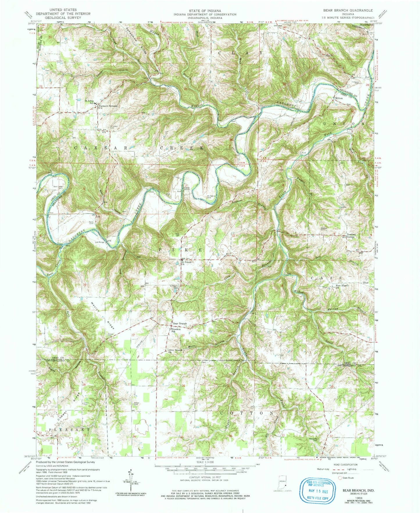
Classic USGS Bear Branch Indiana 7.5'x7.5' Topo Map
Couldn't load pickup availability
Historical USGS topographic quad map of Bear Branch in the state of Indiana. Map scale may vary for some years, but is generally around 1:24,000. Print size is approximately 24" x 27"
This quadrangle is in the following counties: Dearborn, Ohio, Ripley, Switzerland.
The map contains contour lines, roads, rivers, towns, and lakes. Printed on high-quality waterproof paper with UV fade-resistant inks, and shipped rolled.
Contains the following named places: Allensville Cemetery, Baum Hollow, Bear Branch, Bear Branch Volunteer Fire Department, Bear Creek, Bear Creek Cemeteries, Bell Branch, Blue, Bobb Branch, Boyd Branch, Chapel Ridge, Chapel Ridge Cemetery, Conaway Cemetery, Cooper Cemetery, Daniel D Bray Lake, Daniel D Bray Lake Dam, Downey Cemetery, Downey Corner, Droege Creek, Dry Branch, Elk Creek, Farmers Retreat, Freedom School, Goodpasture Branch, Guionsville Post Office, Hayes Branch, Knigga Branch, Logson Branch, Long Branch, Lost Bridge, Marker - Althoff Cemetery, Mexico Ridge, Milton, Mire Branch, Mount Hebron Cemetery, Mud Lick, Mud Lick Creek, Murray Branch, New Hope Church, Olive Branch Church, Pate Cemetery, Pelser Cemetery, Posky Hollow, Pruss Airport, Rand Cemetery, Saint Johns Lutheran Cemetery, Saint Johns School, Saint Peters Church, South Fork Laughery Creek, Sugar Branch, Township of Caesar Creek, Township of Pike, Willow Creek, ZIP Codes: 47011, 47018