
MyTopo
Classic USGS Bearskin Mountain Utah 7.5'x7.5' Topo Map
Couldn't load pickup availability
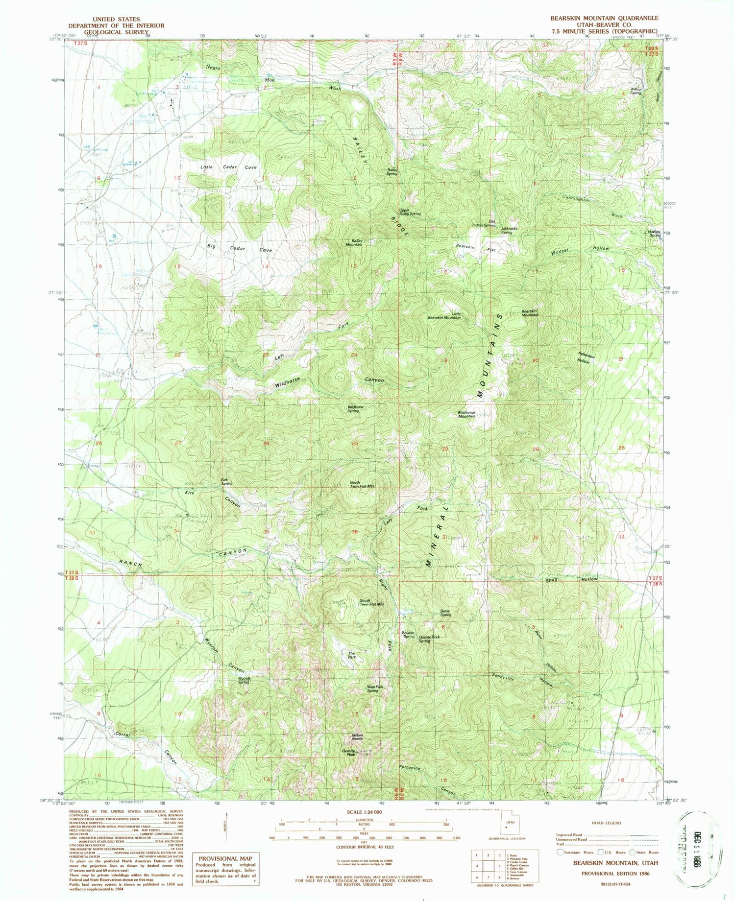
Historical USGS topographic quad map of Bearskin Mountain in the state of Utah. Map scale may vary for some years, but is generally around 1:24,000. Print size is approximately 24" x 27"
This quadrangle is in the following counties: Beaver.
The map contains contour lines, roads, rivers, towns, and lakes. Printed on high-quality waterproof paper with UV fade-resistant inks, and shipped rolled.
Contains the following named places: Bailey Mountain, Bailey Ridge, Bailey Spring, Bearskin Flat, Bearskin Mountain, Bettie Spring, Big Cedar Cove, Boulder Spring, Burnt Hollow, Carlyle Spring, Granite Peak, Granite Rock Spring, Jackrabbit Spring, Kirk Canyon, Kirk Spring, Left Fork Ranch Canyon, Left Fork Wildhorse Canyon, Little Bearskin Mountain, Little Cedar Cove, Mathew Spring, Milford Needle, North Twin Flat Mountain, Old Indian Spring, Patterson Hollow, Pumice Hole Mine, Right Fork Ranch Canyon, Ryan Ranch, Schoo Mine, Shag Hollow, South Twin Flat Mountain, Sunnyside Hollow, The Park, Upper Bailey Spring, West Park Spring, Wildcat Hollow, Wildhorse Canyon, Wildhorse Mountain, Wildhorse Spring, Willow Spring, Wycroft Canyon, Wycroft Spring


