MyTopo
Classic USGS Bedford East Indiana 7.5'x7.5' Topo Map
Couldn't load pickup availability
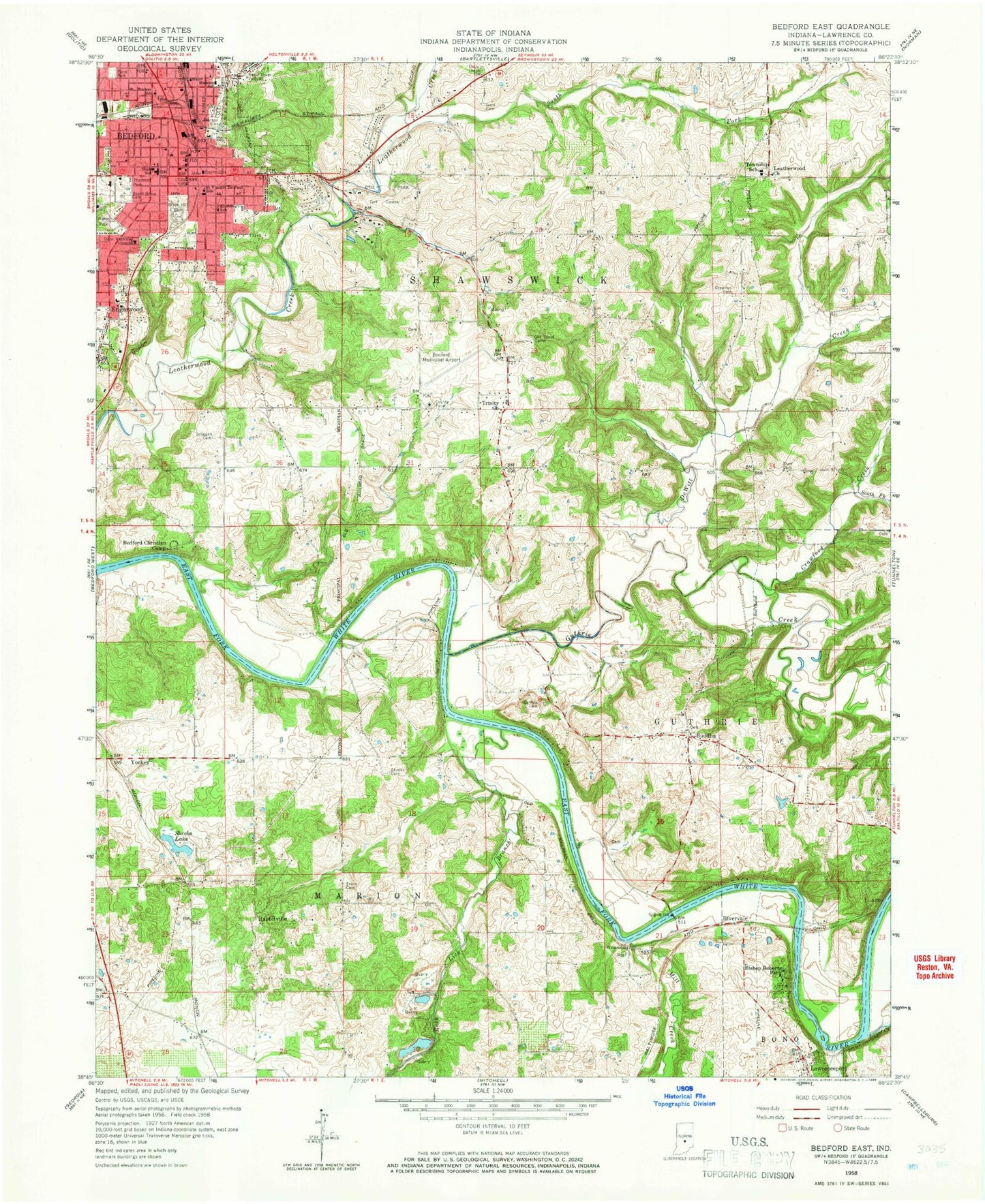
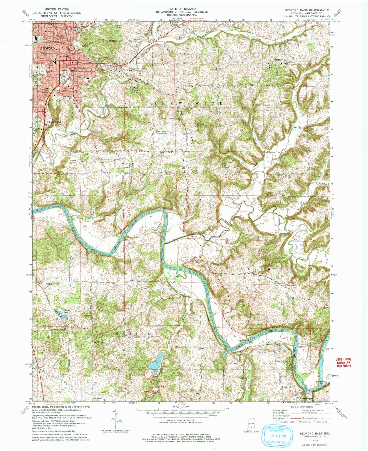
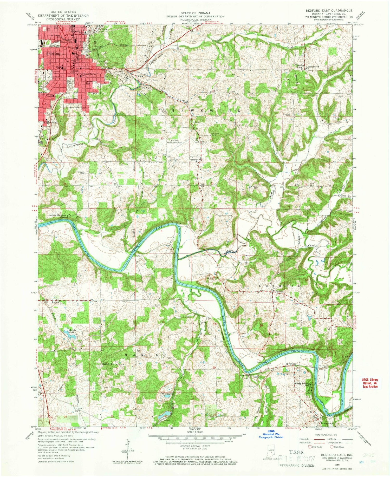
Historical USGS topographic quad map of Bedford East in the state of Indiana. Typical map scale is 1:24,000, but may vary for certain years, if available. Print size: 24" x 27"
This quadrangle is in the following counties: Lawrence.
The map contains contour lines, roads, rivers, towns, and lakes. Printed on high-quality waterproof paper with UV fade-resistant inks, and shipped rolled.
Contains the following named places: Bedford Christian Camp, Beech Grove Cemetery, Bishop Roberts Park, Buddha, Carlton Cemetery, Crawford Cemetery, Crawford Creek, DeWitt Creek, Ascension Saint Vincent Dunn Hospital, Englewood, Erwin Cemetery, Fishing Creek, Furst Park, Green Hill Cemetery, Ikerd Cemetery, Lawrenceport, Leatherwood Church, Lincoln Elementary School, Mill Creek, Otis Park, Rabbitville, Rock Lick Branch, Saint Vincent Depaul School, Scoggan Cemetery, Sheeks Cemetery, Sheeks Lake, South Fork Crawford Creek, Stalker Elementary School, Starr Cemetery, Sugar Creek, Thornton Park, Trinity Church, Water Madden School, Wilson Park, Yockey, Shawswick Elementary and Junior High School, Bedford Middle School, Woodville, WBIW-AM (Bedford), WBIF-FM (Bedford), Rivervale, Bedford, Guthrie Creek, South Fork Leatherwood Creek, Lawrence County, Virgil I Grissom Municipal Airport, Crawford, Township of Shawswick, City of Bedford, Bedford Fire Department Station 1 Central, Bedford Fire Department Station 2, Guthrie Township Volunteer Fire Department Station 2, Shawswick Volunteer Fire Department Station 1, Evans Quarry, Bedford Fire Department Central Station, Bedford Police Department, Lawrence County Sheriff's Office, Lawrence County Jail, Bedford Post Office, Leatherwood Cemetery