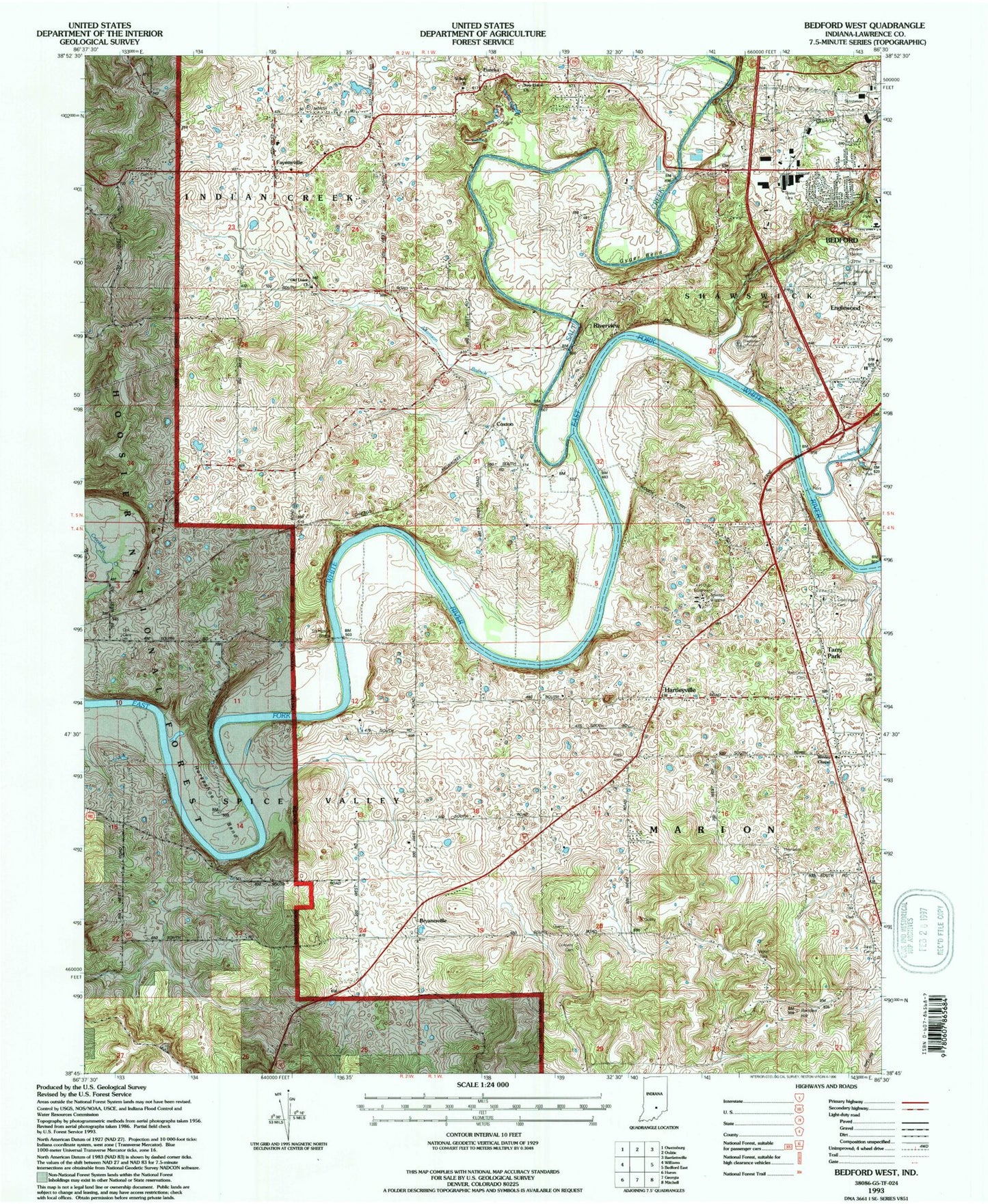
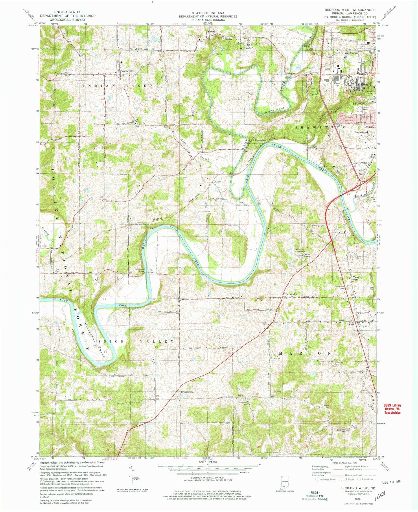
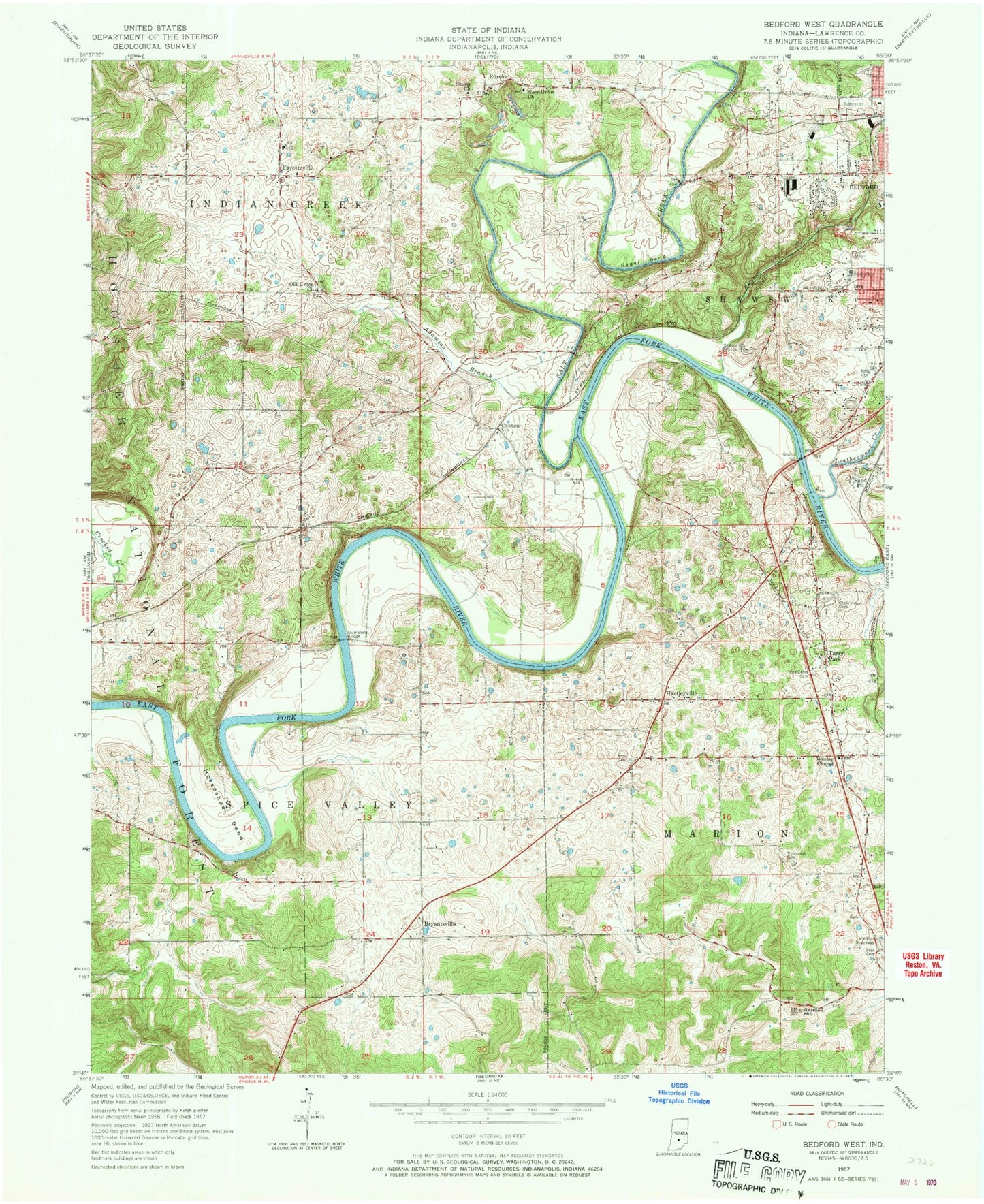
MyTopo
Classic USGS Bedford West Indiana 7.5'x7.5' Topo Map
Couldn't load pickup availability
Historical USGS topographic quad map of Bedford West in the state of Indiana. Map scale may vary for some years, but is generally around 1:24,000. Print size is approximately 24" x 27"
This quadrangle is in the following counties: Lawrence.
The map contains contour lines, roads, rivers, towns, and lakes. Printed on high-quality waterproof paper with UV fade-resistant inks, and shipped rolled.
Contains the following named places: 4-H Club Fairground, Adamson Branch, Bass Cemetery, Bedford Fire Department Englewood Station, Bedford Fire Department Station 3 Englewood, Bedford Quarry, Bryantsville, Connelly Cemetery, Cox Cemetery, Coxton, Cresthaven Memory Gardens Cemetery, Eureka, Fayetteville, Gyger Bend, Hartleyville, Horseshoe Bend, Indian Creek Volunteer Fire Department, Indiana University Health Bedford Hospital, Knott Cemetery, Leatherwood Creek, Mitchell Speedway, New Union Church, Old Union Cemetery, Old Union Church, Pearson Kaolin Mines, Rariden Hill, Red Cross Cemetery, Redding, Riverview, Salt Creek, Shiloh Church, Spider Creek, Stumphole Bridge, Tarry Park, Thomason Cemetery, Township of Indian Creek, Township of Spice Valley, Wesley Chapel