MyTopo
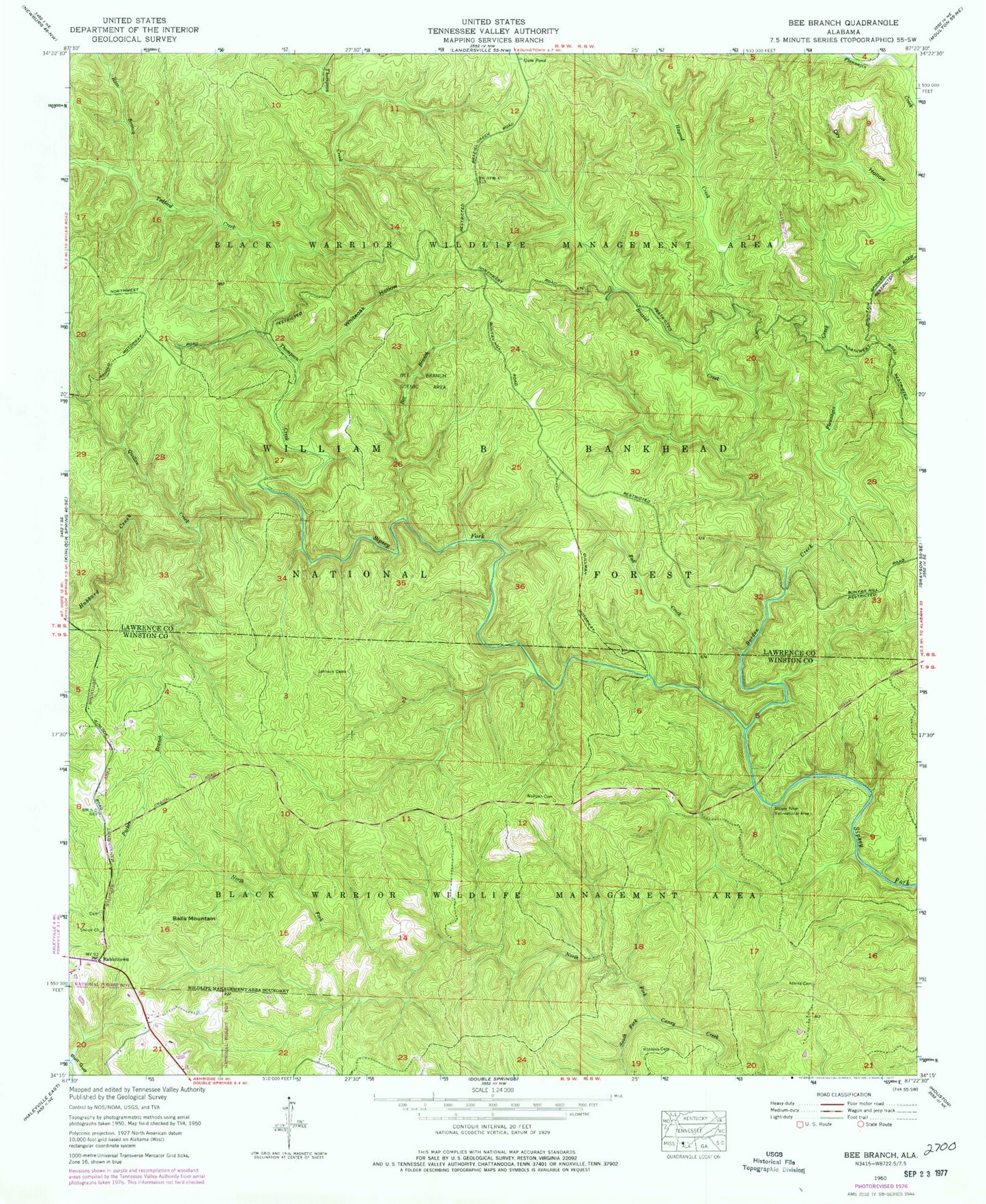
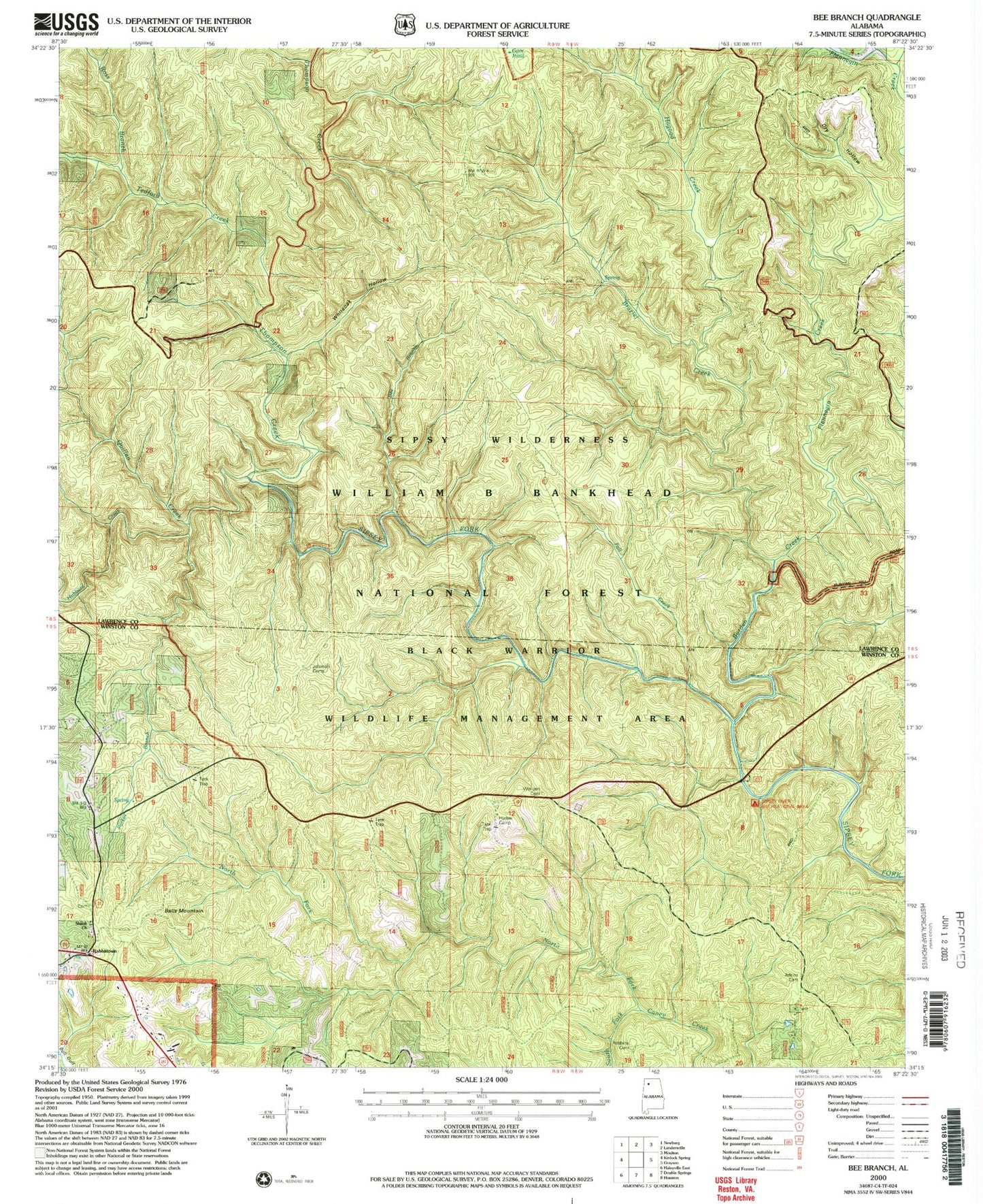
USGS Classic Bee Branch Alabama 7.5'x7.5' Topo Map
Couldn't load pickup availability
Historical USGS topographic quad map of Bee Branch in the state of Alabama. Scale: 1:24000. Print size: 24" x 27"
This quadrangle is in the following counties: Lawrence, Winston.
The map contains contour lines, roads, rivers, towns, lakes, and grids including latitude / longitude and UTM / MGRS. Printed on high-quality waterproof paper with UV fade-resistant inks.
Contains the following named places: New Brashier Church, Adkins Cemetery, Balls Mountain, Bee Branch, Bee Branch Scenic Area, Borden Creek, Braziel Creek, Dry Hollow, Fall Creek, Flannagin Creek, Gum Pond, Hagood Creek, Hubbard Creek, Johnson Cemeteries, North Fork Caney Creek, Parker Branch, Quillan Creek, Rabbittown, Garrison-Payne Cemetery, Ross Branch, Shiloh Missionary Baptist Church, Sipsey River Recreational Area, South Fork Caney Creek, Tedford Creek, Thompson Creek, Whiteoak Hollow, Wolfpen Cemetery, Turkey Foot Station Forest Camp, Hunter Camp, Johnson Church, Sipsey Wilderness, Cranal Post Office (historical), Bee Branch Canyon, Borden Creek Trail, Braziel Canyon, Braziel Creek Trail, Buck Rough, Big Tree Canyon, Clifty Canyon, Flannagin Canyon, Hubbard Canyon, Needles Eye, Parker Canyon, Parker Cascades, Quillan Canyon, White Oak Branch, Little Ugly Canyon, Parker Falls, Ugly Creek, Wolf Pen Branch, Devils Backbone, North Caney Creek Canyon, Shiloh School (historical), Union Chapel School (historical), Washington School (historical), Johnson Cemetery East, Johnson Cemetery West, Shiloh Cemetery, Shiloh East Cemetery, Sipsey Fork of the West Fork Wild and Scenic River