
MyTopo
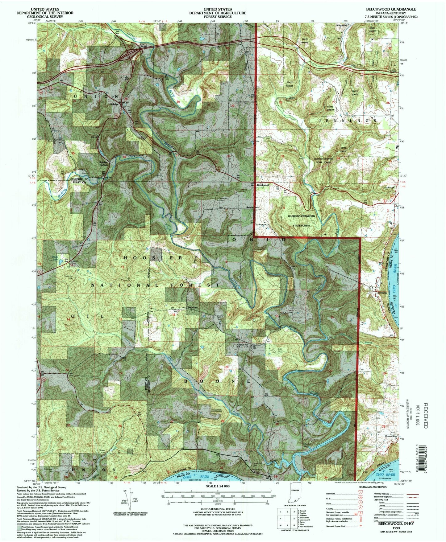
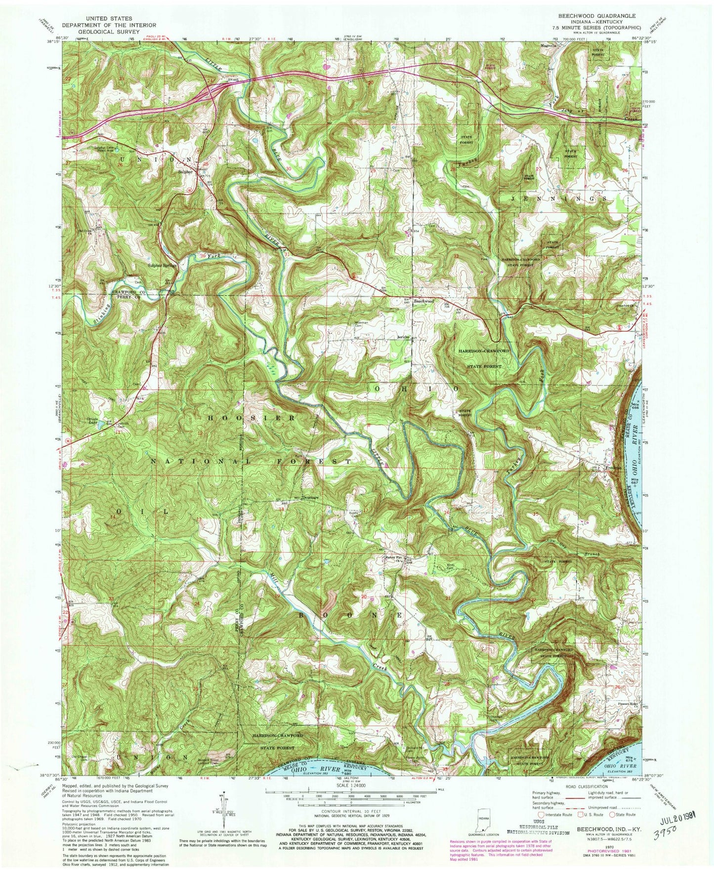
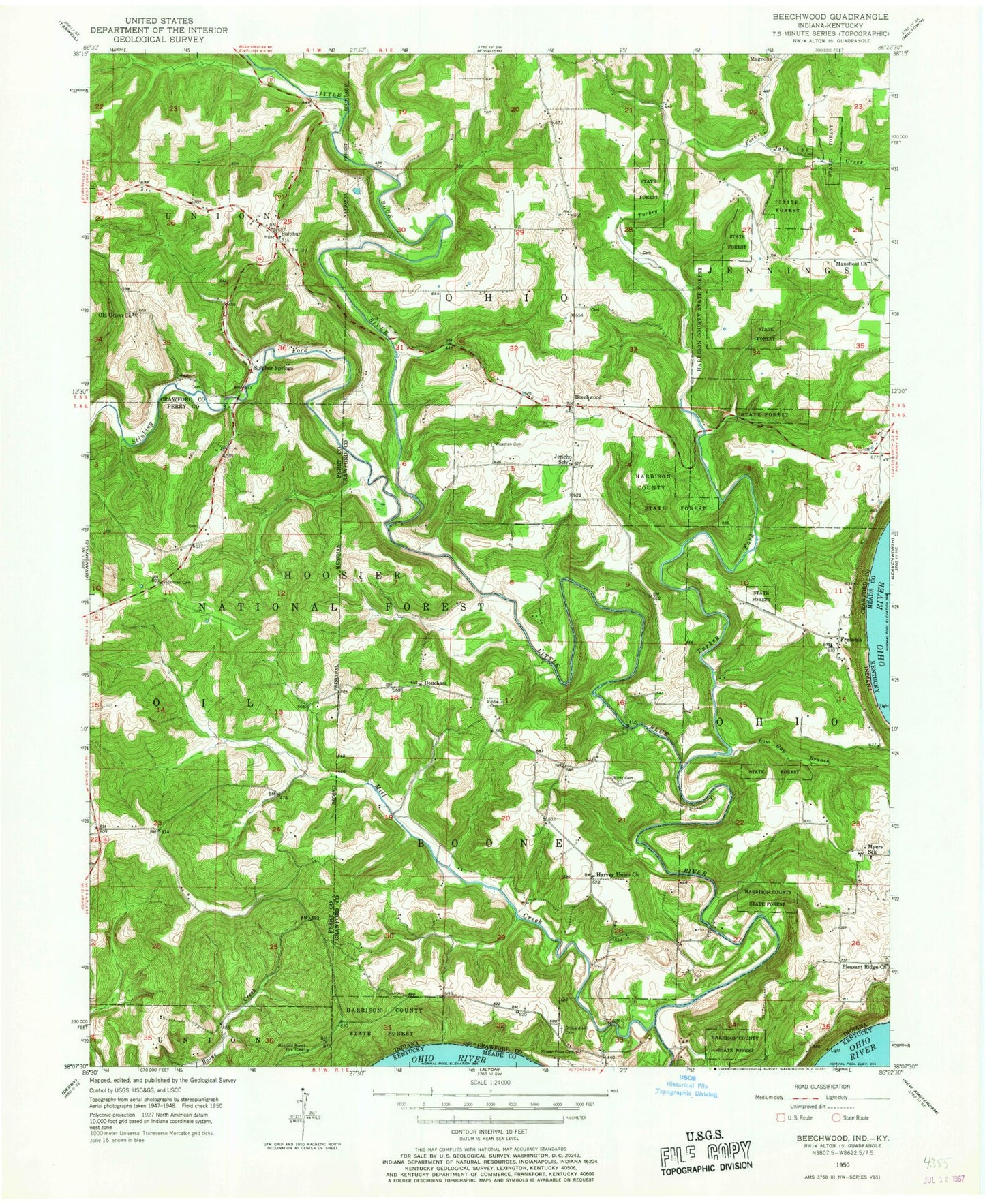
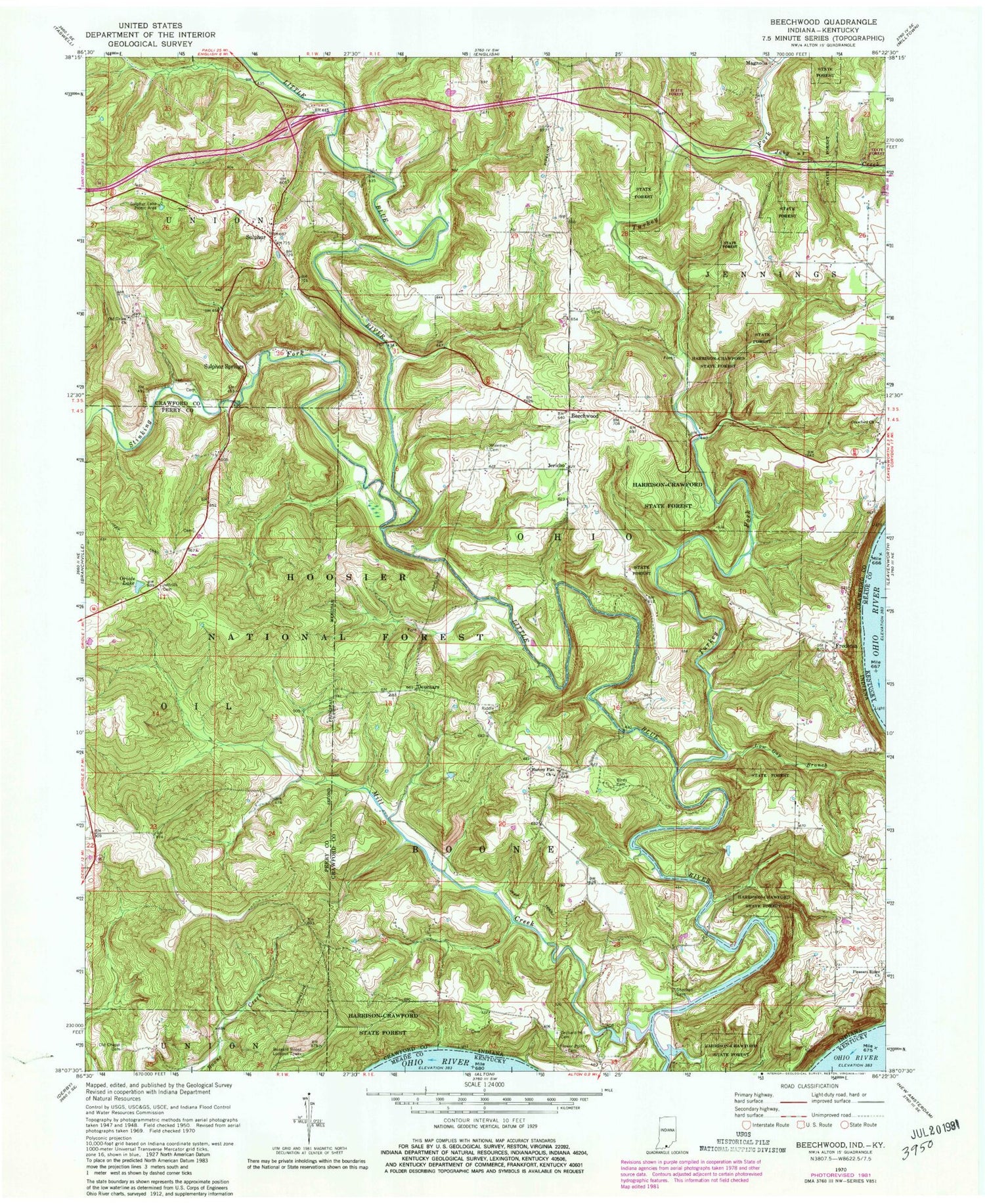
Classic USGS Beechwood Indiana 7.5'x7.5' Topo Map
Couldn't load pickup availability
Historical USGS topographic quad map of Beechwood in the state of Indiana. Map scale may vary for some years, but is generally around 1:24,000. Print size is approximately 24" x 27"
This quadrangle is in the following counties: Crawford, Meade, Perry.
The map contains contour lines, roads, rivers, towns, and lakes. Printed on high-quality waterproof paper with UV fade-resistant inks, and shipped rolled.
Contains the following named places: Beechwood, Birds Cemetery, Bloom Riddle Cemetery, Buzzard Roost Lookout Tower, Crawford Church, Deuchars, East Cemetery, English Volunteer Fire Department Union Station, Flower Point Cemetery, Fredonia, Fredonia Cemetery, Fullenwider Cemetery, Harvey Flat Church, Jaby Creek, Jeffries Cemetery, Jericho, Low Gap Branch, Magnolia, Mill Creek, Old Chapel Cemetery, Old Union Cemetery, Old Union Church, Orchard Hill Cemetery, Oriole Lake, Pleasant Ridge Church, Sheckell Cemetery, Stinking Fork, Sulphur, Sulphur Lake Picinic Area, Sulphur Springs, Township of Boone, Township of Ohio, Turkey Fork, Wiseman Cemetery, ZIP Code: 47137