MyTopo
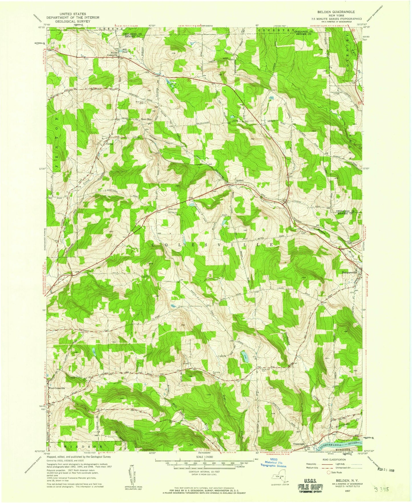
Classic USGS Belden New York 7.5'x7.5' Topo Map
Couldn't load pickup availability
Historical USGS topographic quad map of Belden in the state of New York. Map scale may vary for some years, but is generally around 1:24,000. Print size is approximately 24" x 27"
This quadrangle is in the following counties: Broome, Chenango.
The map contains contour lines, roads, rivers, towns, and lakes. Printed on high-quality waterproof paper with UV fade-resistant inks, and shipped rolled.
Contains the following named places: Belden, Belden Hill, Belden Hill Campground, Belden Hill Golf Course, Coles Hill Cemetery, Colesville Town Hall, Colesville Volunteer Ambulance Service, Country Manor, Creekside Village, Flannerys Mobile Home Park, Hapursville Fire Department Station 2, Harpursville Baptist Church, Harpursville Post Office, Mill Pond, New Ohio, New Ohio Cemetery, North Colesville, Ouaquaga, Ouaquaga Creek, Ouaquaga Fire Company, Ouaquaga Post Office, Ouaquaga United Methodist Church, Pratt Cemetery, Town of Colesville, Tunnel, Tunnel Post Office, Watersnake Creek, West Colesville, West Colesville Baptist Church, West Colesville Fire Company, Windy Hill Farms, Wooded Estates, ZIP Code: 13787