
MyTopo
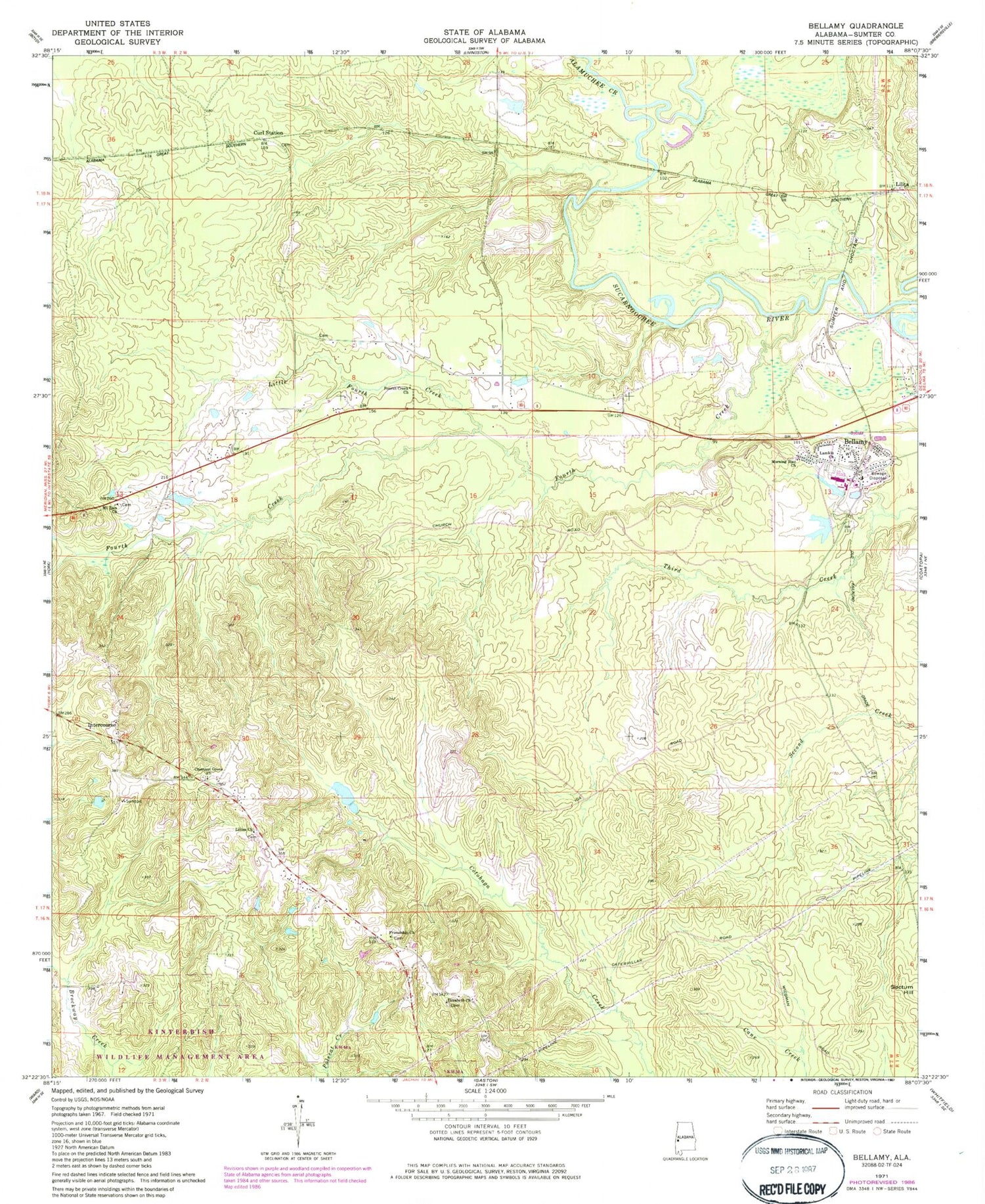
Classic USGS Bellamy Alabama 7.5'x7.5' Topo Map
Couldn't load pickup availability
Historical USGS topographic quad map of Bellamy in the state of Alabama. Map scale may vary for some years, but is generally around 1:24,000. Print size is approximately 24" x 27"
This quadrangle is in the following counties: Sumter.
The map contains contour lines, roads, rivers, towns, and lakes. Printed on high-quality waterproof paper with UV fade-resistant inks, and shipped rolled.
Contains the following named places: Alamuchee Creek, Bellamy, Bellamy Census Designated Place, Bellamy Post Office, Bellamy Volunteer Fire Department, Bennett, Chesnut Grove, Chestnut Grove Methodist Church, Chilies Mill, Curl Station, Elizabeth Church, Fourth Creek, Fourth Creek Methodist Church, Fourth Creek School, Friendship Baptist Church, Friendship Cemetery, H and Y Hunting Lodge, Hicks Cemetery, Intercourse, Lamkin Church, Lilita, Lillies Chapel Methodist Church, Lillies Chapel School, Little Fourth Creek, Morning Star Church, Mount Zion Baptist Church, Opossum Creek, Walk, York Division, ZIP Codes: 36901, 36925


