MyTopo
Classic USGS Belmont New Hampshire 7.5'x7.5' Topo Map
Couldn't load pickup availability
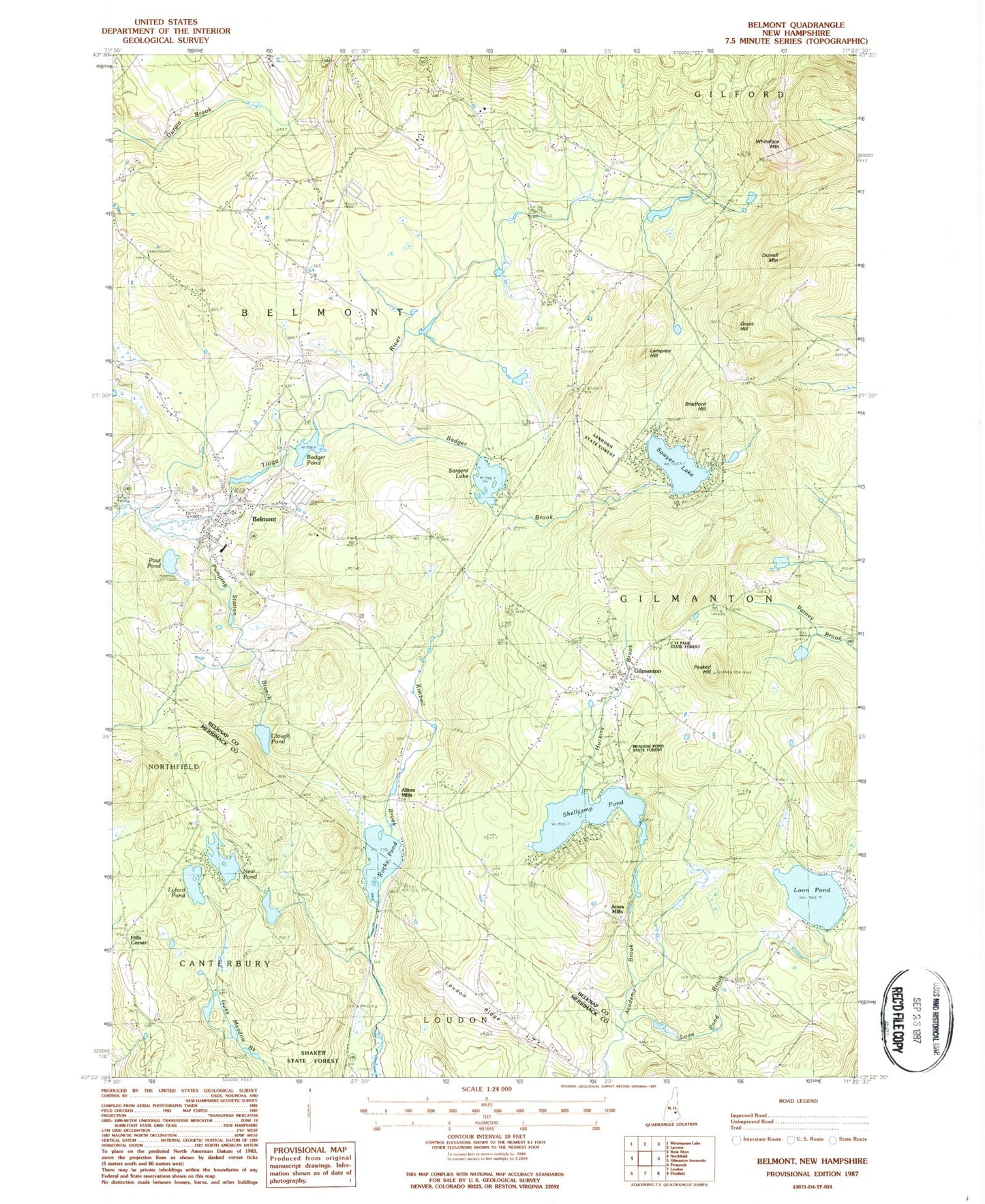
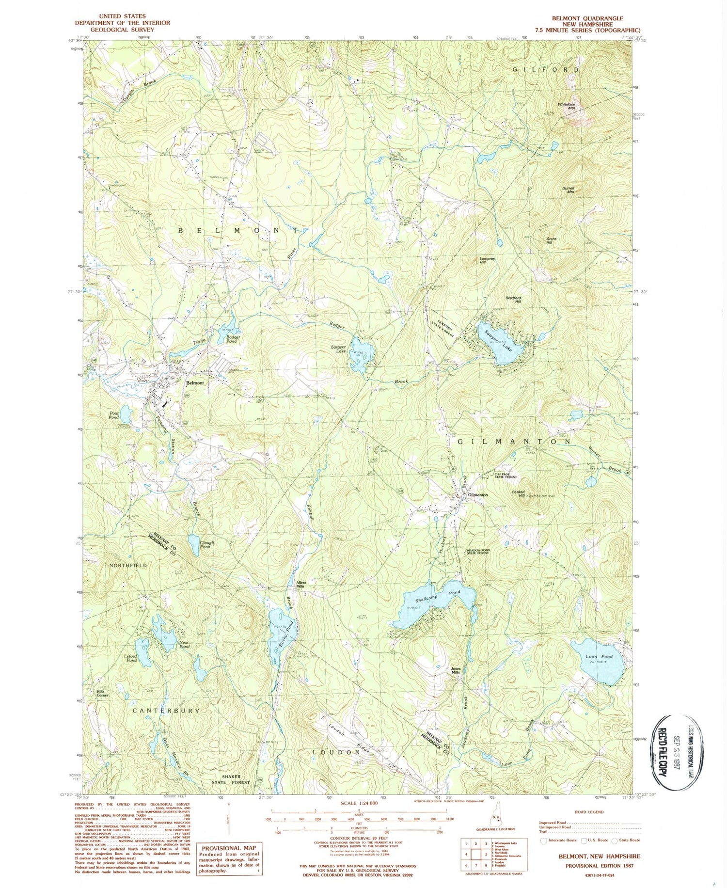
Historical USGS topographic quad map of Belmont in the state of New Hampshire. Typical map scale is 1:24,000, but may vary for certain years, if available. Print size: 24" x 27"
This quadrangle is in the following counties: Belknap, Merrimack.
The map contains contour lines, roads, rivers, towns, and lakes. Printed on high-quality waterproof paper with UV fade-resistant inks, and shipped rolled.
Contains the following named places: Allens Mills, Badger Brook, Badger Pond, Belmont, Bradford Hill, Clough Pond, Gilmanton, Grant Hill, Ham Cemetery, Hills Corner, Kimball Brook, Lamprey Hill, Loon Pond, Loon Pond Brook, Loudon Ridge, Loudon Ridge School, Lyford Pond, Meadow Pond State Forest, New Pond, Peaked Hill, Pout Pond, Pumping Station Branch, Rocky Pond, Sargent Lake, Sawyer Lake, Shaker State Forest, Shellcamp Pond, Whiteface Mountain, Town of Belmont, Sawyer Lake Dam, Badger Pond Dam, Sargent Lake Dam, Bean Dam, Tioga River Reservoir, Lyford Pond Dike, Shellcamp Pond Dam, Tioga River Dam, Tioga River Reservoir, Belmont Baptist Church, Belmont Elementary School, Belmont Fire Department, Belmont High School, Belmont Middle School, Belmont Post Office, Belmont Town Hall, C H Page State Forest, Center Congregational Church, Gilmanton Post Office, Gilmanton Public Library, Jones Mills, Lakes Christian Center, Saint Joseph Church, The Acord Campground, Faith Christian Academy, Heavenly Sonshine Preschool, Gilmanton Fire Department Station 2, Smith Orchard, Belmont Census Designated Place, Gilmanton Public Safety Complex, Belmont Police Department