
MyTopo
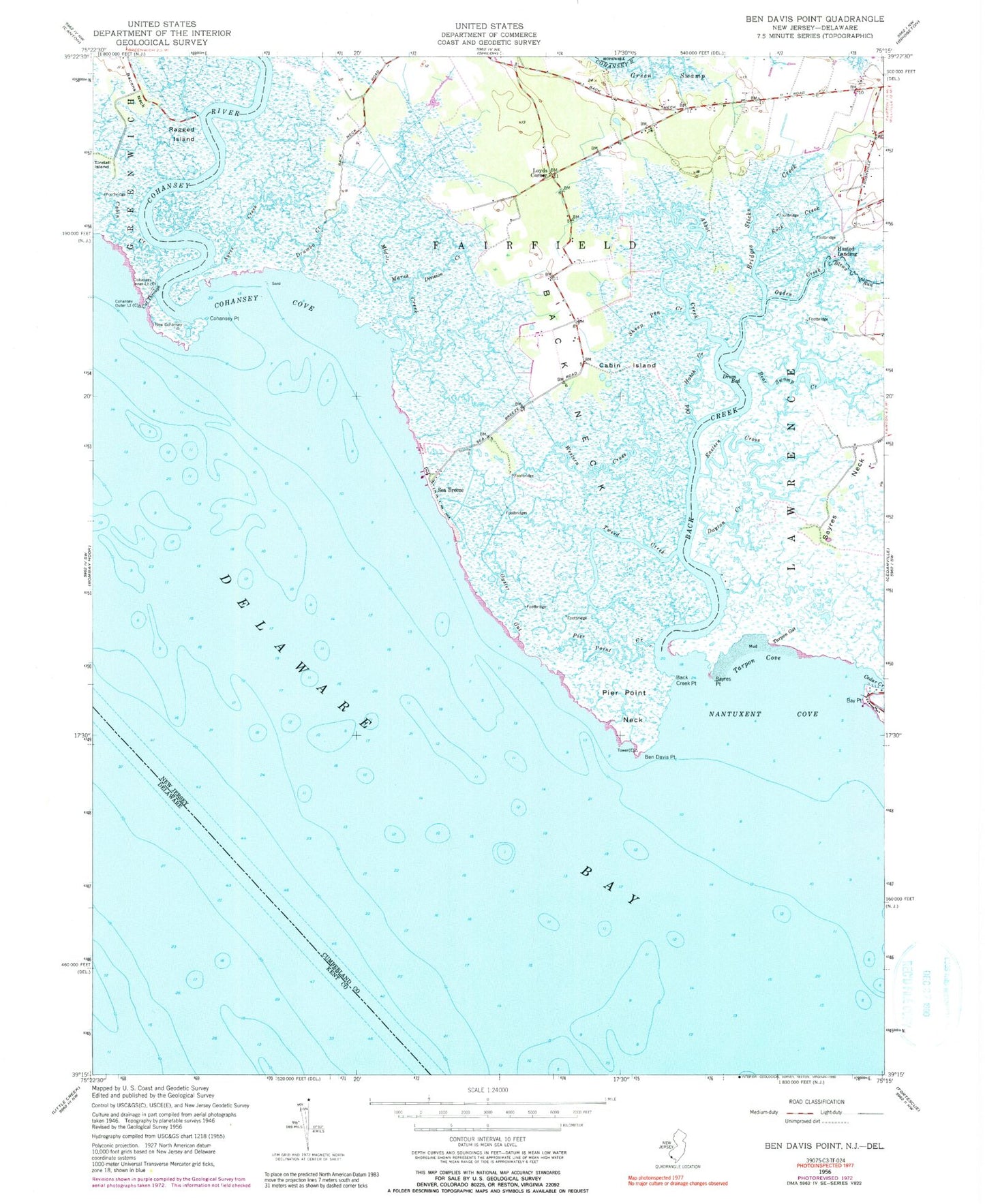
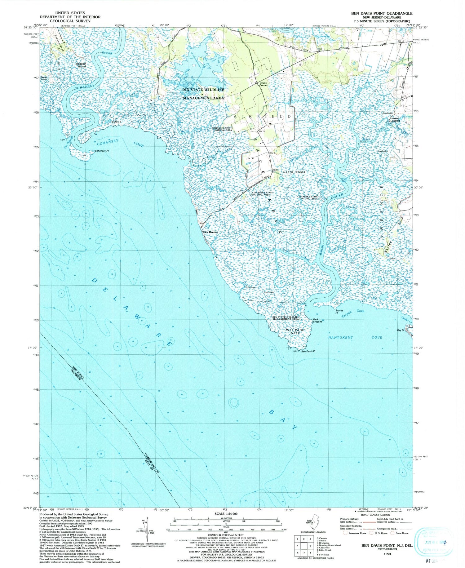
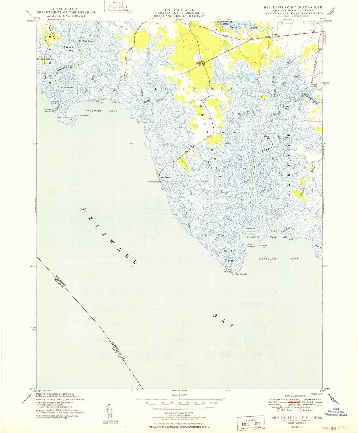
Classic USGS Ben Davis Point New Jersey 7.5'x7.5' Topo Map
Couldn't load pickup availability
Historical USGS topographic quad map of Ben Davis Point in the state of New Jersey. Map scale may vary for some years, but is generally around 1:24,000. Print size is approximately 24" x 27"
This quadrangle is in the following counties: Cumberland, Kent.
The map contains contour lines, roads, rivers, towns, and lakes. Printed on high-quality waterproof paper with UV fade-resistant inks, and shipped rolled.
Contains the following named places: Abbot Creek, Ayres Creek, Back Creek, Back Creek Point, Back Neck, Bay Point, Bear Swamp Creek, Ben Davis Island, Ben Davis Point, Ben Davis Point Shoal, Blews Run, Bridges Sticks Creek, Cabin Creek, Cabin Island, Cedar Creek, Cohansey Cove, Cohansey Inner Light, Cohansey Outer Light, Cohansey Point, Cohansey River, Cut Through, Dayton Creek, Division Creek, Dix Fish and Wildlife Management Area, Drum Bed, Drumbo Creek, Eastern Cross, Halka Nurseries Airport, Husted Landing, Loyds Corner, Middle Marsh Creek, Nantuxent Cove, Ogden Creek, Old Hatch Creek, Oyster Gut, Pier Point Creek, Pier Point Neck, Ragged Island, Rock Creek, Sayres Neck, Sayres Point, Sea Breeze, Sheep Pen Creek, Tarpon Cove, Tarpon Gut, Tindall Island, Tweed Creek, Western Cross