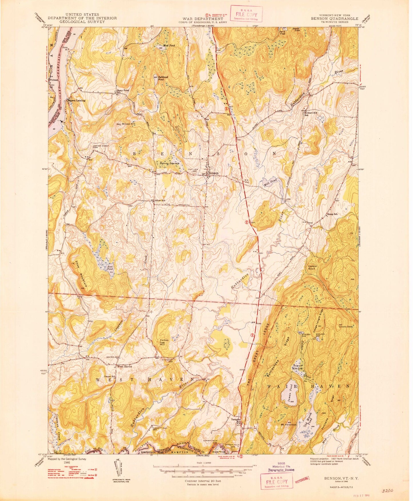
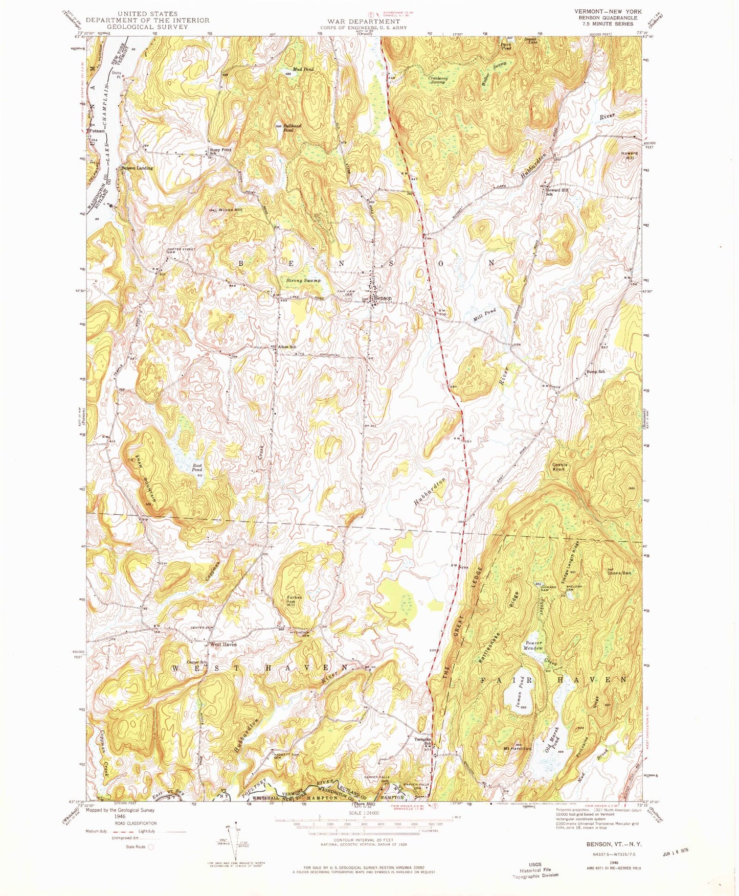
MyTopo
Classic USGS Benson Vermont 7.5'x7.5' Topo Map
Couldn't load pickup availability
Historical USGS topographic quad map of Benson in the states of Vermont, New York. Map scale may vary for some years, but is generally around 1:24,000. Print size is approximately 24" x 27"
This quadrangle is in the following counties: Rutland, Washington.
The map contains contour lines, roads, rivers, towns, and lakes. Printed on high-quality waterproof paper with UV fade-resistant inks, and shipped rolled.
Contains the following named places: Aiken School, Beaver Meadow, Benson, Benson Census Designated Place, Benson Fire Department, Benson First Response, Benson Landing, Benson Post Office, Benson Town Hall, Benson Village Historic District, Benson Village School, Bullhead Pond, Bump School, Carter Street Cemetery, Carver Falls Cemetery, Carver Falls Dam, Center Cemetery, Center School, Claycreek Farm, Cobble Knoll, Coggman Creek, Coons Den, Cranberry Swamp, Fair Haven Municipal Forest, Fair View Cemetery, Forbes Hill, Hackett Dam Cemetery, Hitchcock Cemetery, Howard Dam, Howard Hill, Howard Hill School, Howard Pond, Hubbardton River, Inman Pond, Inman Pond Dam, Mill Pond, Mount Hamilton, Mud Pond, Old Cemetery, Old Marsh Pond, Old Marsh Pond Dam, Parsons Mill Dam, Pond Woods Wildlife Management Area, Porcupine Ridge, Poultney River, Putnam Station, Rattlesnake Ridge, Root Pond, Shaw Mountain, Sheldon Dam, Sheldon Pond, Sledge Length Ridge, Stony Point, Stony Point School, Strong Swamp, Sucker Creek, The Great Ledge, Town of Benson, Town of West Haven, Turnpike School, Walker Swamp, West Haven, West Haven Volunteer Fire Department, Wilcox Hill, ZIP Code: 05743