MyTopo
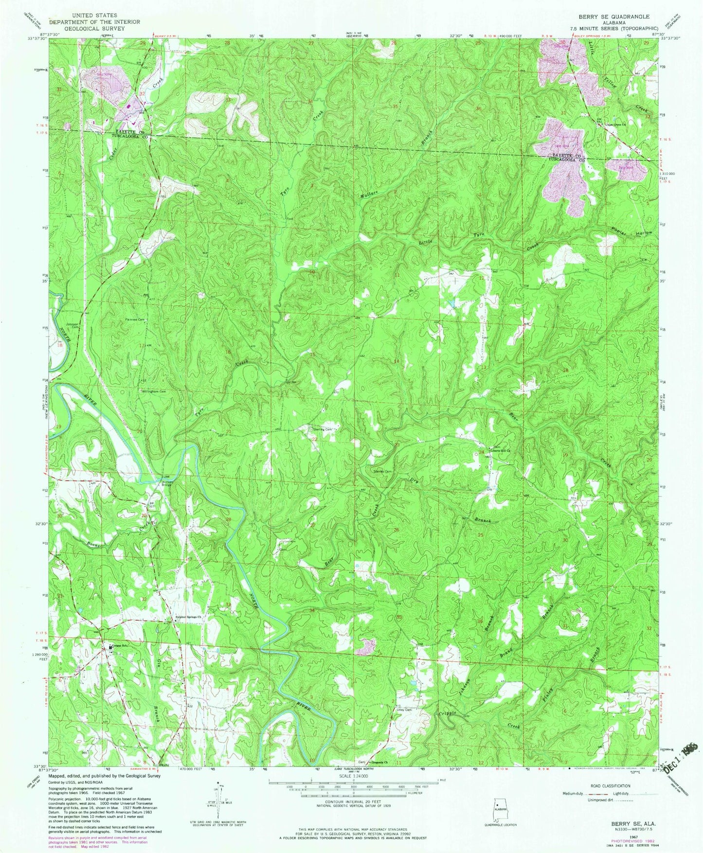
Classic USGS Berry SE Alabama 7.5'x7.5' Topo Map
Couldn't load pickup availability
Historical USGS topographic quad map of Berry SE in the state of Alabama. Map scale is 1:24000. Print size is approximately 24" x 27"
This quadrangle is in the following counties: Fayette, Tuscaloosa.
The map contains contour lines, roads, rivers, towns, and lakes. Printed on high-quality waterproof paper with UV fade-resistant inks, and shipped rolled.
Contains the following named places: Appling (historical), Bear Creek, Bethlehem Church, Bethlehem Church Spring, Boone Creek, Brand Branch, Cedar Creek, Dobbs Temple (historical), Dry Branch, Evanstown (historical), Fairview Cemetery, Fairview Church (historical), Fairview School (historical), Finley Branch, Gorgas, Gorgas Elementary School (historical), Gum Springs Church, Gum Springs School (historical), Johnson Branch, Johnson Cemetery, Liberty Hill Cemetery, Liberty Hill Primitive Baptist Church, Little Tyro Creek, Meg Mine, North River Number 1 Mine, Oregonia Baptist Church, Oregonia Cemetery, Poplar Hollow, Ridge School (historical), Scraptown (historical), Stanley (historical), Stanley Cemetery, Sterling (historical), Sterling Cemetery, Sulphur Springs Cemetery, Sulphur Springs Freewill Baptist Church, Tyro Creek, Tyro Creek Hill, Union Grove Baptist Church, Union Grove Cemetery, Union Grove Mine, Utley Cemetery, Wallace Branch, Willingham Cemetery, Wilsons School (historical), Wittson Bridge