
MyTopo
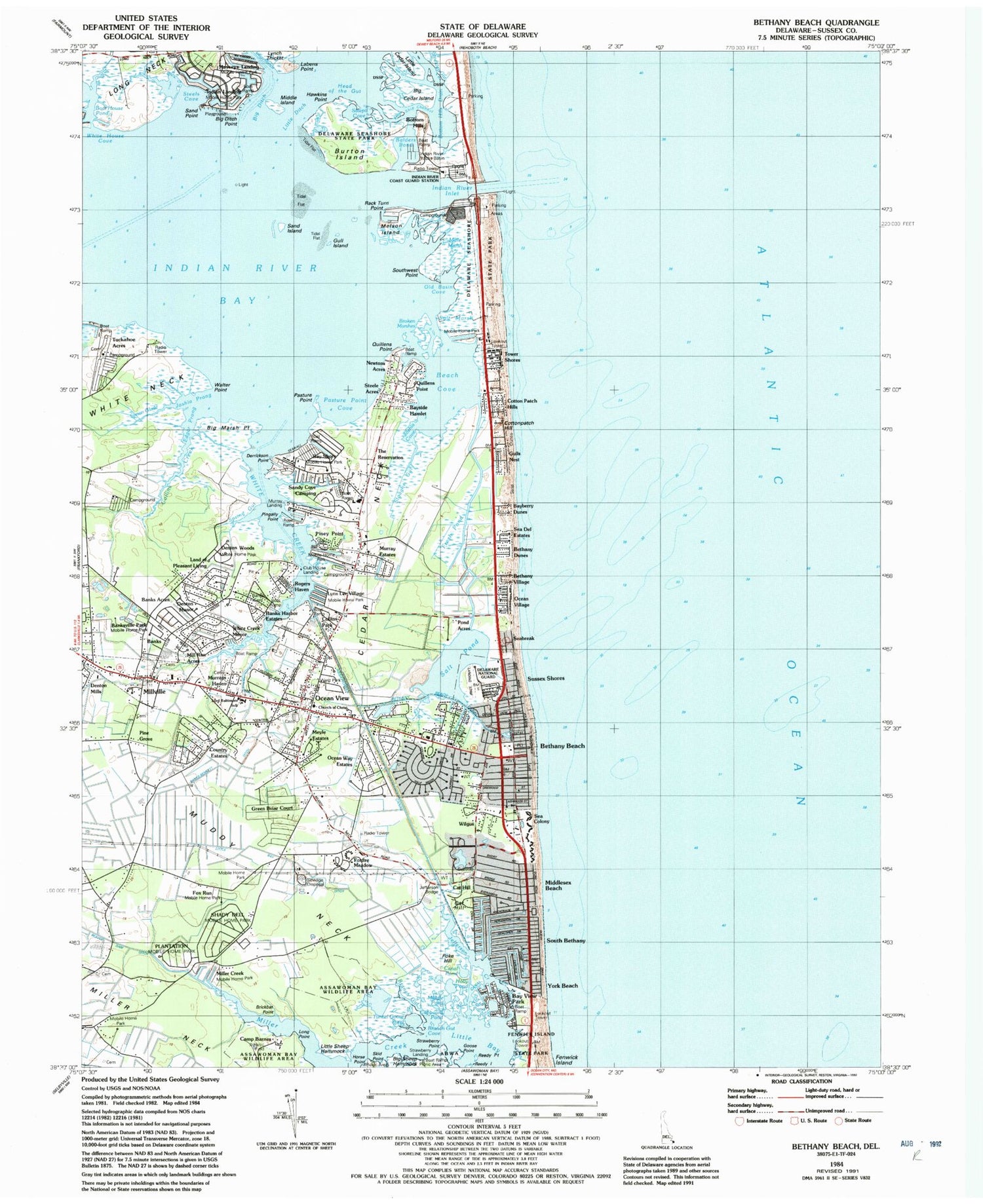
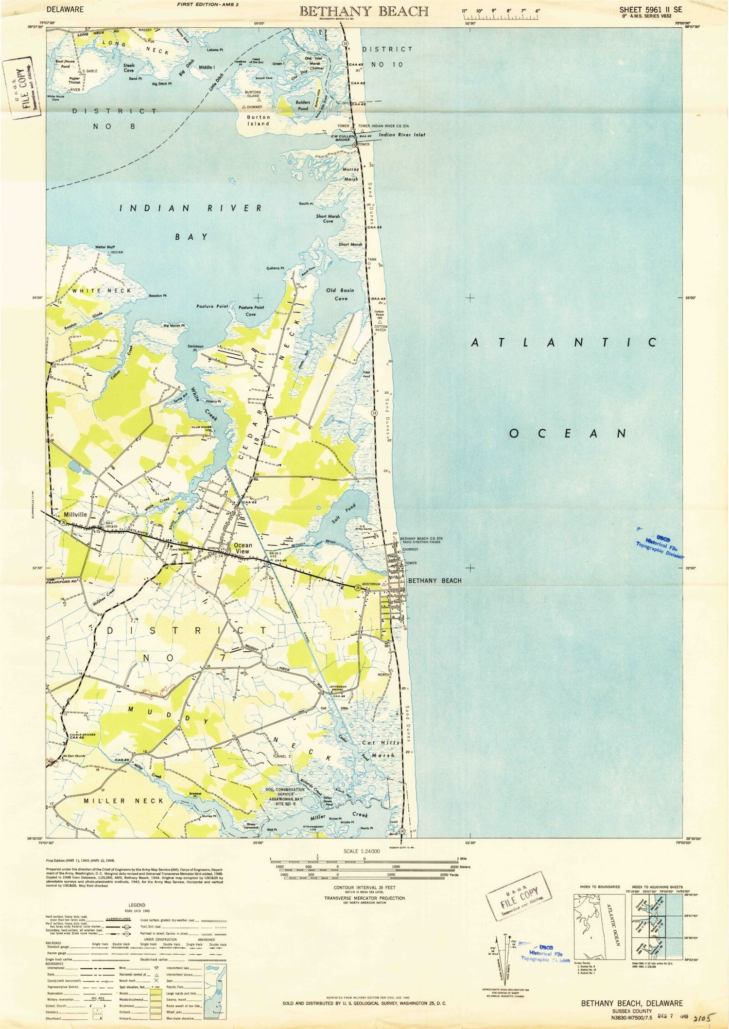
Classic USGS Bethany Beach Delaware 7.5'x7.5' Topo Map
Couldn't load pickup availability
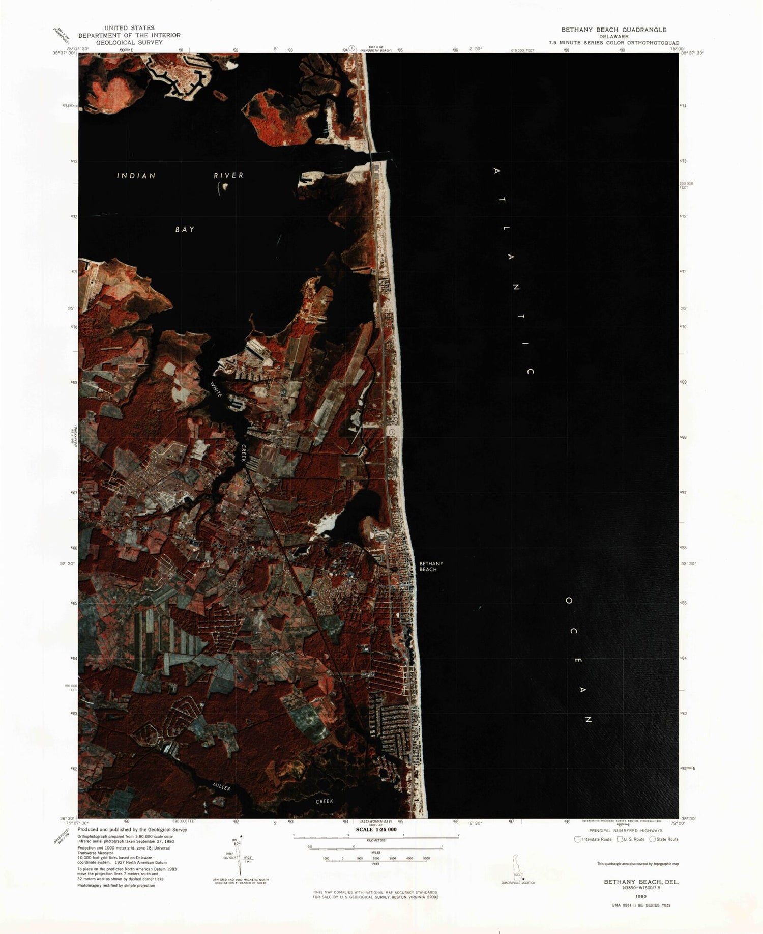
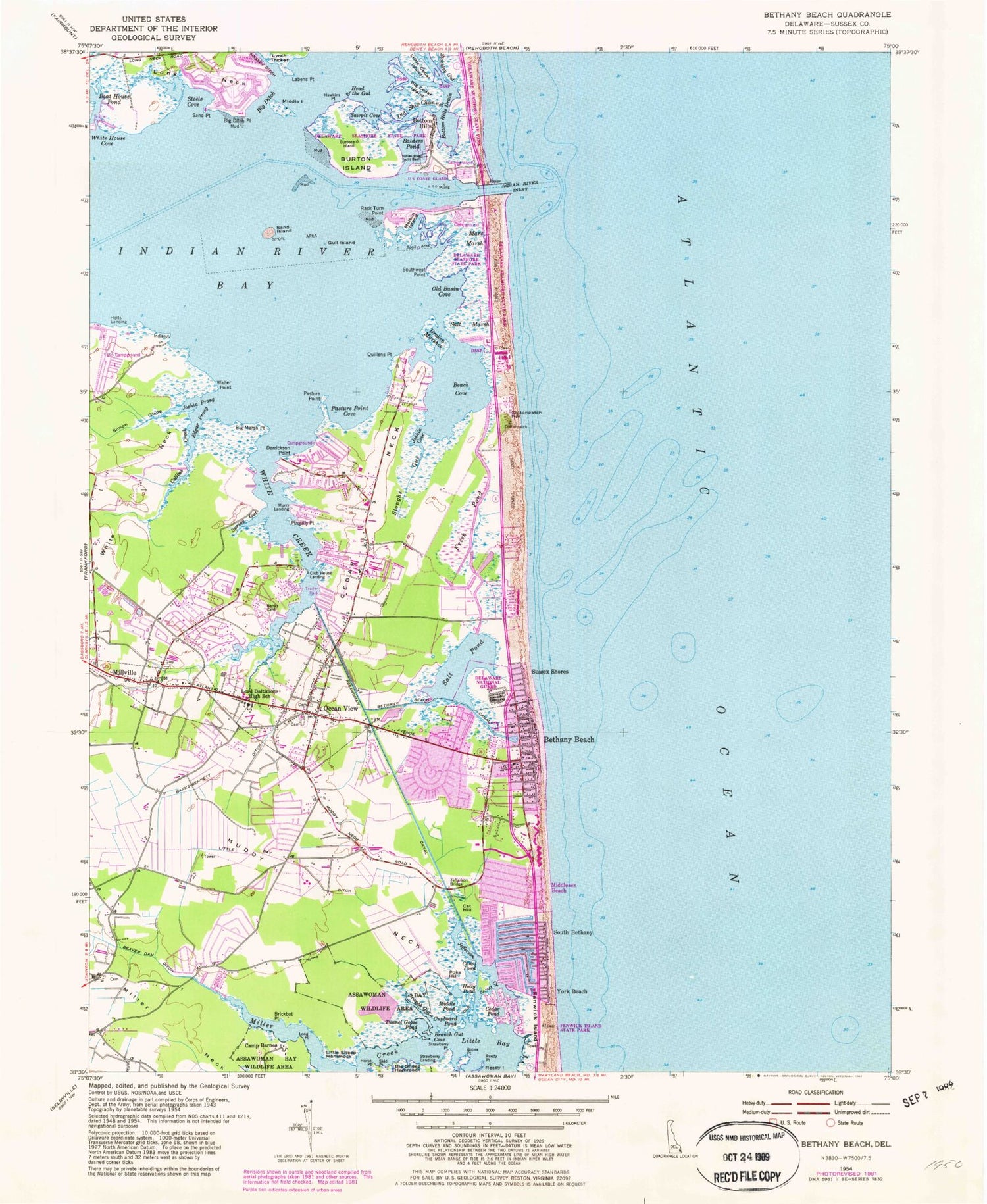
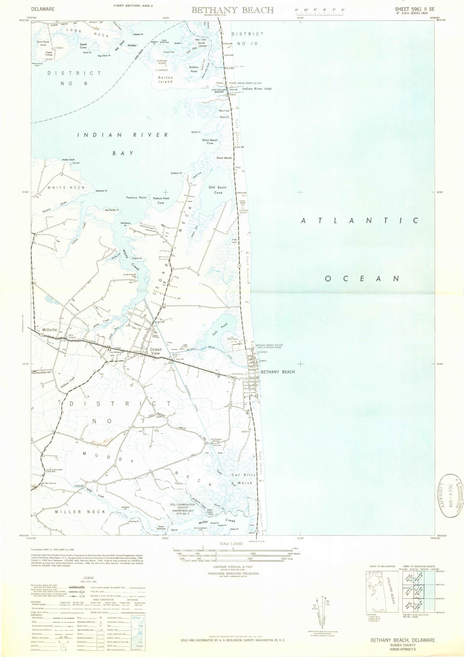
Historical USGS topographic quad map of Bethany Beach in the state of Delaware. Typical map scale is 1:24,000, but may vary for certain years, if available. Print size: 24" x 27"
This quadrangle is in the following counties: Sussex.
The map contains contour lines, roads, rivers, towns, and lakes. Printed on high-quality waterproof paper with UV fade-resistant inks, and shipped rolled.
Contains the following named places: Assawoman Canal, Balders Pond, Banks Cemetery, Banks-Bennett Ditch, Beach Cove, Bethany Beach, Bethany Beach Canal, Big Cedar Island, Big Ditch, Big Ditch Point, Big Marsh Point, Big Sheep Hammock, Boat House Pond, Bottom Hills Drain, Branch Gut, Branch Gut Cove, Brickbat Point, Burton Island, C W Cullen Bridge, Camp Barnes, Canal Pond, Cat Hill, Cedar Neck, Cedar Pond, Collins Creek, Cottonpatch Hill, Cupboard Pond, Derrickson Point, Edgar Prong, Fresh Pond, Goose Point, Gull Island, Hawkins Point, Head of the Gut, Holly Pond, Horse Point, Indian River Bay, Indian River Inlet, Indian River Yacht Basin, Jefferson Bridge, Joshia Cove, Joshia Prong, Labens Point, Little Bay, Little Sheep Hammock, Long Point, Mare Marsh, Melson Island, Middle Island, Middle Pond, Middlesex Beach, Miller Creek, Millville, Muddy Neck, Ocean View, Old Basin Cove, Old Canal, Old Ship Channel, Pasture Point, Pasture Point Cove, Pingally Point, Poke Hill, Quillens Point, Rack Turn Point, Reedy Island, Reedy Point, Salt Pond, Sand Island, Sand Point, Sawpit Cove, Simon Glade, Skid Point, Sloughs Gut, South Bethany, Southwest Point, Spring Gut, Steels Cove, Stockley Gut, Strawberry Point, Sussex Shores, Tunnel Goose Pond, Walter Point, White Creek, York Beach, Mariners Bethel United Methodist Church, Saint Anns Catholic Church, Gulls Nest, Bayberry Dunes, Quillens Point, Newtons Acres, Bayside Hamlet, Steele Acres, Holly Ridge, Sandy Cove Camping, Cedar Shores, Tower Shores, Indian Harbor Villa, Bank Harbor Retreat, Strawberry Landing, Sea Colony East, Foxfire Meadow, Sea Del Estates, Bethany Dunes, Bethany Village, Seabreak, Pond Acres, Murray Estates, Murrays Haven, Banks Acres, White Creek Manor, Denton Manor, Rogers Haven, Mill Run Acres, Banksville Park, Byewood Manor, Collins Creek Estates, Denton Mills, Pine Grove, Meyle Estates, Ocean Way Estates, Green Briar Court, Banks Development, Land of Pleasant Living, Bottom Hills, Club House Landing, Calhoun Landing, Murry Landing, Strawberry Landing, Lord Baltimore Elementary School, Salt Works Marsh, Church of Christ, Piney Point, Country Estates, The Reservation, West Park, Tuckahoe Acres, Banks Harbor Estates, Broken Marshes, Sea Colony, Bay Shore Mobile Home Park, Cedarville Mobile Home Park, Indian Landing Mobile Home Park, Miller Creek Park Mobile Home Park, Plantation Park II Mobile Home Park, Shady Dell Mobile Home Park, Lynn Lee Village Mobile Home Park, Collins Park Mobile Home Park, Denton Woods Mobile Home Park, Fox Run Mobile Home Park, Little Ditch, Holts Landing State Park, Rogers Haven, Derrickson Ditch, Deep Hole Ditch, McCabe Ditch, Little Bay Ditch, Bay View Park, Cat Hill Marsh, Jefferson Creek, Bethany Beach, Ocean Village, Murray Marsh Cove, Bethany Beach Post Office (historical), United States Army Air Warning Station Number 11 (historical), South Bethany Police Department, Ocean View Police Department, Bethany Beach Police Department, Millville Town Hall, Bear Trap Dunes Golf Course, Creekside Plaza Shopping Center, Bethany Bay Golf Course, Ocean View Post Office, Ocean View Presbyterian Cemetery, The Salt Pond Golf Course, Route 26 Mall Shopping Center, South Bethany Town Hall, South Coastal Public Library, Beach Plaza Shopping Center, Bethany Beach Town Hall, Marketplace at Sea Colony Shopping Center, Bethany Beach Post Office, Town of Bethany Beach, Town of Ocean View, Town of South Bethany, Coast Guard Station Indian River Inlet, Bethany Beach Volunteer Fire Company Station 1, Millville Volunteer Fire Company Station 1, Saint Martha's Episcopal Church, Assawoman Canal, Balders Pond, Banks Cemetery, Banks-Bennett Ditch, Beach Cove, Bethany Beach, Bethany Beach Canal, Big Cedar Island, Big Ditch, Big Ditch Point, Big Marsh Point, Big Sheep Hammock, Boat House Pond, Bottom Hills Drain, Branch Gut, Branch Gut Cove, Brickbat Point, Burton Island, C W Cullen Bridge, Camp Barnes, Canal Pond, Cat Hill, Cedar Neck, Cedar Pond, Collins Creek, Cottonpatch Hill, Cupboard Pond, Derrickson Point, Edgar Prong, Fresh Pond, Goose Point, Gull Island, Hawkins Point, Head of the Gut, Holly Pond, Horse Point, Indian River Bay, Indian River Inlet, Indian River Yacht Basin, Jefferson Bridge, Joshia Cove, Joshia Prong, Labens Point, Little Bay, Little Sheep Hammock, Long Point, Mare Marsh, Melson Island


