MyTopo
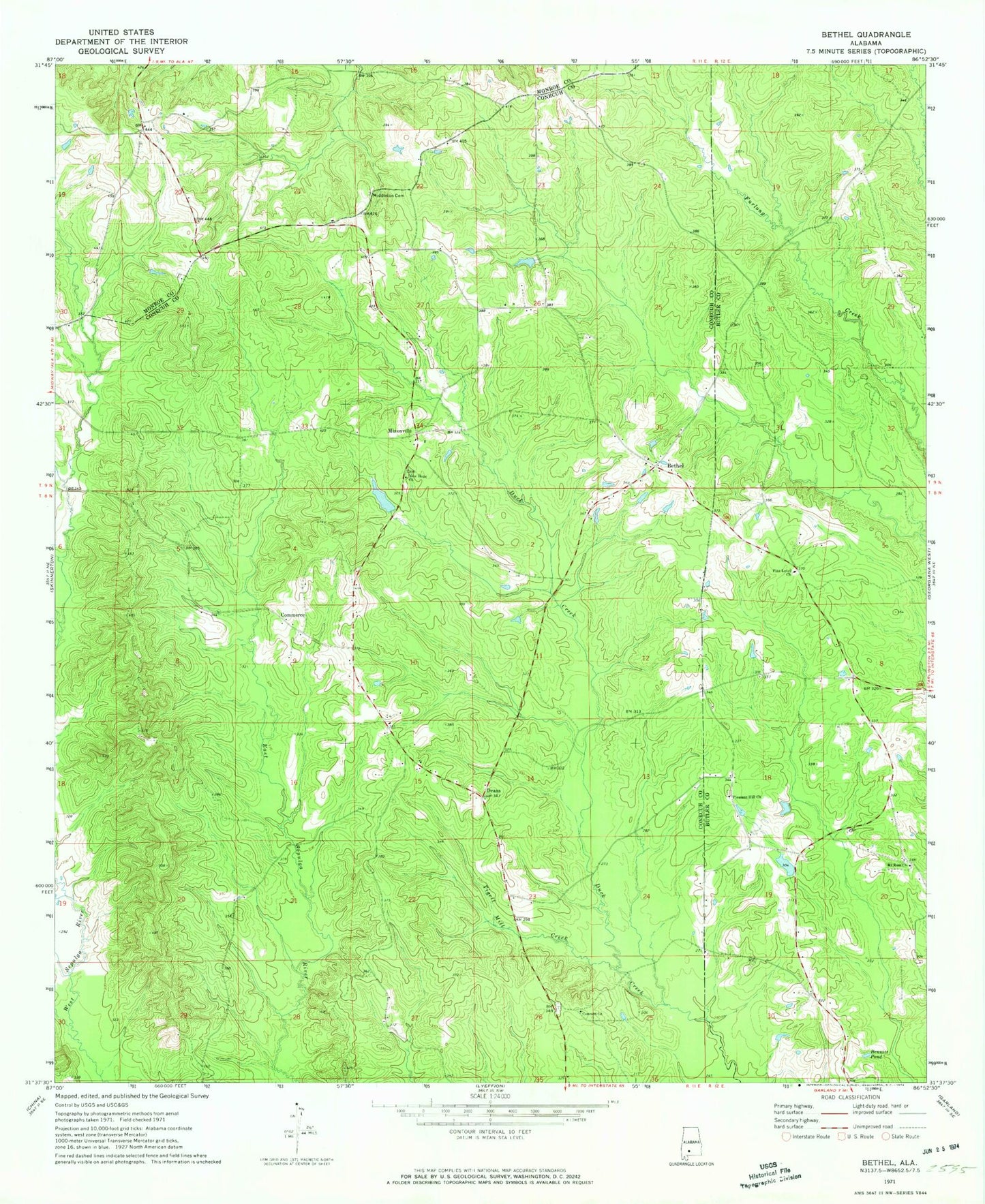
Classic USGS Bethel Alabama 7.5'x7.5' Topo Map
Couldn't load pickup availability
Historical USGS topographic quad map of Bethel in the state of Alabama. Map scale may vary for some years, but is generally around 1:24,000. Print size is approximately 24" x 27"
This quadrangle is in the following counties: Butler, Conecuh, Monroe.
The map contains contour lines, roads, rivers, towns, and lakes. Printed on high-quality waterproof paper with UV fade-resistant inks, and shipped rolled.
Contains the following named places: Alvin Mixon Dam, Alvin Mixon Lake, Bennett Pond, Bethel, Bethel West Cemetery, Bethel West Church, Commerce, Concord Cemetery, Concord Methodist Church, Deans, Horse Branch, Little Duck Creek, McCreary School, Middleton Cemetery, Mixonville, Mount Ross Church, Mount Zion Cemetery, Mount Zion Church, Mount Zion Junior High School, New Hope Church, Old Bethel Cemetery, Pilgrim Rest Church, Pine Level Church, Pine Level School, Pleasant Hill Church, Salter School, Sepulga Post Office, Tigett Mill Creek, Tisdale School