MyTopo
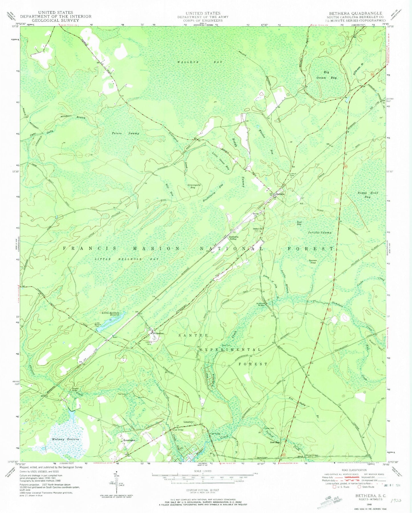
Classic USGS Bethera South Carolina 7.5'x7.5' Topo Map
Couldn't load pickup availability
Historical USGS topographic quad map of Bethera in the state of South Carolina. Map scale may vary for some years, but is generally around 1:24,000. Print size is approximately 24" x 27"
This quadrangle is in the following counties: Berkeley.
The map contains contour lines, roads, rivers, towns, and lakes. Printed on high-quality waterproof paper with UV fade-resistant inks, and shipped rolled.
Contains the following named places: Alligator Bridge, Alligator Creek, Back Dam, Berea Cemetery, Berea Church, Bethel Baptist Church, Bethel Cemetery, Bethera, Bethera School, Big Ocean Bay, Boar Bay, Boggy Head Rifle Range, Boggy Swamp, Burtons, Conifer, Cooks Creek, Darlington Creek, Fifty-cent Branch, Fourth of July Branch, Fox Gully Branch, Gough Bridge, Graveyard Bay, Herberta Siding, Hickory Grove Cemetery, Hickory Grove Holiness Church, Huckleberry Bay, Huger Bridge, Huger Recreation Area, Jericho Branch, Jericho Swamp, Jerico Horse Trail, Kensington, Kutz Creek, Limerick, Little Hellhole Bay, Little Hellhole Dam, Little Hellhole Reserve, Little Ocean Bay, Macedonia Rural Fire Department Station 2, Malpus Island, Midway Reserve, Mill Bay, Ned Dam, Negro Field Branch, Nicholson Bridges, Nicholson Creek, Peters Swamp, Poplar Dam, Raccoon Pond, Razorville, Reed Corner Cemetery, Rock Hole, Santee Experimental Station, Spring Head, Swamp Fox Trailhead, Turkey Creek, United States Forest Service Witherbee, Walleye Bay, Whitten Bay, Whittley Bridges, William Moultrie Civilian Conservation Corp Camp, Witherbee, Witherbee Lookout Tower, Witherbie Ranger Station, Wrangle Town, ZIP Code: 29434