
MyTopo
Classic USGS Bethlehem New Hampshire 7.5'x7.5' Topo Map
Couldn't load pickup availability
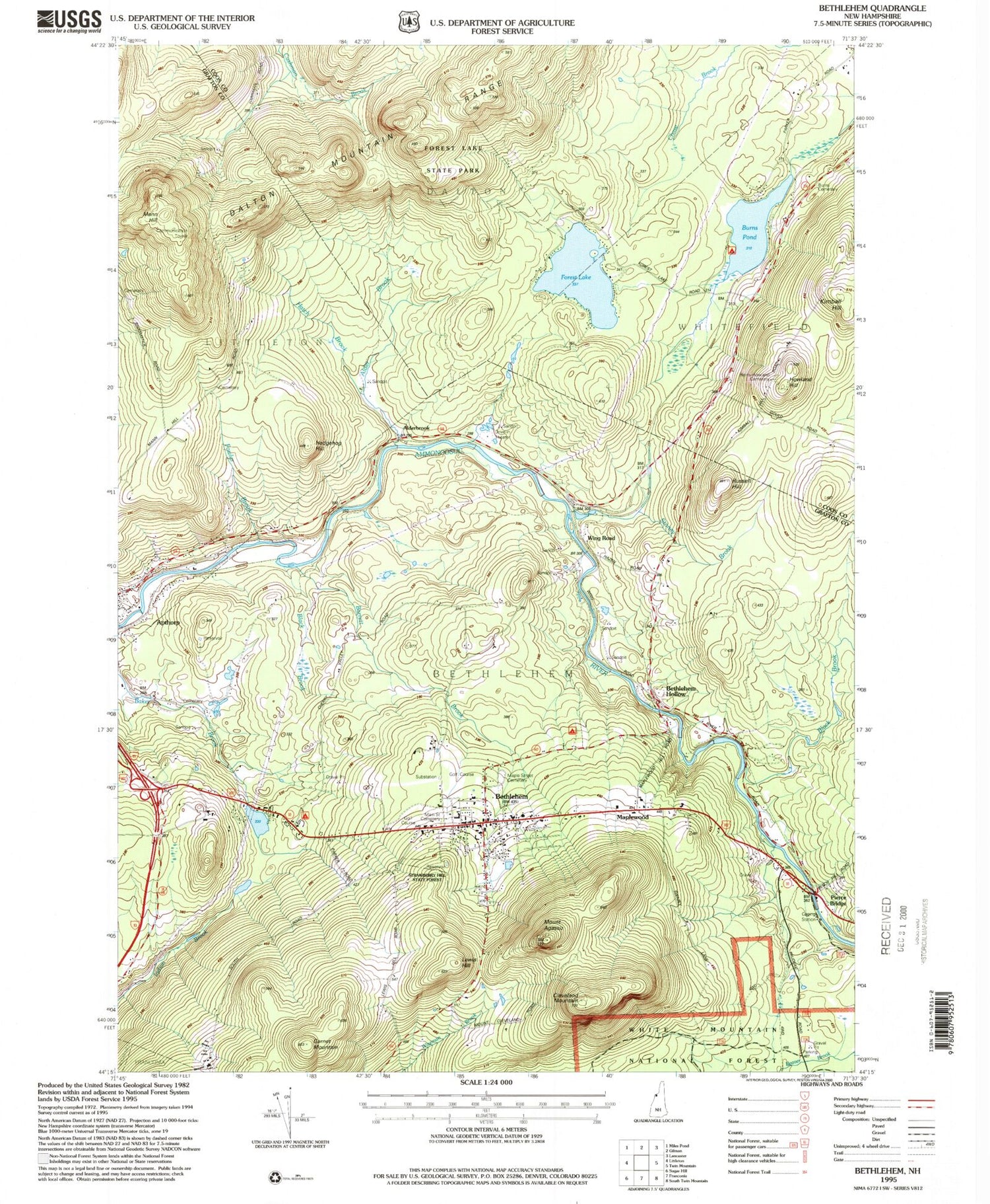
Historical USGS topographic quad map of Bethlehem in the state of New Hampshire. Map scale may vary for some years, but is generally around 1:24,000. Print size is approximately 24" x 27"
This quadrangle is in the following counties: Coos, Grafton.
The map contains contour lines, roads, rivers, towns, and lakes. Printed on high-quality waterproof paper with UV fade-resistant inks, and shipped rolled.
Contains the following named places: Alderbrook, Ammonoosucuc River Reservoir, Apple Hill Campground, Apthorp, Apthorp Common, Apthorp Dam, Barrett Brook, Bethlehem, Bethlehem Census Designated Place, Bethlehem Christian Center, Bethlehem Country Club, Bethlehem Dam, Bethlehem Elementary School, Bethlehem Fire Department, Bethlehem Hebrew Congregation, Bethlehem Police Department, Bethlehem Post Office, Bethlehem Town Hall, Black Brook, Burn Lake Dam, Burns Pond, Christ the King Roman Catholic Church, Cleveland Mountain, Durrell Memorial United Methodist Church, Forest Lake, Forest Lake Dam, Forest Lake State Park, Fowler Brook, Garnet Mountain, Hatch Brook, Hedgehog Hill, Howland Hill, Ivie Memorial Church of the Messiah Episcopal Church, Kimbal Hill, Lewis Hill, Mann Hill, Maple Street Cemetery, Maplewood, Miller Pond, Miller Pond Dam, Mount Agassiz, Newtons Mobile Park, Pierce Bridge, Profile Junior and Senior High School, Russell Hill, Wing Road, WLED-TV (Littleton), WMTK-FM (Littleton), Woodland Community School


