
MyTopo
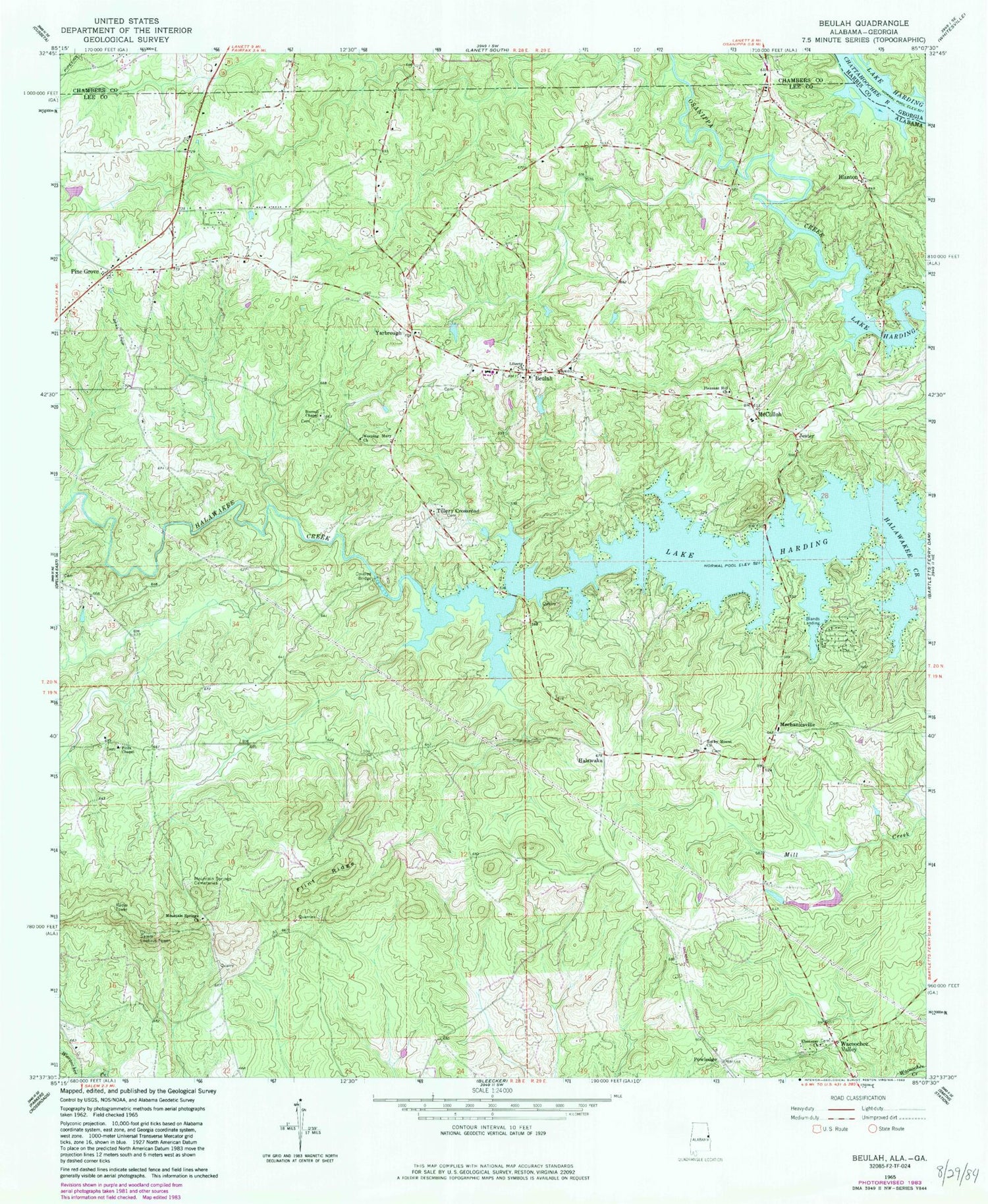
Classic USGS Beulah Alabama 7.5'x7.5' Topo Map
Couldn't load pickup availability
Historical USGS topographic quad map of Beulah in the state of Alabama. Typical map scale is 1:24,000, but may vary for certain years, if available. Print size: 24" x 27"
This quadrangle is in the following counties: Chambers, Harris, Lee.
The map contains contour lines, roads, rivers, towns, and lakes. Printed on high-quality waterproof paper with UV fade-resistant inks, and shipped rolled.
Contains the following named places: Beulah, Blanton, Burrell Chapel, Flint Ridge, Pleasant Hill Church, Weeping Mary Church, R E Newman Dam, R E Newman Number Two Dam, Berlin (historical), Beulah Cemetery, Beulah Baptist Church, Beulah High School, Dickinson Chapel Methodist Church (historical), Flint Hill Cemetery, Flint Hill School (historical), John Calhoun Tillery Cemetery, John Vines Dunn Plantation (historical), Lamb Cemetery, Meadow Mill (historical), Mechanicsville Cemetery, Pitts Chapel Cemetery, Rocky Mount Cemetery, Wacoochee Valley School (historical), Wells Bridge (historical), Beulah United Methodist Church, Mountain Springs Cemeteries, Pitts Chapel, Rocky Mount Baptist Church, Blands Landing, Halawaka, Jester, McCulloh, Mechanicsville, Powledge, Tillery Crossroad, Yarbrough, WSWS-TV (Opelika), Hattie (historical), Milner (historical), Blanton Church, Hephzibah Cemetery, Holt Cemetery, Living Water Church, Old Path Church, County Line Baptist Church (historical), Ebenezer Church, Mountain Springs Church, Wacoochee Valley, Salem Lookout Tower, Beulah Division, County Line Baptist Church Cemetery, Lee Chambers Fire Department Station 5, Lee Chambers Fire Department Station 3, Lee Chambers Fire Department Station 4, Beulah Fire Rescue, Lee Chambers Fire Department Station 2


