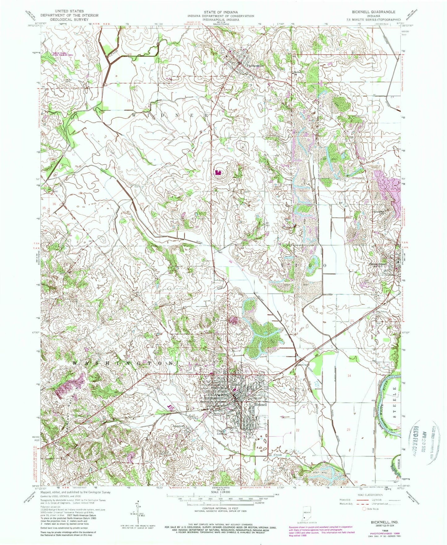
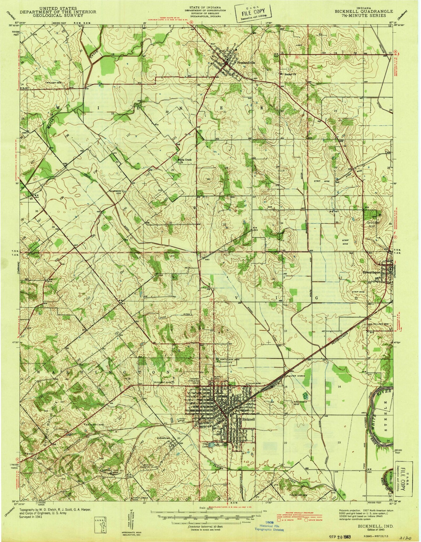
MyTopo
Classic USGS Bicknell Indiana 7.5'x7.5' Topo Map
Couldn't load pickup availability
Historical USGS topographic quad map of Bicknell in the state of Indiana. Map scale may vary for some years, but is generally around 1:24,000. Print size is approximately 24" x 27"
This quadrangle is in the following counties: Daviess, Knox.
The map contains contour lines, roads, rivers, towns, and lakes. Printed on high-quality waterproof paper with UV fade-resistant inks, and shipped rolled.
Contains the following named places: Barefoot Nation Hills, Bethel Church, Bicknell, Bicknell Country Club, Bicknell Fire Department, Bicknell Post Office, Bicknell Vigo Township Fire Department, Bicknell Volunteer Fire Department, Chambers Cemetery, City Lake, City of Bicknell, Edwardsport, Edwardsport Volunteer Fire Department, Fore and Atkinson Levee, Freelandville, Freelandville Census Designated Place, Freelandville Post Office, Freelandville Volunteer Fire Department, Hooper Athletic Field, Johnstown, Knox County Emergency Medical Services Bicknell, Kuhn Ditch, McClure Cemetery, Miller Ditch, Mills Prairie, North Knox Central Elementary School, North Knox East Elementary and Junior High School, North Knox High School, Odd Fellows Cemetery, Pickel Ditch, Purdy-Marsh Ditch, Scudder Hill, Tilley Ditch, Town of Edwardsport, Township of Widner, Vigo Township Volunteer Fire Department, Walker Cemetery, ZIP Codes: 47512, 47528, 47535