MyTopo
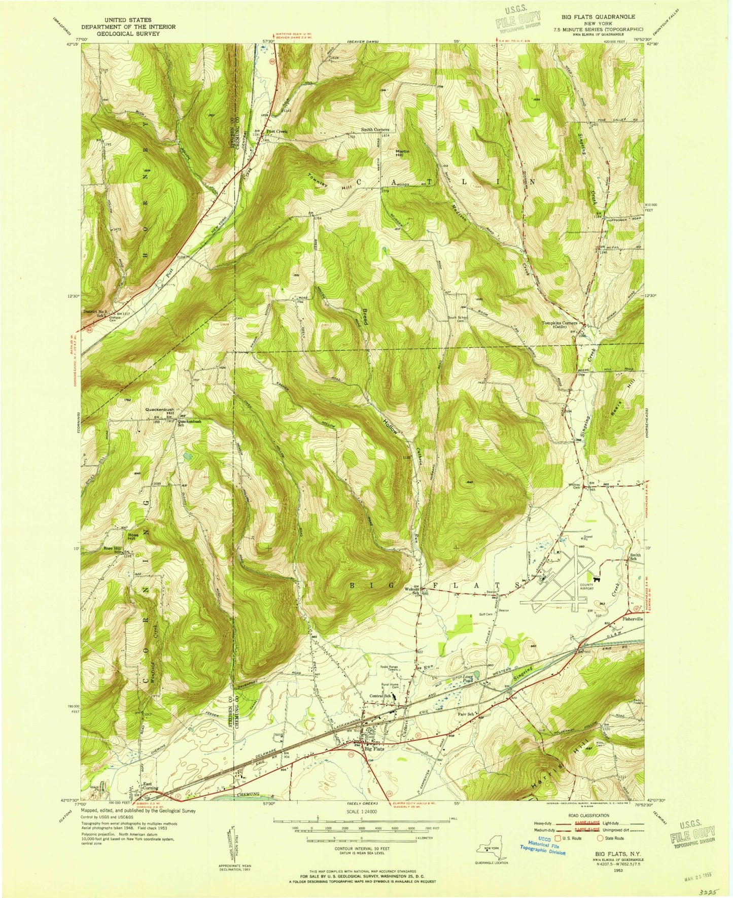
Classic USGS Big Flats New York 7.5'x7.5' Topo Map
Couldn't load pickup availability
Historical USGS topographic quad map of Big Flats in the state of New York. Typical map scale is 1:24,000, but may vary for certain years, if available. Print size: 24" x 27"
This quadrangle is in the following counties: Chemung, Steuben.
The map contains contour lines, roads, rivers, towns, and lakes. Printed on high-quality waterproof paper with UV fade-resistant inks, and shipped rolled.
Contains the following named places: Big Flats, Breed Hollow, Chemung Feeder Canal, Cuthrie Run, Eacher Hollow, East Corning, Pioneer Cemetery, Lowe Pond, Madison Creek, Martin Hill, Mills Cemetery, Mud Ditch, Oldfield Cemetery, Owen Hollow, Quackenbush Hill, Reasor Hollow, Rose Hill, Rural Home Cemetery, Smith Corners, South School Cemetery, Tompkins Corners, Townley Hill, Post Creek, Whitney Cemetery, Winfield Creek, Elmira/Corning Regional Airport, Town of Big Flats, Town of Catlin, Guthrie Corning Hospital, Big Flats Airport Census Designated Place, Big Flats Census Designated Place, Catlin United Methodist Church, Collingwood, Post Creek Cemetery, Miller Cemetery, Big Flats Wesleyan Church, First Presbyterian Church, Hillview United Methodist Church, Unitarian Fellowship, Spruce Run Tree Farm, Chemung Valley Montessori School, Big Flats School, American Baptist Community Church, Quackenbush Hill Baptist Church, Friends of the Cross Christian, Big Flats Post Office, Big Flats Town Hall, Big Flats Library, Willowcreek Golf Club, Willows Course at Willowcreek Golf Club, Goff Road Mobile Home Park, National Warplane Museum, Big Flats Volunteer Fire Company, Elmira Corning Regional Airport Fire Department, Gibson Volunteer Fire Department Station 2