
MyTopo
Classic USGS Big Lake Maine 7.5'x7.5' Topo Map
Couldn't load pickup availability
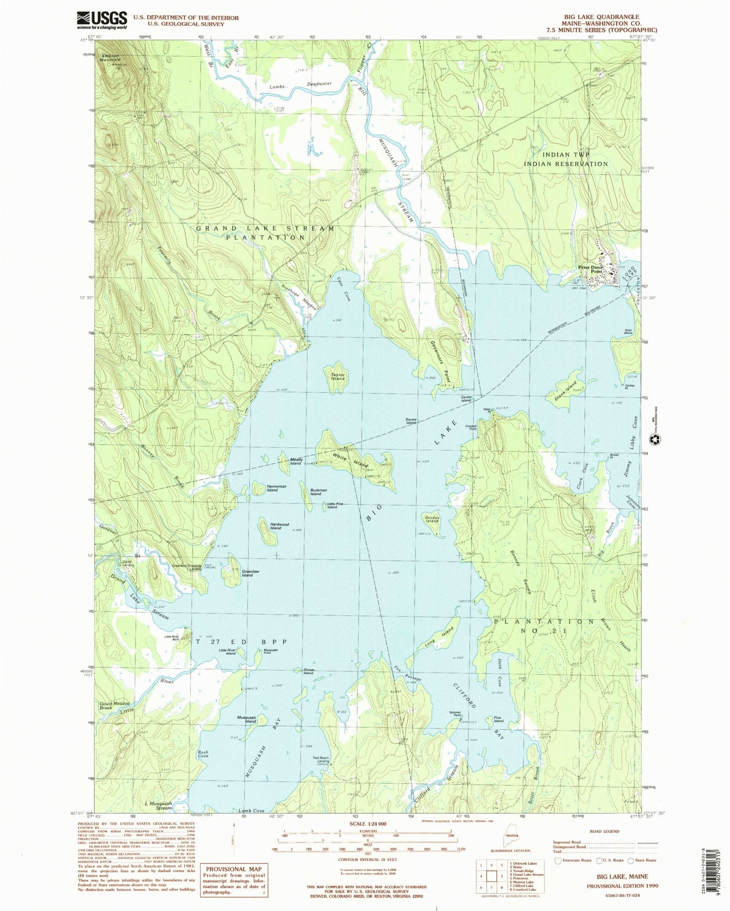
Historical USGS topographic quad map of Big Lake in the state of Maine. Typical map scale is 1:24,000, but may vary for certain years, if available. Print size: 24" x 27"
This quadrangle is in the following counties: Washington.
The map contains contour lines, roads, rivers, towns, and lakes. Printed on high-quality waterproof paper with UV fade-resistant inks, and shipped rolled.
Contains the following named places: Amazon Mountain, Big Brook, Big Musquash Stream, Bonney Brook, Bonney Swamp, Brown Point, Buckman Island, Cass Cove, Center Island, Clark Cove, Clifford Bay, Clifford Stream, Corliss Point, Crockett Point, Deep Cove, Dinner Island, East Branch Big Musquash Stream, Elijah Brown Heath, Flipper Creek, Fourmile Brook, Fox Passage, Gardner Brook, Gordon Island, Gould Meadow Brook, Governors Point, Grand Lake Stream, Greenlaw Island, Hanneman Island, Hardwood Island, Jimmy Libby Cove, Lamb Cove, Lambs Deadwater, Little Musquash Stream, Little Pine Island, Little River, Little River Bluff, Little River Island, Long Island, Moody Island, Musquash Bay, Musquash Island, Musquash Point, Peter Dana Point, Pine Island, Rush Cove, Saint Annes Cemetery, Scott Brook, Spooner Point, Epahsakom Island, Stanhope Meadow, Stone Island, Taylor Island, West Branch Big Musquash Stream, White Island, Yates Point, Campbell Shore, Gould Landing, Greenlaw Chopping Landing, Red Beach Landing, Plantation of Grand Lake Stream, Big Lake Township, Greenlaw Chopping Township, Indian Township School, Calligan Point


